bookmark_borderPost-175: In New York City (Part IX, Rego Park and Its History)

Previous Post: Part VIII, Asian New York

This will be the last post about NYC. Whew!

Here is a question for you. Does the below look like an “upper middle class neighborhood” to you?
.

Picture

Rego Park

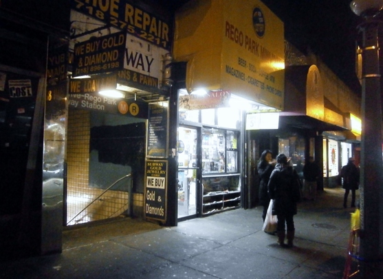
As the yellow sign says, this is “Rego Park”. I mentioned visiting it in Part-VIII, “Asian New York”. Some Wiki writer calls it “upper middle class”. It seemed on the run-down side, to me. I was only in the subway station vicinity, though.

According to City-Data.com, it may be an expensive place (I’m not sure if “NY” here means city or state; Manhattan apartments cost $3,400/month today, on average):
Picture

Here is the location of Rego Park, anchored on the subway entrance (the red marker). You can zoom in or out:
The subway ride from Manhattan took around 45 minutes, as I remember.

I was amazed to learn that Rego Park was a Chinese area around the time of the Spanish-American War. I wrote:

“Rego Park” was dominated by the Chinese in the late 1800s. At that time, it was farmland.  The farms were bought-up by the Chinese and they sold “exclusively” [naturally…] to Manhattan’s Chinatown.

            By 1870, there was a Chinese population [in Manhattan Chinatown] of 200. By the time the
            Chinese Exclusion Act of 1882 was passed, the population was up to 2,000 residents. By 1900,
            there were 7,000 Chinese residents [Wiki]

This should give a clue as to the timeframe of “Rego Park” Sinicization. Today, the neighborhood has a predominantly Soviet-Jewish character, with a 20% East-Asian minority, mostly Chinese.

Here’s the rest of the story, which I find both fascinating and emblematic of NYC generally:

Rego Park History, Early 1600s to Early 2000s

  • 1600s: The area is settled by Dutch and Germans, who farmed there for over two centuries.
  • 1870s: Chinese immigrants begin buying up the farmland in the area. The Chinese start farming, “[selling] their goods exclusively to [Manhattan’s] Chinatown“. (Note: I’ve come to see that this kind of action is stereotypical of the Overseas Chinese, especially in Southeast-Asia [e.g. Malaysia]. They often seem to attract the reputation of “scheming to take over” via ethnic-networking, etc. And who likes that?).
  • 1882: “Chinese Exclusion Act” passed by U.S. Congress, banning further Chinese immigration (lifted in WWII).
  • 1880s-1910s: Rego Park farmland is solidly occupied by Chinese farmers.
  • 1923: The “Real  Good Construction Company” starts residential development of Rego Park (giving it its name).
  • 1920s: Germans, Italians, Irish, and Jews begin to buy the newly-developed houses/apartments of Rego Park.
  • 1930s-1940s: Neighborhood attracts more and more Jews; Non-Jews begin to leave.
  • 1939: Rego Park Jewish Center opens. (It still stands today, imposing, near the subway station.)
  • From 1940s: Rego Park is defined by its large population of Jewish immigrants.”
  • 1970s-1980s: Rego Park becomes “a haven for Jews emigrating from Central Asia in the 1970s, when thousands of Bukharian Jews fled Uzbekistan and Tajikistan”. The neighborhood thus stayed Jewish, but shifted to one with a predominantly Soviet-Jewish character, which it maintains today.
  • 2010: Rego Park is predominantly Jewish, heavily ex-Soviet-Jewish. Other groups: 15-20% East-Asian (mostly Chinese); 16% Hispanic; 7% South-Asian; 2% Black-American (+1% Black-Hispanic).

Sources:

  • U.S. Census 2010;
  • “Rego Park: A ‘real good’ neighborhood” by Michael Lanza  in the Queens Chronicle [Nov 12, 2009] [Link]
  • City of New York Parks and Recreation history [Link]
  • RegoParkNY.com history synopsis [Link]
  • “Rego Park, Queens” article on Wikipedia [Link]


Today, in this 45,000-person community of Rego Park,
  • There are several Jewish synagogues.
  • There are zero Episcopal churches.
  • There are zero Methodist churches.
  • There are zero Presbyterian churches.
  • There are zero Baptist churches. (All this is according to Google Maps.)

I am surprised to find one Lutheran church in Rego Park. Unlikely enough, it’s of the conservative “Missouri Synod”.

It turns out this church is a holdover, an anachronism we might say, from the time when Protestants actually lived in Rego Park in any numbers. The congregation was organized in 1926 under a Pastor Kuechle (and If you fit this date into the above timeline, it makes sense). Here is a history of that church.

PictureSubway Vigilante Bernie Goetz (c.),
Arrested for ‘pre-emptively’ shooting muggers

By the way, one page in that history of Rego Park’s Lutheran church lists the members active in 1936. Several people surnamed Goetz are listed.

I’m reminded that the famous “Subway Vigilante” of NYC in the ’80s was also a Lutheran named Goetz (Bernie Goetz). Amazingly, I see that Bernie Goetz was born and raised only two miles away from Rego Park! He was born and raised in Kew Gardens, Queens in 1947.

The Rego Park Goetzes in ’36 very plausibly could’ve been relatives of his.


I only took one other picture in Rego Park:
Picture

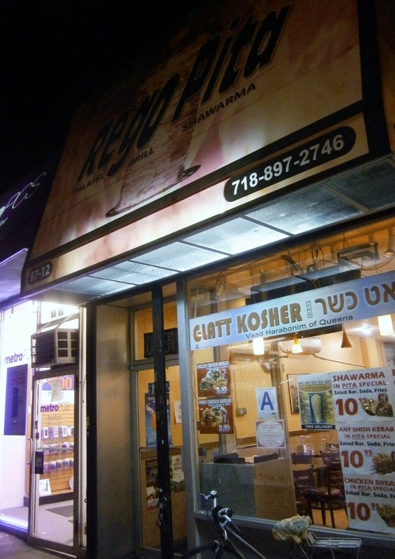
Rego Park “Falafel / Grill / Shawarma” Eatery

They are selling kosher falafels. Surprisingly to me, Wiki implies that falafels may have been introduced to the USA by Jews. (Incidentally, I’m not sure, really, what either of those terms mean. As far as I know, falafel is a Middle-Eastern mystery paste, and kosher refers to food “approved by a rabbi” [what the approval process involves is beyond me].)
Picture

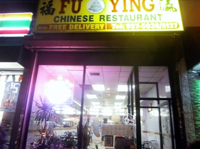
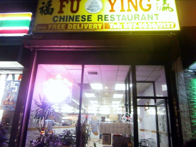
Chinese restaurant, Rego Park [commented on in Part VIII]

To return to the theme of Part-II (“Feeling Provincial”) and Part-VI (“The Ghost of Sherman McCoy”): In my time in Rego Park, I experienced a dearth of sights, sounds, smells, and people, with which I could identify in the slightest. Every storefront, just about, proclaimed itself Kosher!”  (except the Chinese restaurant, which I am pretty sure served pork).  The streetside was peppered with Cyrillic, too.

In my seven months in Germany (as a student, in 2007), I felt a lot more at-home than I felt (could feel) in a place like Rego Park, or even (“White”-)Manhattan. It’s amazing how that can work. I arrived speaking quite poor German, too.

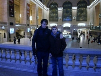
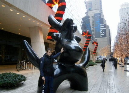
It is time to put the subject of New York City to rest. To close it all up, below is a picture of me with my friend T.A. from Kazakhstan. T.A.’s financial dealing with an Uzbek resident of Rego Park is what brought us there that evening. She was a strictly off-stage villain in this drama. I didn’t see her; I only heard what T.A. relayed. She herself may or may not have been Jewish, but when the phone conversation between her and T.A. turned negative (due to her own mercurial arrogance), she threatened T.A. by informing him, in Russian, that her husband is “powerful in the Jewish community” (her husband is a Russian-Jewish emigree from the ’70s or ’80s, I think T.A. said, i.e. a typical Rego-Parker). More ethnic aggressiveness! Poor T.A., the Kazakh-Gentile. I think he was genuinely a bit intimidated by this implied-threat. Setback notwithstanding, he recovered his optimism soon when we returned to Manhattan.
Picture

Me (left) with T.A., NYC, Dec 2013.

I thank T.A. for his hospitality! He took the day off to show me around, and I appreciate it a lot. What a good guy.

Next Post: None

bookmark_borderPost-176: “Did Anything Good Happen in 2013?” (Dave Barry)

I found this to be funny, from Dave Barry:

Did anything good happen in 2013? Yes! There was one shining ray of hope in the person of Toronto Mayor Rob Ford , who admitted that, while in office, he smoked crack cocaine, but noted, by way of explanation, that this happened “probably in one of my drunken stupors.” This was probably the most honest statement emitted by any elected official this year, and we can only hope that more of our leaders follow Mayor Ford’s lead in 2014. (We mean being honest, not smoking crack in a drunken stupor.) (Although really, how much worse would that be?)

.

It’s part of a longer year-end review:

Dave Barry’s Review of 2013, the Year of the Zombies

It was the Year of the Zombies. Not in the sense of most of humanity dying from a horrible plague and then reanimating as mindless flesh-eating ghouls. No, it was much worse than that. Because as bad as a zombie apocalypse would be, at least it wouldn’t involve the resurrection of Anthony Weiner’s most private part.

We thought that thing was out of our lives forever, but suddenly there it was again, all over the Internet, as Weiner came back from the political grave like the phoenix, the mythical bird that arose from the ashes to run for mayor of New York and use the name “Carlos Danger” to text obscene photos of its privates to somebody named “Sydney Leathers.”

Speaking of pathologically narcissistic sex weasels: Also coming back from the dead in 2013 to seek elective office in New York (What IS it with New York?) was Eliot “Client 9” Spitzer, who ran for city comptroller under the slogan: “If you can’t trust a proven sleazebag with your municipal finances, who CAN you trust?”

And then — not to leave out the ladies — there was Miley Cyrus. We thought her career was over; we remembered her fondly as a cute and perky child star who played Hannah Montana, wholesome idol of millions of preteens. And then one night we turned on MTV’s Video Music Awards and YIKES there was this horrifying, mutant, vaguely reptilian creature in Slut Barbie underwear twerking all over the stage while committing unhygienic acts with both Robin Thicke and a foam finger, both of which we hope were confiscated by a hazmat team.

This year was so bad that twerking wasn’t even the stupidest dance craze. That would be the “Harlem Shake,” which is not so much a dance as a mass nervous-system disorder, and which makes the “Gangnam Style” dance we mocked in 2012 look like “Swan Lake.”

We miss 2012.

But getting back to the zombies: It wasn’t just people who came back alarmingly in 2013. The Cold War with Russia came back. Al-Qaeda came back. Turmoil in the Middle East came back. The debt ceiling came back. The major league baseball drug scandal came back. Dennis Rodman came back and went on humanitarian missions to North Korea (or maybe we just hallucinated that). The Endlessly Looming Government Shutdown came back. People lining up to buy iPhones to replace iPhones that they bought only minutes earlier came back. And for approximately the 250th time, the Obama administration pivoted back to the economy, which has somehow been recovering for years now without actually getting any better. Unfortunately, before they could get the darned thing fixed, the administration had to pivot back to yet another zombie issue, health care, because it turned out that Obamacare, despite all the massive brainpower behind it, had some “glitches,” in the same sense that the universe has some “atoms.”

Were there any new trends in 2013? Yes, but they were not good. Kale, for example. Suddenly this year restaurants started putting kale into everything, despite the fact that it is an unappetizing form of plant life that until recently was used primarily for insulation. Even goats will not eat it. Goats, when presented with kale, are like, “No, thanks, we’ll just chew on used seat cushions.”

Another annoying 2013 trend was people who think it is clever to say “hashtag” in front of everything. Listen carefully, people who think this is clever: Hashtag shut up.

Did anything good happen in 2013? Yes! There was one shining ray of hope in the person of Toronto Mayor Rob Ford , who admitted that, while in office, he smoked crack cocaine, but noted, by way of explanation, that this happened “probably in one of my drunken stupors.” This was probably the most honest statement emitted by any elected official this year, and we can only hope that more of our leaders follow Mayor Ford’s lead in 2014. (We mean being honest, not smoking crack in a drunken stupor.) (Although really, how much worse would that be?)

[A month-by-month commentary follows]

bookmark_borderPost-174: In New York City (Part VIII, Asian New York)

Previous Post: Part VII, Modern Art

Two East-Asians, well dressed, passed us by. A man and a woman. They spoke a foreign language. Half a moment swirling around in my brain, and it registered. It’s Korean. Korean, a language I’d heard near-daily for three years (with mostly no understanding).

It was a little disorienting, somehow, but not as much as encountering this a moment later:
.

Picture

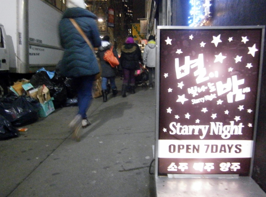
Advertisement for a Korean nightclub in Manhattan.

The above is a sign for a nightclub which advertises (in Korean only) that it offers soju (a terrible drink similar to vodka); beer; and yangju (양주), which I long thought was a super-special Korean alcohol due to its high price whenever I saw it on a menu, but it turns out it just means “Western liquor”.

We can tell with certainty that it’s a genuine-Korean affair, you know, because even with only five English words on their sign, they still manage a mistake (no space between ‘7’ and ‘Days’). Haha. Sorry, Korean readers, if any. ^_^

Here is another marker of Korean presence in NYC that I immediately recognized:
Picture

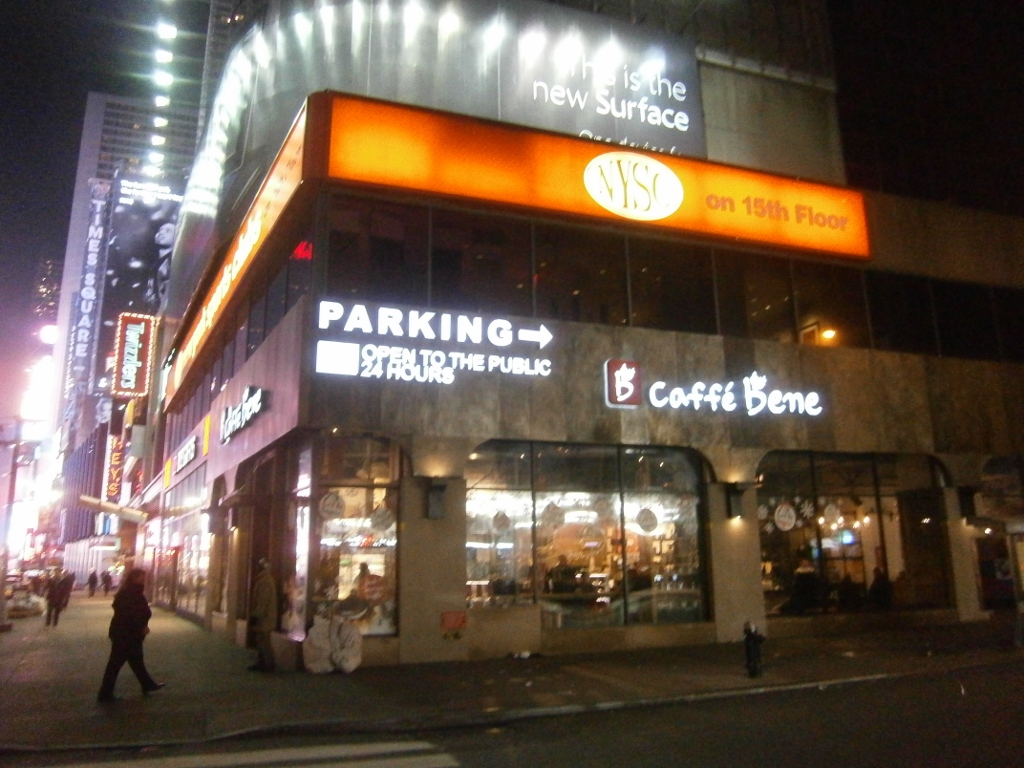
Cafe Bene (a Korean coffee chain), Manhattan

“Caffe Bene” is everywhere in South Korea. It’s one of the more-successful of the many, many coffeshop chain stores.

This Manhattan Caffe Bene I saw may be something brand new. From the Korea Tourism organization:

Caffe Bene is a leading coffee label of Korea. It is a trend-setting multi-cultural space that offers an ideal combination of coffee, waffle, and gelato. [….] Following the opening of its 500th store in Korea, Caffe Bene is set to open its first branch in New York.


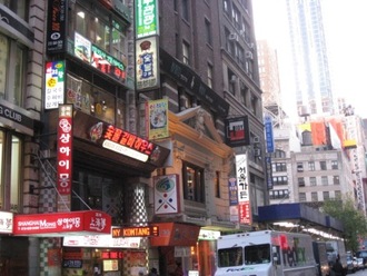
PictureManhattan Koreatown, complete with gaudy signs
covering as much square-footage as possible,
in the usual South-Korean style. (Found online).

It’s news to me that there is a “Koreatown” in Manhattan. (At left is a photo of it that I found. We didn’t visit it.)

The Census reports that there are 200,000+ Koreans in the NYC Metro Area. I already knew that there were two million Koreans in the USA — Allegedly, up to one million in Southern California and one million in the rest of the USA. I have rarely encountered many, leading me to conclude they are invisible.

Maybe the USA’s two million Koreans are, mostly, invisible, because they cluster around each other. You won’t see any most of the time, but when you see one, you’ll see many. My impression. Koreans’ group-orientation is among the strongest I’ve encountered…

My friend B.W. stayed at a Korean guesthouse in Manhattan for his two weeks there in 2010. I had gently discouraged him from that (being in the cocoon of Koreanness abroad). See Part-III for comments on B.W.’s impressions of NYC.


Koreans are not the only East-Asians in New York, of course. There are many more Chinese.

PictureInside Chinese restaurant

My friend T.A. had to go to the “Rego Park” neighborhood of Queens on an urgent errand. I went along. We ate at a typical American “Chinese-takeout”-style restaurant there.

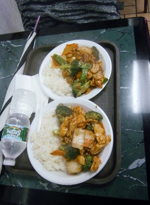
It all fit the bill: the greasy food, the utter minimization of all costs (crummy styrofoam plates and plastic forks), the poor grammar and mildly-sour attitude of the Chinese woman taking the order, and the fact that all the cooks seemed likely to be family members. Here was our meal:

Picture

“Chicken and Vegetables” in Queens

It was a filling meal, cheaply had, the raison d’etre of these kinds of places. Here was the restaurant:
Picture

Front of Chinese “Takeout” in Rego Park (there were some tables to eat-in)

Surprisingly, I read that this “Rego Park” was dominated by the Chinese in the late 1800s. At that time, it was farmland. All the farms were bought-up by the Chinese and they sold “exclusively” [naturally…] to Manhattan’s Chinatown. 

By 1870, there was a Chinese population [in Manhattan Chinatown] of 200. By the time the Chinese Exclusion Act of 1882 was passed, the population was up to 2,000 residents. By 1900, there were 7,000 Chinese residents [Wiki]

This should give a clue as to the timeframe of “Rego Park” Sinicization. Today, the neighborhood has a predominantly Soviet-Jewish character, with a 20% East-Asian minority, mostly Chinese.
The history of this neighborhood is so interesting to me that I did some research on it, which I’ll present in Part IX, and finally put the topic of NYC to rest.

bookmark_borderPost-173: In New York City (Part VII, Modern Art)

.

Picture

In front of the Museum of Modern Art

This bizarre sculpture is called “Moonbird” by a Spaniard, Joan Miro.

The sculpture looks like a cow to me, not a moonbird, but I must confess that I’ve yet to see an actual moonbird. Perhaps this is a faithful representation of moonbirds, whatever they are. On second thought, the words “faithful representation” are almost-certainly banned from the lexicon of Modern Art.

The Museum of Modern Art features in Bluebeard by Kurt Vonnegut, which I’ve recently read. The main character, artist Rabo Karebekian, rebels against the realistic painting style of his mentor, goes on to create thousands of Modern Art paintings, but because of a certain chemical in the paint he uses, each and every one of them spontaneously disintegrates and is lost forever. It’s a symbol of the shallowness of Modern Art, as I read it, but Vonnegut also criticizes the super-realist style of the mentor, so who knows what he’s saying.

bookmark_borderPost-171: In New York City (Part V, Under the Christmas Tree Like It’s 1999)

Previous Post: Part IV, “Paying Up”
Another post about cruising around Manhattan in Dec. 2013:
Picture

.

Picture

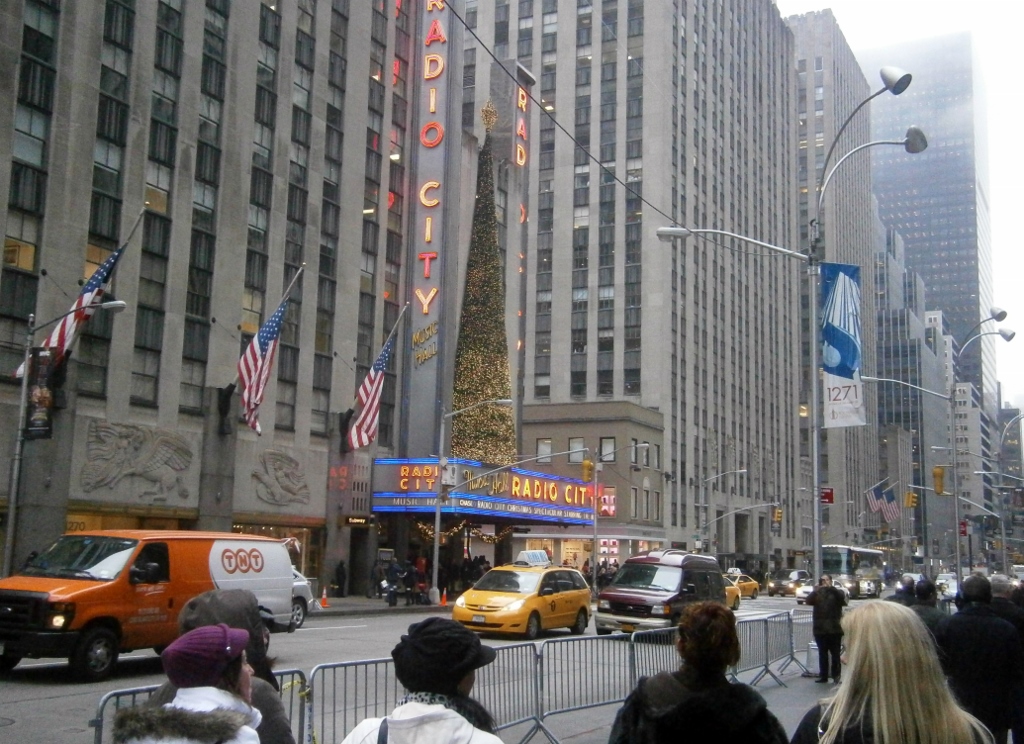
I was inside Radio City Music Hall once, but not in 2013. It was back in ’99. That was the first time I went to New York City. It was on a school trip. The school rented a “charter bus” and we left at 4:00 AM, arriving back after midnight. I remember walking up the inner-stairs of the Statue of Liberty in ’99, and being amused by the substantial amount of graffiti on every square inch of that staircase, written over many decades.

I have another ’99 memory: In the evening, we watched
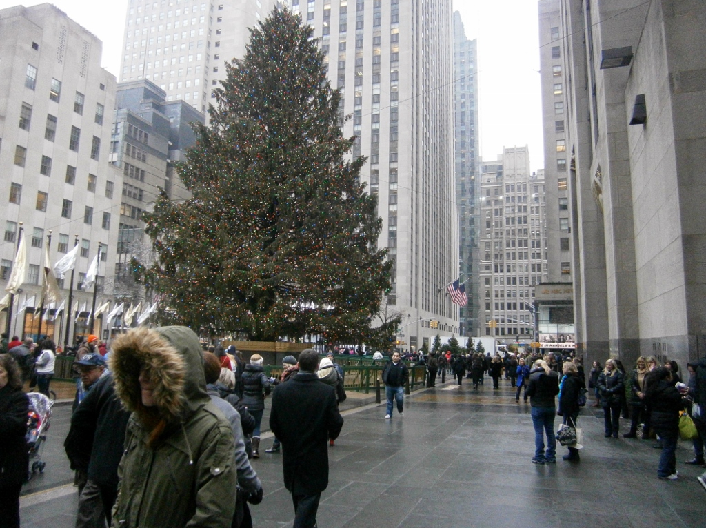
some kind of singing-and-dancing thing inside Radio City Music Hall. Our English teacher who was chaperoning us 8th-graders — a brash, humorous, selfconsciously-Irish, native-Chicagoan — decided that she was bored and wanted to see “the tree”, so conspicuously bailed out on the dancing down below. I was among the defecting grouplet. (Mrs. Brown later got a talking-to by somebody about that stunt). This was the same tree, I think:
Picture

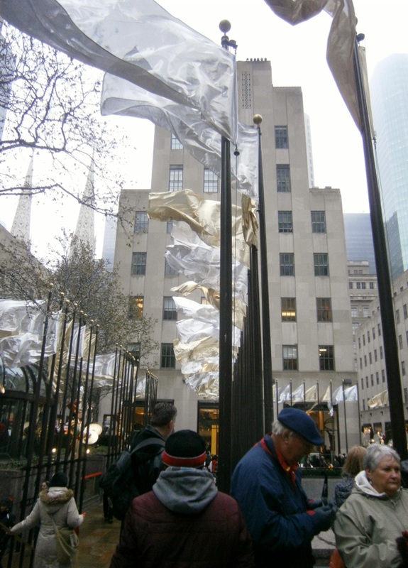
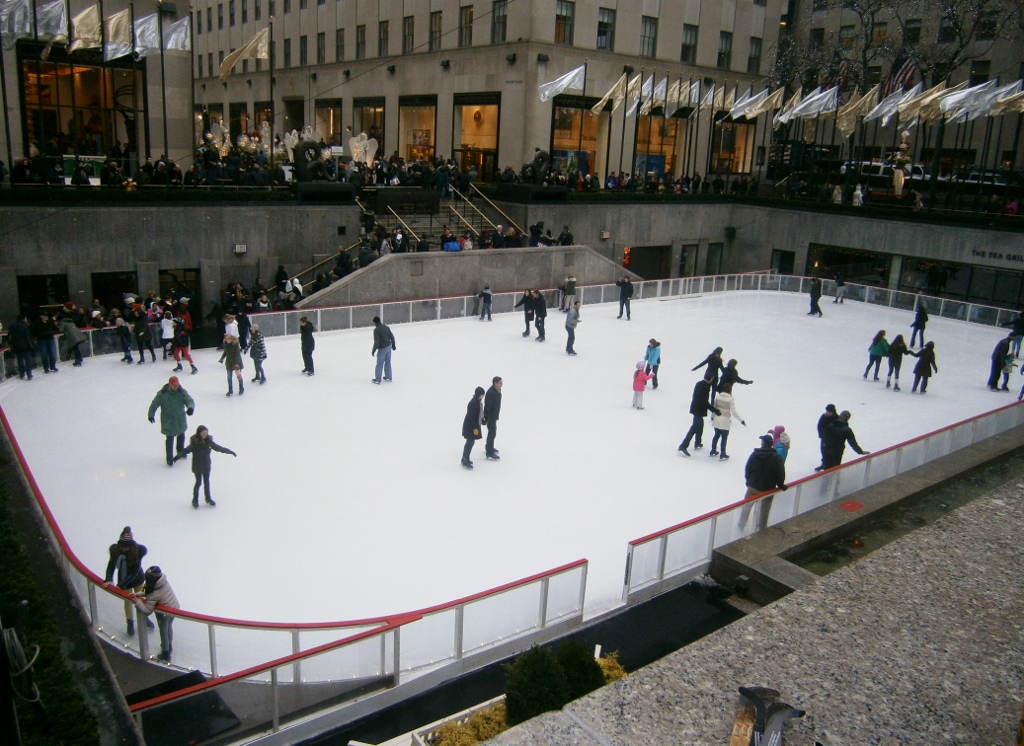
Next to this Rockefeller Christmas Tree were white flags, regally swaying. Ice skating below:
Picture

Picture

Guess what a 90-minute session of ice skating there costs. — Per person, including skate rental, it’s $39! Geez, I say.


bookmark_borderPost-172: In New York City (Part VI, The Ghost of Sherman McCoy)

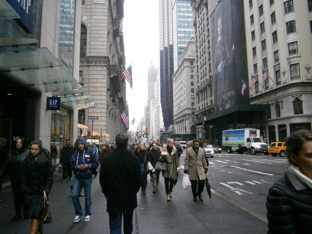
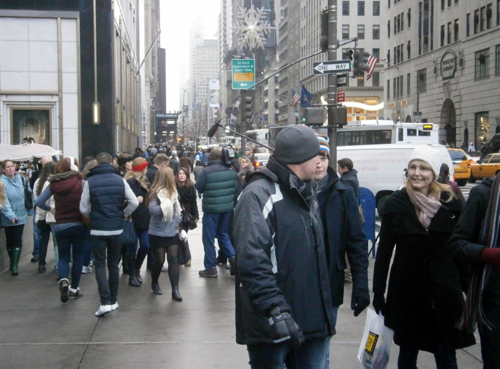
A Manhattan street scene:
Picture

.

Notice that most people are stylishly dressed (except the dark man in blue). Typical Manhattan, I guess.

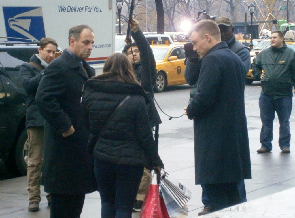
Another stylish thing to do is to buy Apple products, of course. In front of the enormous underground Apple Store, we saw yet another group of people recording some video footage. Look in the center rear of this photo:
Picture

A closer angle:
Picture

For a TV show? For a movie? A commercial?

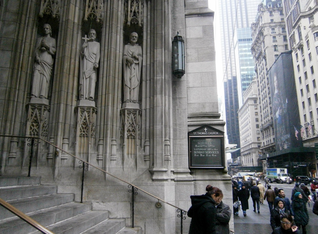
Even Manhattan’s unexpectedly-elegant cathedrals, as below, seem lifted from a movie (a European movie, even):
Picture

Protestant Episcopal church (a cathedral, really), Manhattan

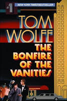
Sherman McCoy (of Park Avenue), in the novel Bonfire of the Vanities, described attending one of these Protestant churches. He sent his daughter to its daycare program. I read it in 2013 (bought in a used bookstore in Itaewon, Seoul).

I couldn’t help but think of that novel frequently, strolling around “White Manhattan” (as author Tom Wolfe calls it).

Picture

Bonfire of the Vanities is a tragedy. It comes to pass that everybody calls for Sherman McCoy’s blood. (It may as well have been, “Crucify him!!”) A multi-ethnic feeding frenzy. The various antagonists’ “vanity” lead each to pile-on poor ol’ Sherman, for all different reasons. All are united, but only to the extent that Get The Wasp!  can unify. Sherman’s entire world falls apart. Nearly everyone deserts him. He ends up in the prison system for a crime he didn’t commit.

Bonfire of the Vanities is a clear allegory, as I read it, for the dispossession of the once-dominant WASPs of New York City (Wolfe usually renders the word as ‘Wasp’). Sherman McCoy represents WASP-New-York, or WASP-America. Wolfe makes clear, in the novel, that their ‘dispossession’ is partly their own fault, as Sherman is a flawed man, too.

Walking around Manhattan in the 2010s, one sees of ethnic assertiveness all around. From all groups, it really seems, except any White-Protestants. Just like in Sherman McCoy’s universe, they are a group disallowed from collective identity, only defined in negative terms!

One could be forgiven for thinking there are no “WASPs” left.


Are there any WASPs left in NYC?

The 2010 Census has it that
Manhattan is 48% White Non-Hispanic, a rate that been steady for decades. Manhattan is probably only 5-10% White-Protestant [Whites of at-least-nominal Protestant affiliation/background). (Wiki says Manhattan is 20% Jewish alone; there must be at least an equal number of White-Catholics there, and 48-20-20=8).

This low ‘WASP’-share must rise substantially in certain neighborhoods, including ol’ Sherman’s Park Avenue. Likewise, it must plummet in the “outer boroughs” of today (except Staten Island, where my mother went to college many years ago). I see that New York City as a whole, all boroughs, is down to 33% White today, of which a large share are Jewish, and so on. NYC as a whole is probably <5% WASP, then.

M
y friend T.A. (from Kazakhstan) described to meriding subway trains in Queens, Brooklyn, and the Bronx and his surprise at the trains being bereft of a single stereotypical ‘White-American’ face.

Bonfire of the Vanities is a brilliant novel. I’d call it the Great American Novel. It seems to me that it catches the quintessence of what today’s USA, as I have know it, is all about. It was written around the time of my birth.

bookmark_borderPost-170: In New York City (Part IV, “Pay Up!”)


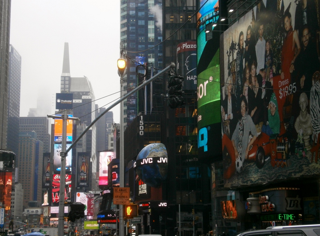
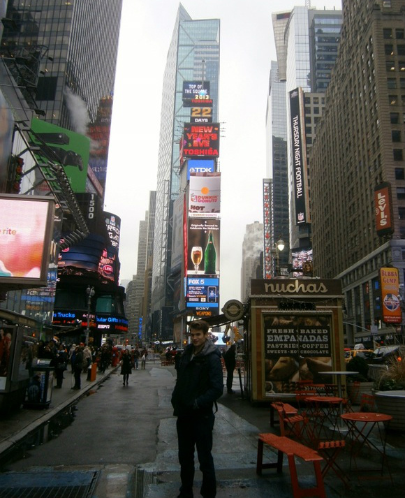
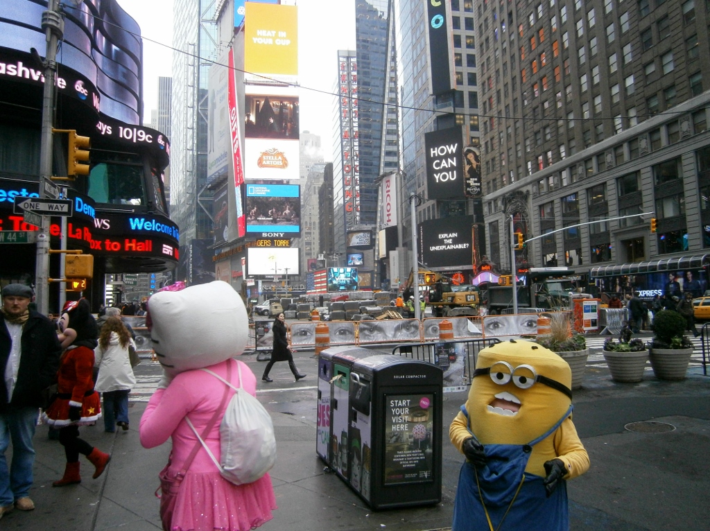
Just like Greenland doesn’t have much “green”, Times Square doesn’t have much of a square, that I could tell. Here it is:
Picture

.

This “Times Square” place may fit some people’s definition of “gaudy”.

If you are that kind of person, I recommend you avoid East-Asia, the neon-dominated public spaces of which can make Times Square look like the little town of Bethlehem…. (Just do an image-search for neon+Seoul or neon+Tokyo).
Picture


Now for a Times Square anecdote.

T.A. gets a phone call and I wander into a nearby drugstore to wait till he’s done. A rack of NYC tourist magnets catches my eye. I pick one out. Price: $2.99. I’ll get it. Behind the counter, a South-Asian woman. Down goes the magnet. Beep goes the scanner. I hand her three pictures of the Man Who Couldn’t Tell a Lie. Glowering back at me, she blurts out, “It’s $3.17; There’s tax!  Don’t you know that? There’s always tax…..” 

Tax? (I’d actually forgotten that U.S. retailers exclude tax in stated prices! I’d been away too long.)

Now, that woman seems rude in my telling of it, above. In fact, precipitating her mini-lecture on the subject of sales tax may have been the fact that, somewhere in there, I’d gently pointed out to her that the label said “$2.99”, not “$3.17”.

Maybe this seems “much ado about nothing”, but it’s actually much ado about 18 cents. Haha. No, there is something wrong with these kinds of “hidden charges”. They really add up sometimes.
I’d vote for any candidate who campaigns to eliminate the following sort of velvet-glove thievery: “$39.95, plus service charge, plus sales tax, plus local tax, plus state tax, plus eat-in tax, plus 20% mandatory gratuity”.  Tell us from the get-go that the price is really $55, all included, so we know what we’re paying! In other countries, in my experience, tax (etc.) is always included in the stated price. Prices are easily-understood, with no surprises, and no need for lengthy calculations. Imagine that!

I was compelled to fish-around for, and surrender, another picture of the man who defeated Cornwallis back circa 1781. (I learned recently that after the surrender at Yorktown, General Cornwallis [of British imperial service] found his way to Malaysia. I learned this while in Penang, Malaysia. “Fort Cornwallis” still stands. We circled the entire thing trying to find a way in, before giving up.)

Chastened, as I’d seemed ignorant of the existence of sales tax, I emerged from the store, with T.A. alongside.

Moments later, would you believe it? A gang of cute hustlers materialized. Here are three (there were others):
Picture

From left: Tourist, Minnie Mouse, Hello Kitty, Garbage Cans, Minion.

In what way were these costume-wearers “hustlers”? I’ll tell you.

PictureMe with “Minion”

At left, you can see a picture of me with the “Minion” (which is from a movie called “Despicable Me”). The small woman in the costume approached us, and essentially forced us to take pictures with her. She was making some kind of muffled, Minion-style noises from inside. After taking the pictures, she produced a sign with the words “Tips, Please” and began making whiny sounds a bit similar to a hungry dog’s. Aha: So it was a bit of a shakedown by the cute cartoon characters.

I didn’t appreciate this, as it was implicitly a bait-and-switch; she forced us to accept a service, and then coyly demanded we pay for it. I implied that I didn’t have money. Suddenly I decided to give her some of the change from the magnet purchase, not more than 50 cents, including several pennies! (A good way to get rid of those pennies, anyway.) She may have been insulted by this “tip”, but that was partly the point. She made some more muffled Minion mumblings of despair and confusion, hoping to sucker us out of more. Not us. We made our escape at a brisk pace, before Minion could call in Minnie Mouse or somebody else to enforce the debt.


bookmark_borderPost-168: Yuletide 2013

Winter has begun, if you follow that clumsy system for determining seasons by the solstices and equinoxes,

Picture[found online] This purports to show
Winter Solstice 2010

The solstice was at 12:11 PM EST on December 21st this year. The Sun was “moving south” at 12:10, and “moving north” at 12:12. It briefly “stood still” sometime in the minute of  12:11. That’s what a solstice is.

Ancient people figured-out the mechanics of this back in the Stone Age and attached special religious meaning to it, to that mystical moment of the reversal, the beginning of the “days getting longer” (as we say). The ancient Northern Europeans developed this into a major holiday. They held elaborate celebrations, which they called Yule or Yuletide, and their descendants continue to celebrate “the holidays” at the same time.

I wrote about the summer solstice in post-92.

2013’s is the first Yuletide during which this weblog has existed, but hopefully not the last!

Thanks for reading.


bookmark_borderPost-169: Teaching the Equinox

Yesterday being the solstice (see Post-168: Yuletide 2013) reminds me of something I ought to record here, a recollection of my time as a hagwon teacher in South Korea. I once taught about the equinox. Let me tell you about it.

[Beware: This runs long When drawing words from the honeyed recesses of a cherished memory, it’s not hard to do so.]

Here it goes:
.


In March 2013, I happened to read that the vernal equinox would occur at 9:02 PM Korea Time on one particular day that month. I was to teach five or six classes that day, from 4:30 PM to 10 PM. I decided to introduce, explain, and discuss the concept of the ‘equinox’ (the moment the Sun hits the equator) to my classes.

I made a point, at the start of each class, to inform the students “the first moment of spring” was imminent, and of the time-of-day that the crossover would occur. I talked, drew pictures, and wrote on the board to explain. They may already have known this stuff in general, but they really wouldn’t have known it in English, I figured. I explained the Latin origin of the word ‘equinox’ (equal+night). I (half-)feigned personal excitement about this movement of the Sun, trying to create a “buzz” in the class about a single moment in time (i.e., the Sun crossing the equator) that would have hitherto had zero relevance to any of them.

I kept up the pace with softball questions to get students “in on it”. “How excited are you that spring will start in 48 minutes? Very excited, a little excited, or not excited at all?”  I went around the room, having each student choose one of those excitement-levels (easy answers). Occasionally I’d ask for elaboration. (Of course they should’ve been happy for spring. Twenty-thirteen’s winter was long. The cold lasted even through April for some reason [see post-34].)

As I say, I half-teasingly encouraged the students to celebrate this event. I even created a “countdown” on the board, which I periodically updated as the class went on.

I was with a class of mid-level ninth-graders when the “equinox moment” hit. As soon as the bell rang to mark the start of class at 8:30 PM, I wrote “32 Minutes Till Spring” in large letters on the board. This was the countdown. I went into my little explanation, soliciting information from them (some vaguely knew the mechanics of the Sun’s movements, but none could manage it in English). We went into the discussion about what this statement that “spring begins in 32 minutes” meant. I modified the number of minutes on the “countdown” as 9:02 PM approached.

I used a handheld stopwatch/clock in classes for various purposes, and when it was 9:01:30 or so, we stopped everything and did a proper countdown with that clock. It was a true New-Year’s-Eve-style countdown for the last ten seconds. I was, I’m pretty sure, the only one actually saying the numbers aloud (“10…9…8…”), but that was okay with me. A few students’ giggles accompanied. When the time hit 9:02, I said “Welcome to spring!” and wrote that same in enormous letters on the board. I asked the students some more questions, similar to the above. A couple of students were rolling their eyes and so on at all this, but the class was more engaged than it otherwise would’ve been, and that’s certain. They were listening.

Students who were following all this highbrow clowning-around were actively using their English skill to understand what the heck I was talking about, and taking in new words like “equator” (for which they learned my second-syllable-stressed pronunciation, eQUAtor, not the first-syllable-stressed version of the U.S. South), all while simultaneously being “entertained” (in a manner of speaking). This beats their usual M.O. of two parts spacing-out, one part rote-memorizing. (Come to think of it, as I recall, that particular class was probably a “three parts spacing out” group.)

I have not even the foggiest recollection, nine months later, of what the “book work” we did on that day was (and they did, most of them, do some; I wouldn’t waste a whole period on a diversion like this). I do remember this “equinox discussion” vividly, though, something which was of no relevance at all to any English test of theirs.

I don’t know how much any of the teenagers in that room remember of me, of what I tried to teach them in my time there, but I’m willing to bet that at least a few of them remember this “equinox discussion” and got something from it.


I’ve described above an example of one of the teaching habits that I developed and found effective. (A similar example: I remember on a Friday the 13th, pretending to be very scared about that date and telling the students so. I think I started with “Today is a bad day. Can anyone tell me why?” They tried to guess, but were all way off. I explained. I got around to telling them, further, that when Friday the 13th falls on a full Moon night, it is the unluckiest possible day in the world! I think most students believed my show, that is to say many believed that I believed this (at least at first) — and those who were unaware of these superstitions learned about them. None “agreed” that Friday the 13th was anything bad; just like White-American students wouldn’t care in the slightest if they were assigned Room #444, a very bad number for Koreans due to the influence of Chinese-superstition.) In some classes, a mischievous student or two teased me by claiming to believe that Friday the 13th was actually lucky.

So to repeat:
I’d sometimes introduce unexpected or irrelevant topics, like talking about solstices and equinoxes, despite these things being nowhere in the textbook. I’d try to be at-once serious and lighthearted, explaining and discussing and so on for a few minutes, usually (but not always) before we started the day’s real work. Some days I’d try to connect this “warm up activity” with the real work if possible. The topics I chose are ones that amused me. Amusing oneself may be the best way to amuse students. Amusing students is the key to it all.

bookmark_borderPost-167: In New York City (Part III, Up the Empire State Building)

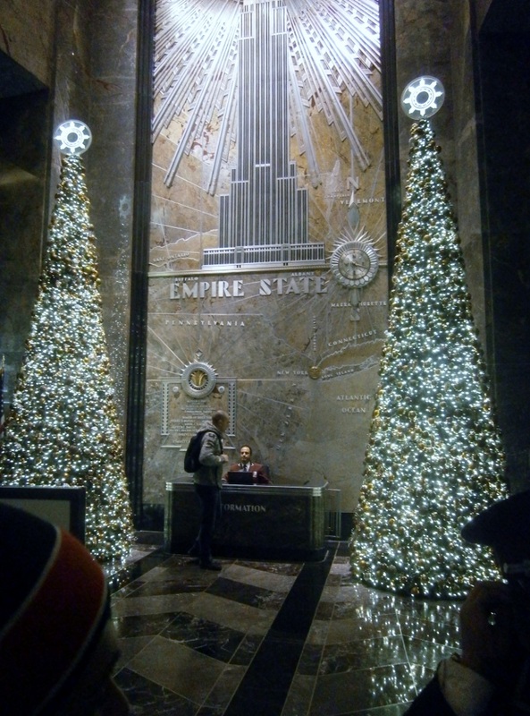
It was a bit eerie how all of them got extra-polite when they saw The Card.  I’m referring to the many staff at the Empire State Building, who were dressed up like hotel doormen. Many made mild noises of being impressed (“ahh”, “wow”, “aha”, you know the sorts of noises I mean). Some actually seemed to bow  when T.A. flashed it. No kidding: There was a distinct lowering of heads, at times, to accompany the extended arms which showed the way to proceed.

T.A. had insisted on going to the Empire State Building. I soon realized this was because he possessed The Card, which, like that “Ring” of the recent movies, allows the possessor access to a magical ability, in this case the ability to rise to the top of the Empire State Building, any time, any day, free, as many times as the possessor wants, with guests in tow, with no need to wait in any lines. Amazing! T.A. had gotten it through another magical ability that many seem to have: Procuring favors from a network of connections. The card was issued by an employer to a Russian-speaking person whom T.A. seems to know. T.A. said that he has been up to the top about fifteen or so times in this way.

Onward with the pictures:
Picture

Inside the Empire State Building as Christmas approaches. Pictured: Unknown tourist.

.

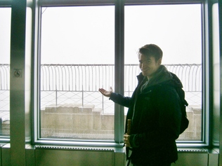
Monday was drizzly and overcast. The Empire State Building staff, when not kowtowing to The Card, gently warned us to save our time and not go up, as there was no visibility due to thick cloud cover. We went up anyway. Why not? We had The Card!  We could do anything!

Alas, The Card’s
magical powers could not control the weather, could not allow holders to enjoy views as unimpeded as the access was. The 2023 model, or maybe the 2033, may feature that ability. The “boys” are working on it, I’m sure. The lowly 2013 edition’s magic remains sadly limited to inside the walls of this building. Magic isn’t what it used to be.
Picture

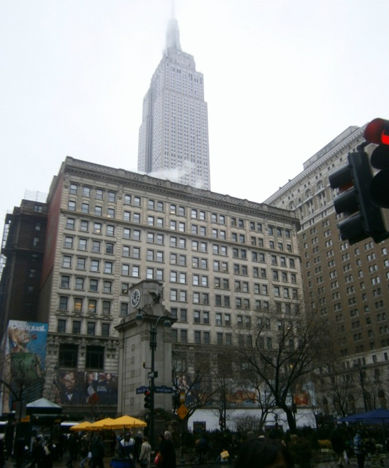
Enshrouded in clouds atop the Empire State Building


Later in the day, the clouds began to lift and the Empire State Building emerged. My memory is a little foggy, but it looked exactly like this:
Picture

It really looks like something out of Batman, doesn’t it?

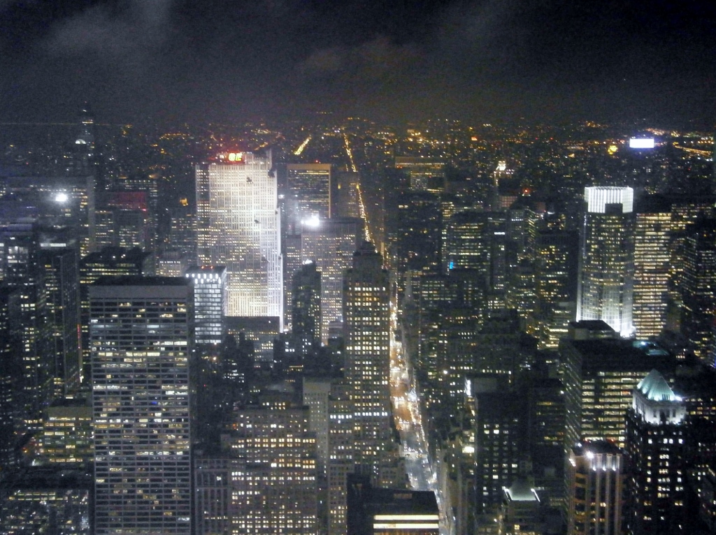
Much later in the day, long past sunset, The Card worked its magic again; up we went; this time the clouds were gone:
Picture

Our night-view from the top of the Empire State Building

Manhattan’s super-density, as above, is impressive in some ways, if you’re into that kind of thing. I’d point out that it would be less unique to the typical urban East-Asian of today. Large East-Asian cities all look a bit like the above.

My Korean friend B.W. from Ilsan (an upscale, dense city near Seoul) spent two weeks as a tourist in New York City in early 2010. He told me that although he liked the visit, he was a little disappointed; the USA was not what he’d expected. What he saw in NYC may have seemed to him too much like an often-shabbier, dirtier, more pretentious, more dangerous version of Seoul, I reasoned at the time. I lamely told him, “New York City is not the USA”.


Density of Manhattan, Compared to Arlington and Compared to the Manhattan of the 1910s
The land area of Manhattan Island [23 sq. mi.] is about equal to my place of birth’s, Arlington [26 sq. mi.]. Arlington is an urban county, and is within the core-area of the six-million-person Washington DC Metropolitan Area. Manhattan has 1,600,000 residents, versus 220,000 in Arlington. Parts of Arlington look a little like Manhattan.

I was surprised to see that Manhattan is a lot less-populated today than it was a century ago, when it had 2.33 million people (according to the 1910 Census). For every 1,000 Manhattanites in 1910, there were only 685 in 2010.

Incredibly, in 1910, tiny Manhattan Island had 2.5% of the USA’s entire population (2.33million/92.23million). By 2010, Manhattan Island had decreased to “only” 0.5% of the USA’s population (1.6million/308million). Manhattanites still have that we-are-the-center-of-the-universe attitude. “Bah; there they go again, strutting around as if they’re still 2.5% of the USA!” a person might quip after seeing a pretentious Manhattanite strutting around.


bookmark_borderPost-166: In New York City (Part II, Feeling Provincial)

Previous Post: Part I, Transportation
I left off in post-165 having just gotten off the bus in midtown Manhattan, about 11 AM.

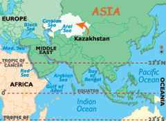
PictureKazakhstan, in central-Asia [from here]

Waiting nearby was one of the most optimistic people I’ve ever come across, my friend T.A. from Kazakhstan. I met him when I was traveling there in 2011. He is in the USA on a “work and travel” visa now. He holds two college degrees back home, and worked in a bank in his hometown. Although ethnically-Kazakh, he cannot speak the Kazakh language very well, as so many of them can’t. He speaks Russian.

T.A. has lived all around
the USA now, from the Southern-efficiency of Carolina, to the Northern-charm of New York City, to
the gentleness of the Pacific Northwest.

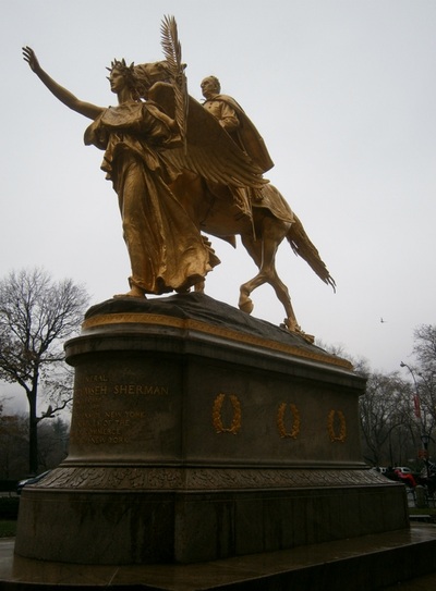
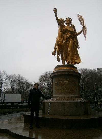
PictureGeneral Sherman

In 2011, I recommended T.A. to read The Great Gatsby after he asked me a question that was, in effect, “What is the Great American Novel?” I found the book locally and bought it for him when I left. / T.A. also asked me around that time about which era or aspect of history one should study “to understand the USA”. Without hesitation, I told him to study the U.S. Civil War, the defining event of the USA, to my mind. In the course of our day touring around Manhattan, we passed a statue of General Sherman on horseback. He didn’t recognize the name. Enthusiastically, I said,” This man won the Civil War”, which, according to my amateur studying of the subject, is not far off from the truth. “Wow!” he said, and insisted on taking my picture in front of the statue (below). I mentioned that if he ever goes back to Spartanburg, South Carolina (his first place of residence, last year), he would do well to not to get too chatty about ol’ Sherman!  [Click on the photos below to enlarge them]

.


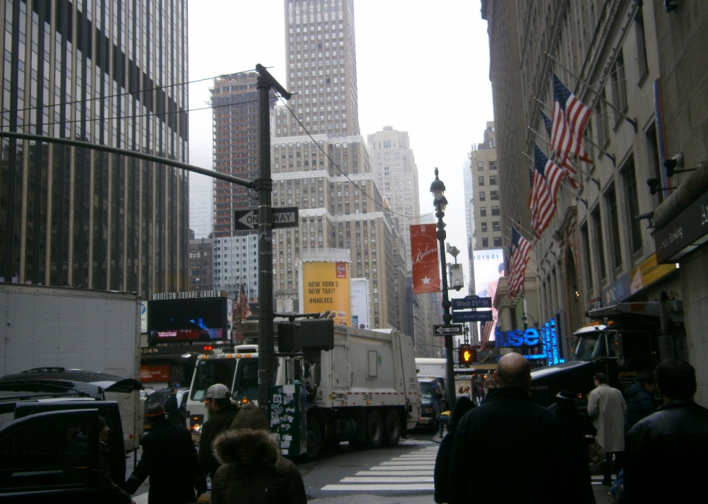
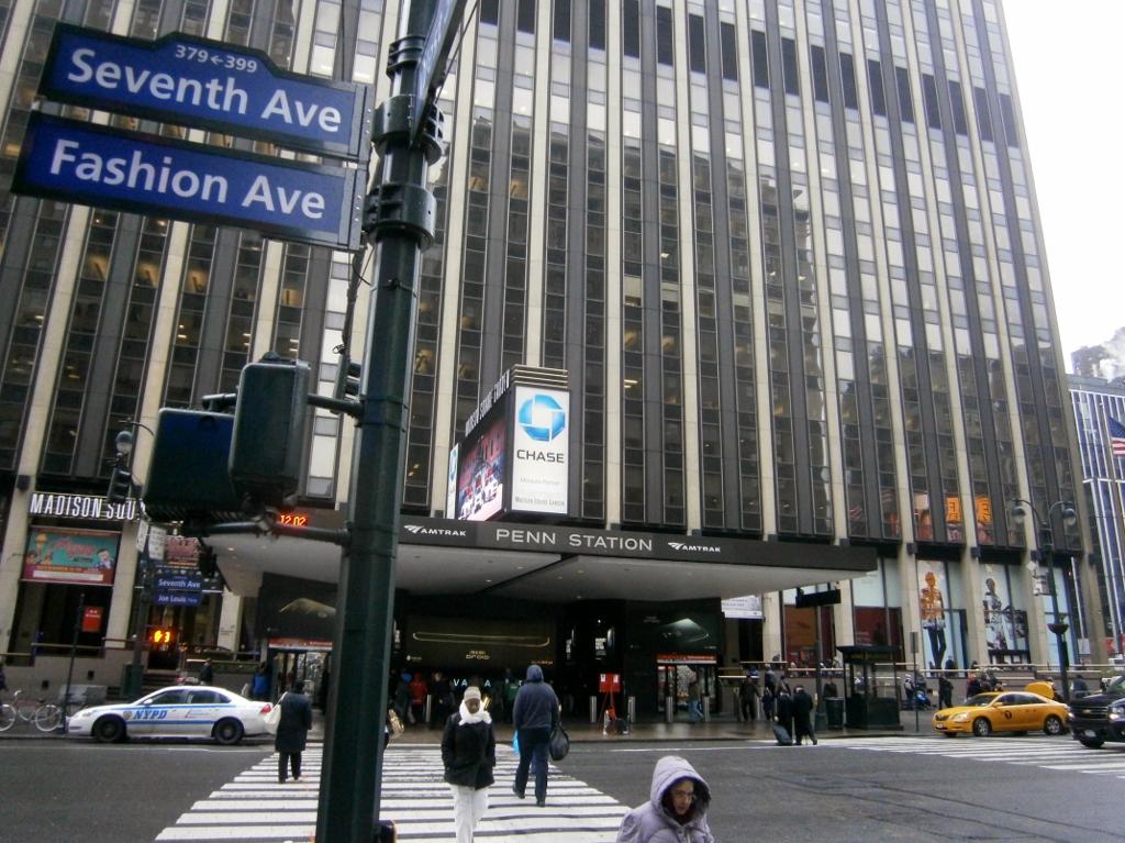
Backtracking to 11 AM, some scenes of the vicinity of the bus drop-off point:
Picture

Picture

Penn Station and Madison Square Garden (part of the same mega-complex).

Picture

A common sight in Manhattan: A team recording some kind of TV spot, or something.


T.A. and I were hungry. He suggested going to a bagel-and-coffee shop nearby, which we did. The menu was plastered up behind the counter. Items on it that I’d never even heard-of before glared back at me menacingly, in that cynical and gritty New York way. My lack of knowledge of basic “bagel fare” immediately made me feel provincial, and/or reinforced my view of NYC as a foreign-country. One particular item on the menu that I’d never heard of was “lox”, apparently a topping for bagels. Who knew? Not I.

T.A. was also unaware of what “lox” was. The next weekend, I learned from a friend of my father’s (Tim) that lox is a fish-spread used traditionally by the Jews on bagels. I’d learned years earlier that bagels were “invented” by Jews in New York City, or perhaps it was that they were invented in the shtetls of Eastern Europe and hopped across the ocean via Ellis Island.

The shtetl lives on New York City.

Picture

Picture

The woman holding the orange sign above is advertising a Jewish catering service.

Many businesses in NYC, it seemed, make it clear that they serve only their own ethic-communities. Another example was a poster (left) I spotted for a ‘Jews-Only’ dating agency called “JDate”. 
[Click to enlarge the poster].


There are a few of us Gentiles in Manhattan, too, though. Here are some:
Picture

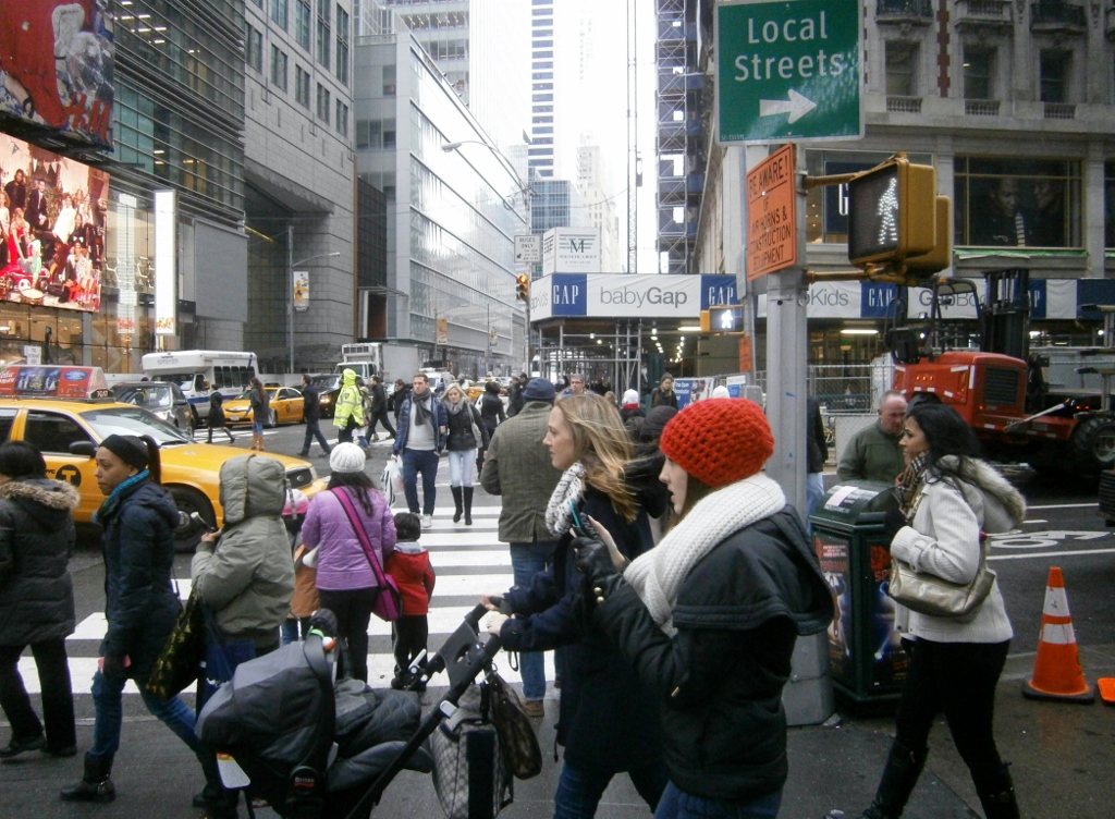
Trendy people cruising around Manhattan

One thing I can say about Manhattan is that the people are (1) more self-consciously wealthy, (2) more fashionable and (3) thinner, than people I’m familiar with elsewhere in the USA. The obesity problem in the USA is almost hard to notice among this kind of chic crowd, as above. The two Nordic-looking young women in the photo exemplify this.
Picture

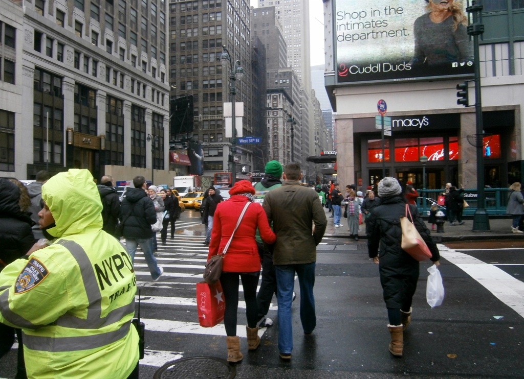
Crossing the street in Manhattan

A large number of women on the streets of NYC seemed to wear these “ugg” boots, visible on the red-coat-wearer and plastic-bag-holder above. You can also see above that this particular Monday was rainy and chilly. Nobody seemed to mind much. Bad weather conditions are a lot easier to deal with on foot than in a car.

bookmark_borderPost-165: In New York City (Part I, Transportation)

I was surprised to find myself in New York City last week.
Picture

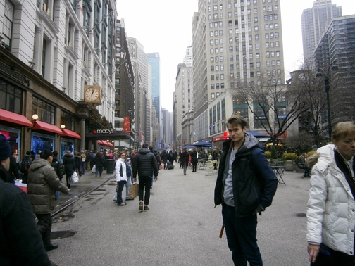
Me in front of the large Macy’s Department Store in Manhattan. [Photo by T.A.]


A whirlwind trip. I enjoyed it, and I was glad to see my friend T.A. remaining in good spirits.

Itinerary
Monday  4:30 AM: I woke up.
Monday  5:00 AM: I left home in Arlington and proceeded to Union Station in Wash DC to get on the inter-city bus.
Monday  6:15 AM: Departure of the bus from Wash DC to NYC, with stops in Maryland and Philadelphia.
           [Bus ride; I sleep]
Monday  10:50 AM: Bus arrived in midtown Manhattan near Penn Station.
           [I meet my awaiting friend; we walk around, etc., etc.]
Tuesday  1:25 AM: Bus departed NYC to Wash DC.
           [Bus ride; Sleeping]
Tuesday  6:45 AM: Bus arrived back in Union Station in Washington.
Tuesday 7:30 AM: I arrived back at the door of my home.

I want to note a few things I find of interest regarding this trip first, then some photos:

The Opposite of Automobile Dependence
Now, any long-distance trip in the USA which requires no use of a personal automobile at all, “from door to door”, is neither easy nor common. I found myself remarking many times while back in the USA, “Why can’t the richest country in the world ‘get it together’ enough to have decent mass-transportation?”  I have ideas about why.

I’ve always found ways to transport myself without an automobile. For some reason, this has been a point of pride for me ever since high school, and this attitude even impelled me to visit my friend J.S. in Roanoke, Virginia in October 2010 in a…highly-unique way, which I will have to elaborate on later, as NYC is the topic at hand now.

This time,
I rode the subway (“Metro”) in Arlington and Washington, the inter-city bus (“Megabus”) for many hours, and the subway in NYC a couple of times; all else came down to expenditure in shoe-rubber, as they say.


Prices
Even after all fees and surcharges (and there always are those in the ol’ USA of today, aren’t there), I paid $42.00 for the round-trip ticket (232 miles one-way; 464 miles round-trip; ten hours on the bus; dropped off in Manhattan). I’d bought the tickets a few days earlier. I paid another $6.20 for two Washington Metro trips to get to and from the bus pick-up place, and a bit more for several NYC subway trips.

I spent little in NYC itself. I also refrained from putting any of my cash directly to an open flame so as to witness it turn to ash and mist away. Seeing the prices in NYC led me to consider those two actions to be close cousins!

Hazy Bus Memories, Clouded by Sleep
My “whirlwind” schedule on this trip was my own choosing. This was, in-no-small-part, to avoid having to pay for a bed in that city. My friend, T.A., was in no position to offer one. I slept plenty but fitfully on the buses. Actually, I hardly remember the ten hours I spent aboard; it’s sort of a sleepy “fog” of a memory; it seems more like it happened a decade ago than a week ago; I remember a large family with several small children boarding in Baltimore; I remember a trim White man in a pilot’s uniform riding the returning bus in a seat near me (by the way, isn’t it odd that one never sees fat pilots in the mostly-overweight USA?); he must’ve been flying from Washington Tuesday morning.

I doubt I was awake more than two of those ten hours. I can’t even remember with certainty if I sat next to anyone.

Here are pictures of my “transportation to New York”.

First I walked, in a brisk snow, to the nearby station of
the Washington, D.C. regional urban-rail network that we call the Metro. I rode on that for a while, got off, tried to find the bus pick-up area, which was curiously almost unmarked. Then I got on the bus, then there is a blurry period of mostly-sleep (not pictured), and finally got off the bus in NYC.
Picture

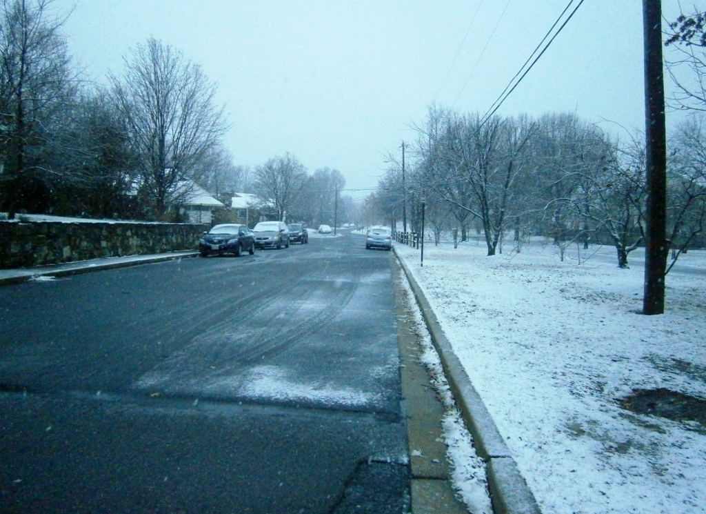
A snowy morning in Arlington

Picture

Typical Metro Station in Arlington. The architecture looks neat, but the network is almost amateurish compared to the East-Asian urban-rail networks I’ve been on, especially Seoul’s.
Picture

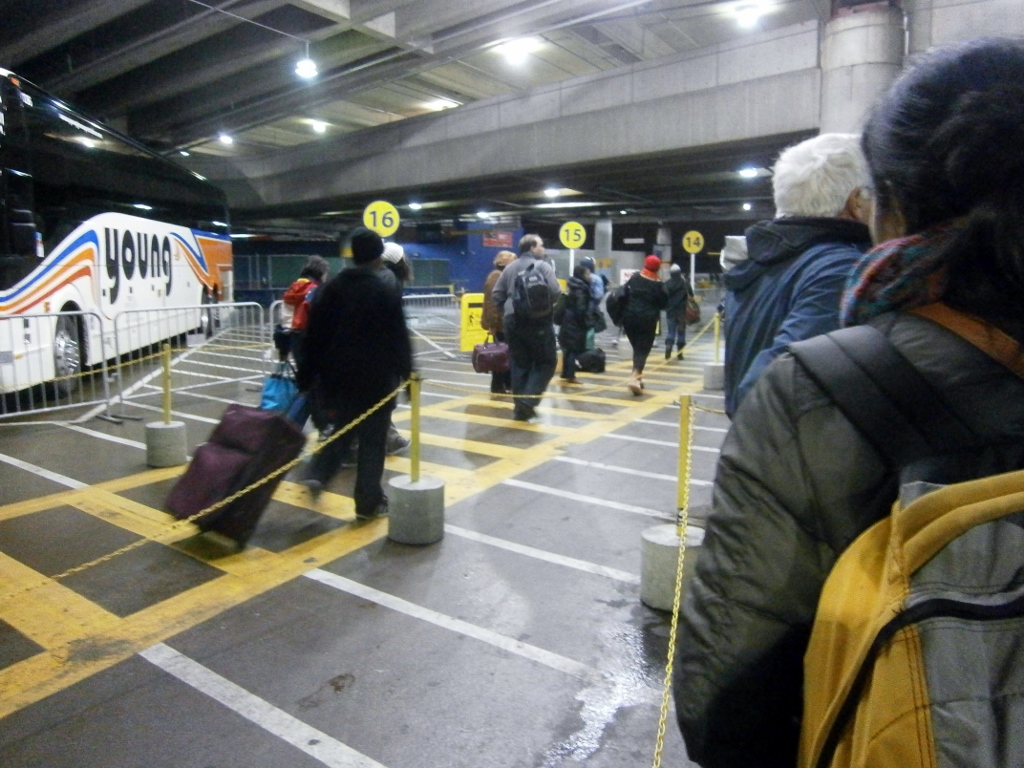
The new defacto “inter-city bus station” at Union Station in Washington DC.

In the caption above, I use quotation-marks around “inter-city bus station” because it’s actually just the upstairs parking lot of the train station. There are no facilities within this bus “area” that I could readily see. No places to wait except standing around on the pavement of the former parking lot, like the people pictured here. No toilets, except far off below in the train station. No clocks even, to check the time; no big boards to check arrivals or departures. No place to buy tickets (you have to buy online) except for Greyhound. No place to buy food or drinks. No payphones that I saw. Nobody was even clearly in charge to ask for help. No lockers to store one’s things. Somehow, it all sort of hobbled along and worked. At least the place offered shelter from the rain, sleet, snow, The bus-stops were sort-of marked.

Now, t
he last time I rode Megabus, in 2011, the bus stop was two blocks away in a slightly-squalid, poorly-lit, and exposed outdoor parking lot, so despite my complaints, it is a move up.
Picture

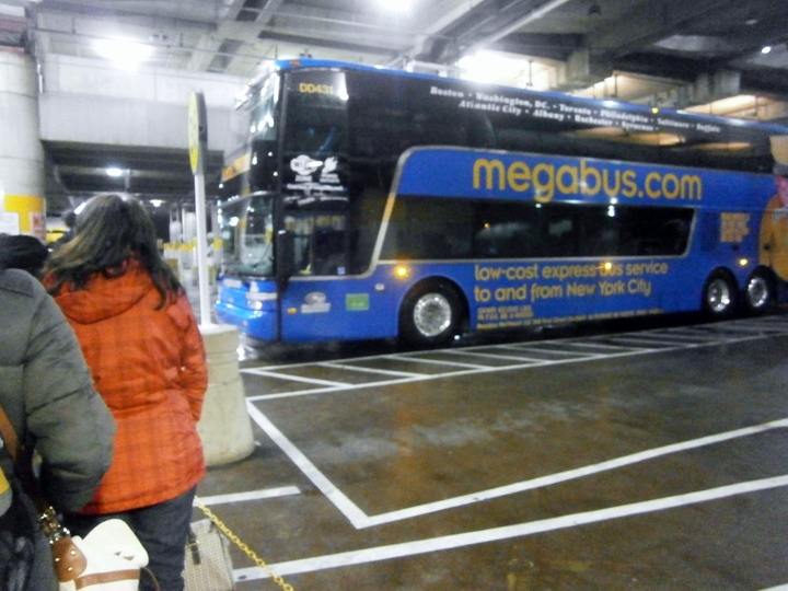
The grainy quality these pictures fits with most people’s mental condition at the time, I think. It was around 6:00 AM.
Picture

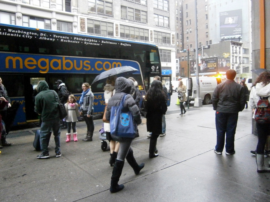
Getting off the bus in Manhattan.

I can here comment on the type of passengers I rode with, some of which are pictured above, just having gotten off.

Impressions of Fellow Passengers
I have ridden inter-city buses in the USA in recent years a number of times, maybe more than anyone else that I personally know. It’s just quite uncommon in the USA to travel in that way. The central reason it is uncommon, in my view, is that people are scared of the other passengers. I don’t blame them. Greyhound, in particular, for some reason attracts some really unsavory, frankly dangerous characters. This is Greyhound’s reputation, and I can say that generally in my experience that reputation is deserved. I mean, really: If I were a father, I would never allow my daughter to ride one of those Greyhound buses. (This makes me sad, as a native-born American, that we have to deal with this kind of thing so commonly). However, this is Megabus, a somewhat-new company. Somehow, much of the criminal and semi-criminal element missed the memo that Megabus exists. Most of my fellow passengers on the above-described trip actually could’ve been distant relatives of mine. The large family I mentioned above, that got on in Maryland, looked and sounded a bit like my cousin N.C.’s family. N.C. and her family also live in Maryland. Many of the other passengers seemed to be foreign college-student types. The “semi-criminal” element was vastly under-represented this time, if present at all! (Later in the week, I rode down to southern Virginia to visit my friend J.S., on an Atlanta-bound bus, and on that bus some of that element manifested itself again.)

The Rise in Bus Popularity Explained–?
A big reason why ‘regular’ Americans are riding these buses more these days is, I expect, the rise of the “electronic world” and companies savvy enough to pander to it.
Megabus advertises itself as giving access to a power outlet in every seat, and having free Wi-Fi on every bus. In the world of these handheld computers that we call “smartphones”, this means a person can “be online” and productive, or at least satiated with entertainment, for the entire ride: One can work, email, ‘facebook’ (it’s a verb, you know), read online article or ebooks, or entertain oneself with downloaded movies or Youtube, or play games, or do whatever else one can with a computer, for the entire ride.

The above small-handful of pictures takes us only through 11:00 AM. There is more to come!

bookmark_borderPost-164: Hiking, Living in Seoul, Visiting Malaysia, Cashing Out of Korea

Welcome back, readers, if any. I apologize for the long hiatus.

When I posted #163, I expected it would be one of many more to come about my partially-successful cross-country mountain hiking trip in Korea (mid-September to early November 2013), the “Baekdu Daegan Trail”. I had many ideas for posts floating around in my head. Somehow, no other posts materialized. I got too busy in November and then got out of the habit.
Executive Summary: Below I explain why I posted only erratically during my hike; reasons for leaving the trail;  about my trip to Hong Kong, Malaysia, and Thailand; how I returned to Korea and settled my affairs. Now I’m in the USA.

Writing While Hiking
I wrote in a small notebook every day on my hike. I only made about five total posts to this blog, though. It’s amazing that I managed any posts at all here after mid-September. Each post was the product of a lot of willpower and some difficulty. Most of the days of my hike I was not even in a position to reliably get a phone signal, much less have access to the Internet. Unlike my earlier posts of 2013, which were written in my apartment at a nice little desk, my posts after mid-September were all made ‘outside’, wherever I could manage to access a workable computer and the Internet. This usually meant I was paying by the hour at a dank, smoky “PC Room” (Internet cafe), or paying by the day in a motel with a computer, in whatever city I was in at the time. Posts were only sporadic because getting into a city meant making a big detour off the trail. When did I leave the trail? —

Reasons for Leaving the Trail
One unfortunate reason I sometimes left the trail,
especially in the early days of my hike, was physical. I got hurt and needed rest to recover. There is one particularly dramatic memory related to this I will post later.

Rain was another reason,
including the case of the unexpected tsunami while going through the Deogyu Mountains in early October. I reached one of the so-called “shelters” (which are really semi-serviced mountain-hostels costing 7,000 Won for a berth).  The pair of shelter rangers took me in, but were astonished I was there. I was the only guest. The more-jovial of the two seemed to be laughing at me condescendingly for trying to make the journey in such conditions (though he was actually trying to be friendly; “condescending laughter” is a way, in my experience, that older Korean men try to bond with younger males).

The biggest “problems” causing me to leave the trail were running out of food and water. Those were problems I faced even living in my apartment in the middle of Bucheon (a large city) for two years, though. In the latter case, it was just plain-old laziness that I didn’t stock-up on food until I ran out of it. In my cross-country hiking attempt, it was because space in my backpack was so limited. I made many, many mistakes on the trip — I’d like to write about them another time — but this was lack of backpack capacity was the most serious mistake, which enabled/caused/exacerbated many other problems/mistakes. Mine was 35 liters. I met one hiker along the way who was carrying an 80-L bag. #5-liters is just too small. I could usually find water near the trail, in mountain runoff, and I almost never bought water, but in dry periods this was sometimes a big headache. Food always required going into town. I would stay at a motel (price usually $25-$30/night), try to get quality rest, eat heartily, and stock up on food. A secondary goal was finding a computer to charge my camera batteries and upload pictures/videos.

I really enjoyed the trip, in the end. It was absolutely worth doing despite the problems I allude to above. The problems are even part of the fun. My goal of crossing the entire country was overly ambitious. I made it halfway across.

My Last Hiking Day
Skipping ahead to my very last day on the hike, I was surprised to find myself staying at a Buddhist temple near Woraksan National Park. I didn’t plan it; it just all fell into place that way. The temple had some austere little guest rooms, and they gave me some food. I’d like to post more about this, and about much else (with photos), later.

I walked across the ridge for the last time early the next morning, found the town on the other side, and found a bus-stop. I rode the bus into town and and returned to Seoul. From waking up in a temple to Seoul, in a few hours.

Back in Seoul / Ten Days for $130
Back up north in Seoul, I rented a tiny little room for 15,000 KRW/night [$13]. It was a mangy little place in some ways, and I shared close quarters with fifty or so others, many of whom were middle-aged men. Those who stayed longer got even better deals than mine. One strange thing about the place is that the manager never asked for my name or ID. There is no record of my having been there. It so happens that I heard Chinese being spoken there sometimes, in the hallways and the kitchen area. I speculated that the speakers may have been illegal immigrants. Since no names are taken down and no papers are needed, just cash, it’s the ideal living place for an illegal immigrant who wants to be off the radar and leave no paper trail. It’s also much cheaper than a real apartment. The longer-term residents of that goshiwon [고시원], I think, paid more like $8 a day (=$244/month to rent a small room in Seoul; a great, great price). I stayed ten nights. The place was near Sindorim Train Station [신도림], a very busy and crowded area.

In this period after my hike, I did a lot of relaxing and meeting of friends, including my Korean friend B.W. (whom I met in 2009 in Ilsan), who has become now a hotshot with Lotte Group. His hours-worked on the week seem more like a slave’s. 

I once created a list of things I wanted to do in Korea, and with so little time left, I felt a bit sad in those ten days because I wouldn’t be able to do them all. I knew I would be leaving Korea, and maybe forever. I’d be walking away from the life I’d created there; friends, routines, favorite places, foods, memories. I’d spent enough time and mental effort to feel established in Korea, for better or for worse (and people in the USA, who have seen it fit to give me unsolicited advice on the matter, almost always say or imply that it has been for the worse, a waste of time; I think a lot of friends, family, and acquaintances in the USA viewed my Korean time as akin to a prison sentence; they were interested only in when I was getting out).

I’ve spent three years and three months
in Korea. This short period at the goshiwon is the only time I slept in Seoul.

Zipping Around Hong Kong
I left Seoul bound for Hong Kong aboard a plane belonging to the surprisingly-nice China Eastern Airlines, which even served ice-cream. I spent around 36 hours in Hong Kong, and met a colorful Guatemalan in his 40s who has lived in Los Angeles for 10 or 15 years. (He said he was no good at remembering specific years, like the year he arrived in the USA, but that it was something over ten years ago.) We spent the day together, zipping around Hong Kong seeing the sights/sites (I’m conflicted about which of those words is more befitting). Maybe in another post I can comment discuss Hong Kong’s bustle and the surprisingly-poor English of the native people there considering the British heritage.

Hospitality in Malaysia
Before I got the invitation to Malaysia, I’d intended to venture into China again, as I did (too-briefly) in May 2010. I planned to return to the USA in late November 2013. I didn’t have a China visa, and getting one in 2013 is a big headache for foreigners in Korea, for some reason. I was going to try to get one in Hong Kong, but that was uncertain to succeed. Fortunately, my father proposed an alternate plan: Malaysia. (Both he and my mother had been U.S. Peace Corps volunteers there many years ago). He was supposed to be there at that time anyway, and he convinced his friend R.B. to go with him, too, and we all met there in mid-November. R.B. is (in his term) an “ex-Malaysian”, a nonreligious Sikh born in Malaysia but who emigrated to the USA in 1970, the same time my father left. They were both teachers together and have remained friends in the USA lo these past forty years. I will post more on Malaysia later, I hope. The warmth and hospitality of the people there impressed me. We crossed into Thailand for a day. I spent not a single minute on any beach in my time in Malaysia. Mostly the time was spent visiting old students my father and R.B. had.

Cashing-Out of Korea
I spent nearly two weeks in Malaysia, before returning to Korea for three days, gathering up my possessions being held by various people, and doing a bunch of other “leaving the country forever” things like going to the bank to send money home, the post office to send stuff home, and going to the pension office to “cash out”. (All salaried workers, legally, have 4.5% of their salaries deducted monthly to set aside in a government-run pension fund, and the employee’s contribution is matched by the employer. This means that, in effect, we get a 4.5%-bonus on all the wages we earn [i.e., the employer’s contribution]. As a U.S. citizen, I was able to “cash it all out”, and send it back to a U.S. account if I show them a return plane ticket.)

The pension office woman, in her 30s, was very kind and efficient. I think she specializes in dealing with foreigners enrolled in the Korean pension system. She had an odd habit, though, of switching randomly between English and Korean when speaking to me. Her English was very good and I showed no sign of knowledge of Korean in my dealings with her, but she switched into Korean several times. She may have done this for her own amusement, to try to gauge my reaction. I also heard her do this on the phone during my 15 minutes with her, when somebody called asking how they could punish an employer who was refusing to contribute to the national pension program on that employee’s behalf. She spoke 90% in Korean, which I tuned-out to focus on the plethora of documents before me I had to fill out. Then, suddenly, she delivered one sentence in English: “We don’t have the power here to force them to pay, you have to contact the….”, then back to Korean.

As of this writing, two years’ worth of Korean pension money in my name has been ‘repatriated’ to my U.S. bank account. It took only two weeks or so.

Back in the USA
I arrived in the USA in time for Thanksgiving, and today is December 10th, thirteen days later. Some things have changed in Arlington, my hometown, but much more is the same. I’ve busied myself visiting people and visiting the library. I really missed the library.

I have plans set for January and probably for February, but 2014 is still more of a question-mark.

bookmark_borderPost-163: At Hwaryeong

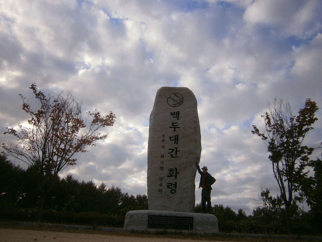
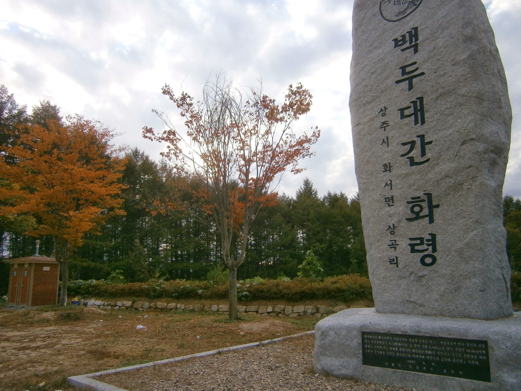
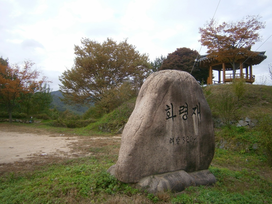
If you go to a place called Hwareyong [화령재] along Korea’s Baekdu-Daegan Trail, you’ll see something about like this:
Picture

Me at the Baekdu-Daegan Hwaryeong Stele
(Camera on 12-second delay, resting against a rock on the ground)

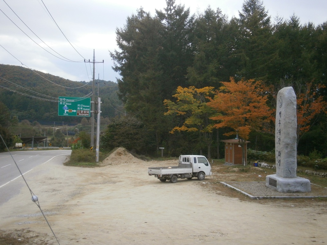
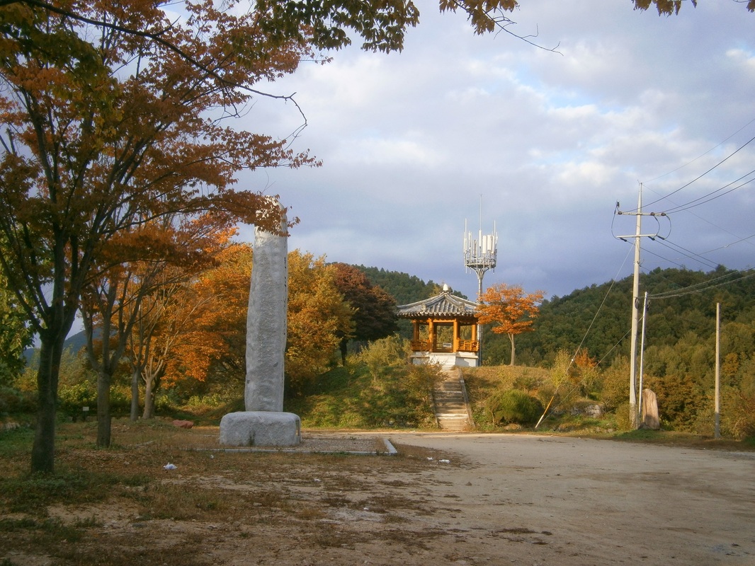
Following are more pictures of the area around this giant stele [seven meters (23 feet) in height] and comments:
It says this stele was erected in September 2007. The various monuments and steles like this of the Baekdu-Daegan were mostly erected in the past ten years (according to their inscriptions), in my experience.
I made my tent and slept in that pavilion (or jeongja) overnight, as is acceptable practice among Korean hikers. (I wouldn’t have done this had I not observed Koreans doing it before several times.) It was very comfortable and dry.
Picture

Dawn at Hwaryeong

That is dawn the next day, and soon I was on my way. The road here, crossing this low pass, was well-frequented by buses (at least one every ten minutes, it felt like) till even after 7 PM, which in rural Korea is about equivalent to the midnight hour in Seoul. There is a town a few kilometers away. The vehicles that stopped at the pull-over area in front of the stele seemed to be lost drivers checking their maps and one guy who used the toilet and then sped off again.

Finding the trail was a little hard north of here, and I got lost on false trails leading to many tombs. That cost me about an hour. Soon I was back on track again, and headed north towards Songni National Park [속리산],…


[I write this from a Jeomchon motel. My trip is ending soon. This is my final anticipated “comfort accommodation” until I return to Seoul next week. I bought a lot of food here. I expect to update next from Seoul in a week’s time.]

bookmark_borderPost-160: At Nongae’s Birthplace

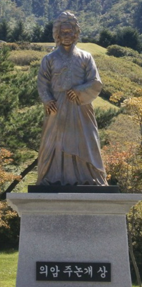
Nongae

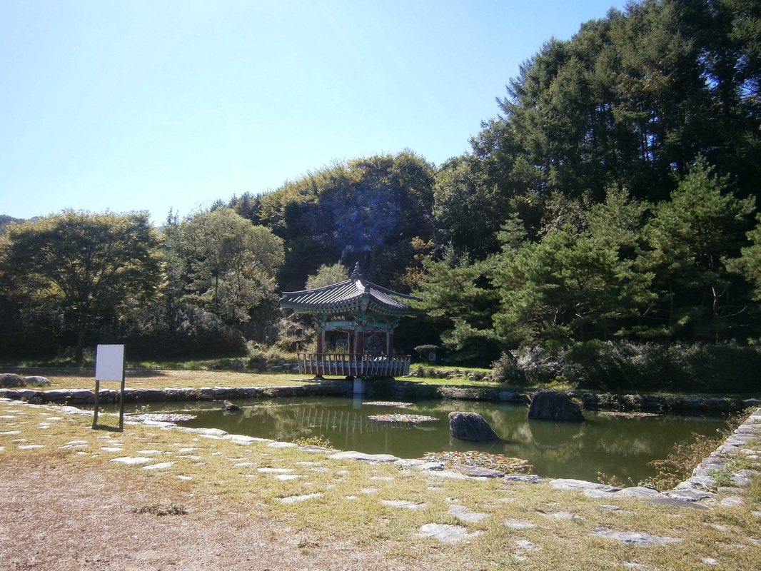
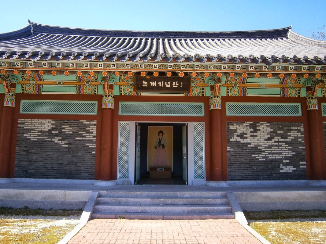
I veered off the trail on Friday, October 4th to visit a nearby (impressive) shrine to a minor Korean historical figure called Nongae [주논개]. It was near her birthplace in Jangsu, Jeolla Province.

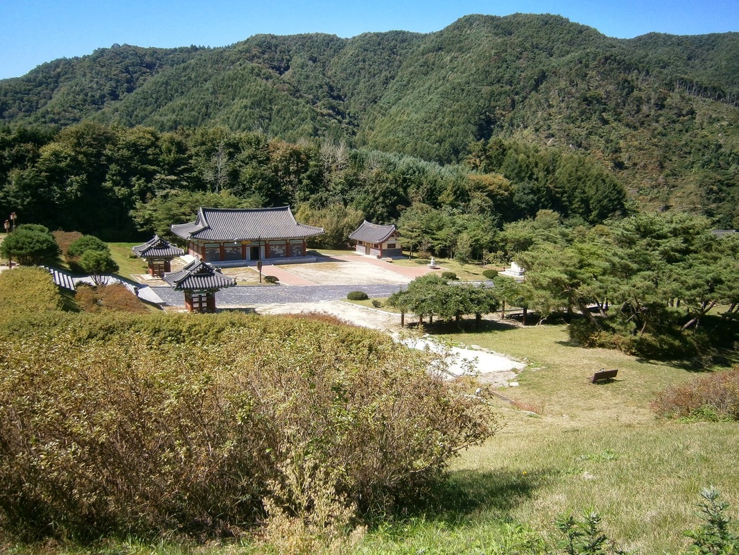
The shrine was mostly empty at midday on a non-holiday Friday, which was good; it was also free, which was better still. The grounds were very large and well-kept.
__________________________________________________
Who was Nongae? She was a patriotic assassin.

The Japanese, it seems, conquered the Korean city of Jinju in 1593. Afterwards, they held a victory celebration, and they compelled the local gisaeng to join in (a gisaeng was a Korean female entertainer like a Japanese geisha). One of these, named Ju Nongae, won the affection of a top Japanese general. During the victory festivities, the general and his entourage (including Nongae) moved to a scenic spot on a high rock overlooking the river. Suddenly, Nongae embraced the conquering general around the neck and threw herself over the edge, which took him down as well. They both drowned.

Earlier this year, I also happen to have visited the very rock on which this murder-suicide happened. The rock is called “Uiam” within Jinju Fortress. (Nongae is given the title “Uiam” in honor of her act.)

Nongae is a symbol of patriotic loyalty for Koreans.
__________________________________________________

Here are some pictures from the large, open grounds of the shrine:


Nongae2

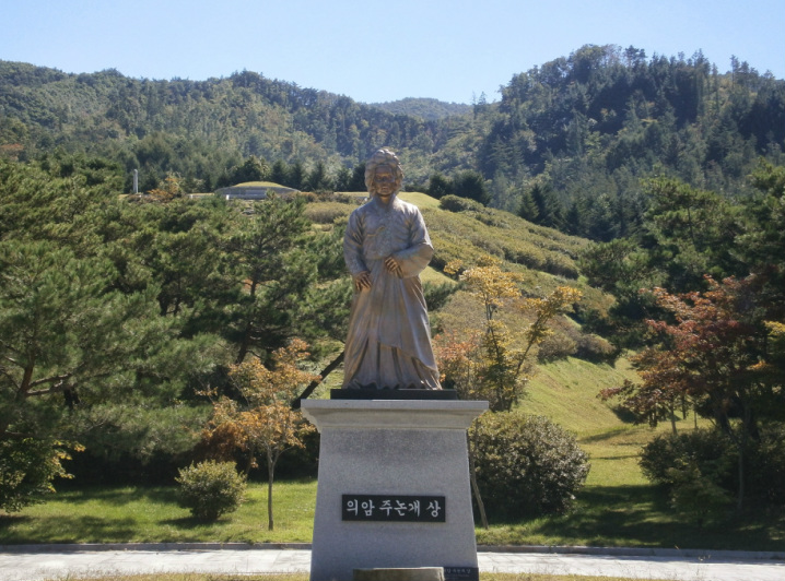
Nongae Statue in the middle of the Nongae Shrine/Park

Picture

Nongae Shrine

Picture

Nongae Museum

What I found interesting is that Jinju historical authorities and Jangsu historical authorities disagree on who she was.

Everyone agrees that Nongae killed the Japanese general by jumping off the high rock in Jinju in 1593 (when she was only 19 years old), but Jinju historical markers and explanatory signs, as I recall, said she was just a lowly gisaeng motivated by spontaneous patriotism. The explanatory messages in Jangsu, though (her birthplace-shrine, pictured above) say she was a married woman who disguised herself as a gisaeng  in order to carry out the assassination.

The Jangsu shrine really gives the impression that Nongae was a saintly yangban aristocratic married woman, the archetype of Korean female virtue. The Jangsu Shrine signs I read, in English translation, said that she felt enraged when her husband died in the battle for Jinju and thus began preparations for the assassination. (Actually, one sign I saw in her birthplace-shrine claimed that her husband hadn’t died in the battle. He had survived the onslaught, it said, but committed suicide at the end rather than surrender. — If you’re going to deify this hypothetical husband, he can’t have simply been “killed by the Japs”, now, can he? He’d have to have been too good, too pure, for such a crude ending.)

The Jangsu version seems — forgive me, Korean readers (if any), for I mean no offense by this, but — It seems to be a case of “a hometown referee calling the game”, if that makes sense. This saintly-yangban Nongae image, with the husband too noble to have died by Japanese hands…It’s creeping closer and closer to that kind of purely self-serving nationalistic mythologizing/deification that the Kim Il-Sung “mythology-apparatus” cranks out in the North...


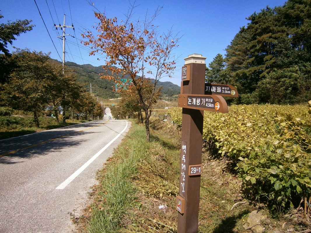
I liked the hour or so I spent at the Nongae Shrine. I spent very little of the day on the trail, though. Mostly I was straddling the yellow line on rural roads in Jangsu, walking to and away from the Nongae Shrine. It looked like this:
Picture

A sign pointing to the Nongae birthplace shrine

Picture

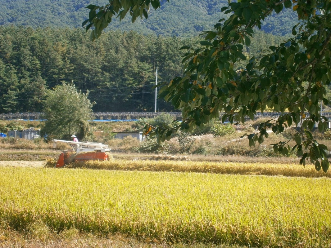
A Jangsu farmer at work near Nongae birthplace


After leaving the shrine, I continued walking on the roads to rejoin the trail at Yukship Pass. On the way, I saw this:
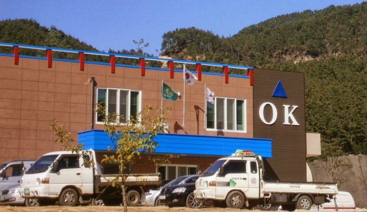
A Brazilian-Korean joint business venture, in one of the ruralest parts of South Korea! Doing what? I don’t know.

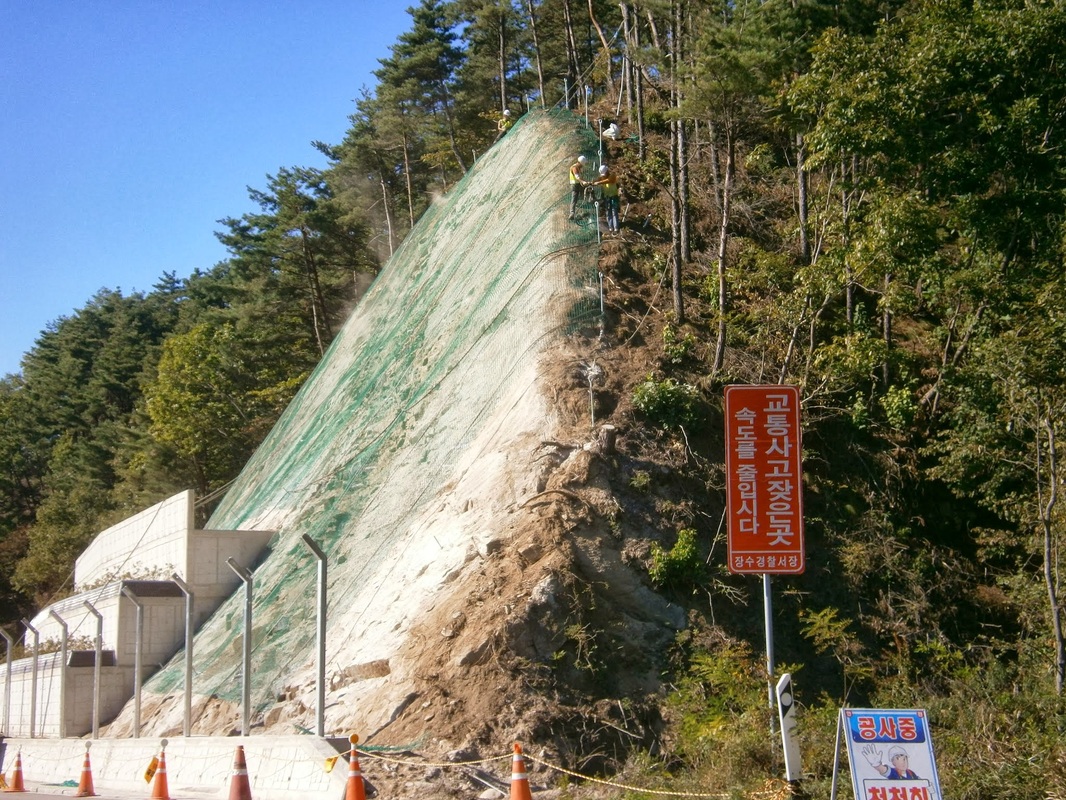
Closer to the pass, I saw construction workers fencing-off a rocky area above a road:

All along many of the roads here, they’ve blanketed the hillsides with a mesh netting to stop any possible rockfalls, and put up a huge fence down below besides. It seems very thorough, and very possibly overkill, but it gives construction crews something to do.

Road-walking is easier on the leg muscles but can be harder on the nerves, as cars and trucks whiz by. A little past the construction scene above, a man pulled alongside and offered me a ride for the final few kilometers to Yukship Pass, I accepted. After getting some food at the pass, I was soon back into the nether regions of the Baekdu-Daegan Trail….

[This was written at a motel in Chupung Pass on October 16th and finished on October 25th in Jeomchon]

bookmark_borderPost-161: At Yukship Pass

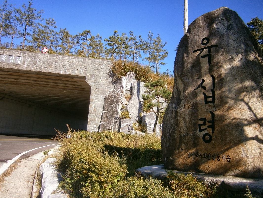
I reached Yukship Pass [육십령] on the afternoon of October 4th, following my detour to Nongae Shrine (post-160).

These passes are often tunneled to preserve the integrity of the ridge-trail above:

Picture

Yukship Pass, Jeolla side

Like most of the southern half of the trail, Yukship Pass sits on a political boundary, dividing Gyeonsang Province from Jeolla Province. The two southern Korean regions have different accents and are in fact different in a lot of ways. It seems they’ve disliked each other for longer than Europeans have been Christian. (They had competing, rival states for a long time, until one of them was finally stamped out of existence by the other over a thousand years ago.)

I saw that there was a village on the Gyeongsang side of the pass, only a few hundred yards away from the border itself. Here’s what I want to know: Do the residents have “Gyeongsang accents”? Do they dislike Jeolla? I don’t know, but one indication of how strong the rivalry between Jeolla and Gyeongsang is (maybe), even at the border is this:

About 200 meters short of Yukship-ryeong, the trail forks, with both branches ultimately heading to the pass. The left trail, heading northwest, emerges on the Jeollabuk-do side of the pass, while the right trail heads northeast, leading to the Gyeongsangnam-do side of the pass. Both are on NH26 and are separated by about 100 meters of road.          [From the Trail Guidebook]

Neither side wanted the trail to only go through the other’s territory so they both carved out separate trail forks.

Along my hiking trip, I’ve always looked forward to reaching one of these semi-populated “passes”. It’s always good news when one is coming up. They have good facilities, food for sale, water. The guidebook promises the following:

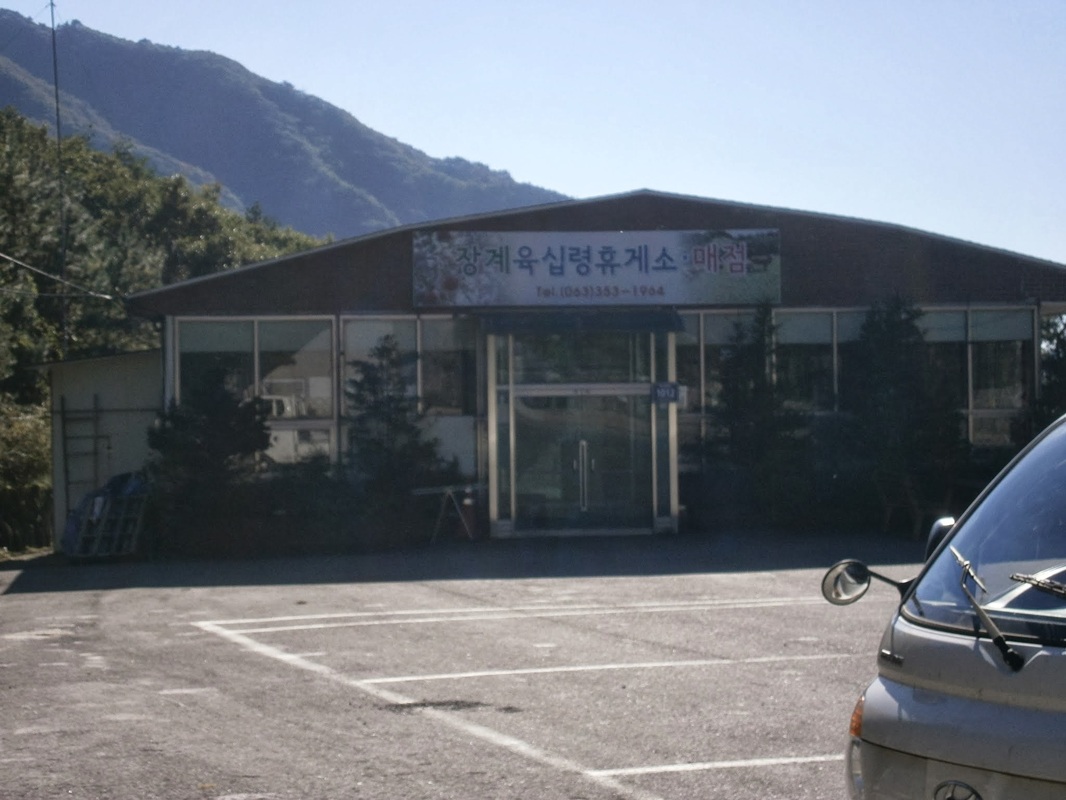
On the western side [of Yukship Pass] is the large “Yukship-ryeong Hyugeso”, which has minbak rooms [simple rooms to sleep in], toilets, a good restaurant and a well stocked supermarket. Also in front of the hyugeso is a large two-story concrete jeongja [pavilion], which is suitable for sleeping in after sightseers have left. On the eastern side of the pass are a small supermarket and restaurant.

The writers went on their trip in September to November 2007, six years ago now. When I passed by in October 2013, the big place they talked-up so much, on the western (Jeolla Province) side was closed completely. It was a big let-down for someone as hungry as I was at the time. The building seemed abandoned and was boarded up:
Picture

The closed store and restaurant on the Jeolla side of Yukship Pass

I loitered for a while around the jeongja (a large, shaded pavilion raised off the ground, which Koreans seem to use for many purposes including overnight camping — I’ve seen Koreans doing it several times and now done it myself once). The jeongja is to the right of the building above, overlooking the valley in Jangsu County. It was empty.

I was waiting for something to happen. The store I’d anticipated buying thousands-of-calories-worth of food from was dead and showed no signs of coming to life. Maybe I expected the lights to spontaneously come on. It was not to be. The only thing happening in the large, nearly-empty parking lot was that a middle-aged man was watching a dog running around. I got the idea that the man was “looking after” the closed store/restaurant. I think he was actually “just a guy”, though, using the place as a big dog park. I asked him if camping was allowed around there. He replied that it wasn’t. No store. No restaurant. No camping. No water. A big disappointment.

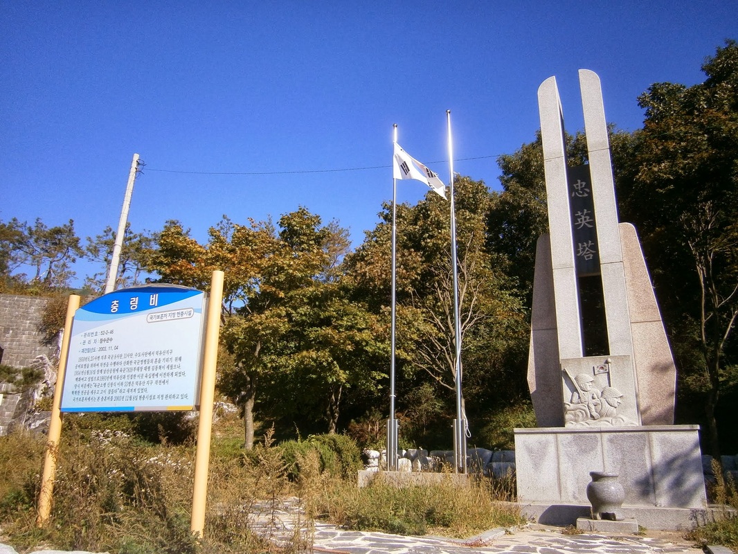
I made by way off to the eastern (Gyeongsang) side of the pass, where there was said to be another “huygeso” or rest-area (store, restaurant, and more). On my way to the tunnel and the other side stood a memorial. It was to the South Korean soldiers killed in the anti-communist-guerrilla campaign fought in this area during the Korean War:

Picture

A memorial at Yukship Pass to South Korean soldiers who died fighting pro-communist guerrillas

(The government chose the Jeolla side for this memorial commemorating [in effect] the large-scale killings of pro-communist civilians, when those communist-sympathizers disproportionately came from Jeolla [as I understand it] — I’d speculate that this choice of location may be the handiwork of the Gyeongsang circle that ruled South Korea for thirty years beginning with General Park Chung-Hee in ’61 (whose daughter is now president).

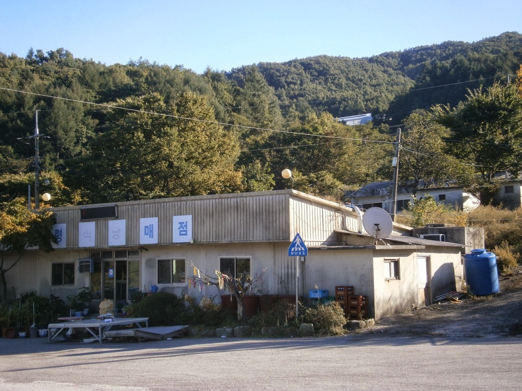
These are thoughts that occur to me long after the fact. At the time I snapped the above picture, I was really hungry and out of food (except peanut butter and some “gorp”). I staggered on to the Gyeongsang side of the pass. On the Gyeongsang side, a smaller and decrepit-looking store/restaurant was (at least nominally) open for business:

Picture

Small store and restaurant at Yukship Pass, Gyeongsang side

I was so hungry.

I walked in, said hello, and clumsily asked “Is this a restaurant?” in my poor Korean. I really wasn’t sure whether it was a restaurant. I couldn’t see a menu anywhere. Maybe you just “had to know” what was on the menu.

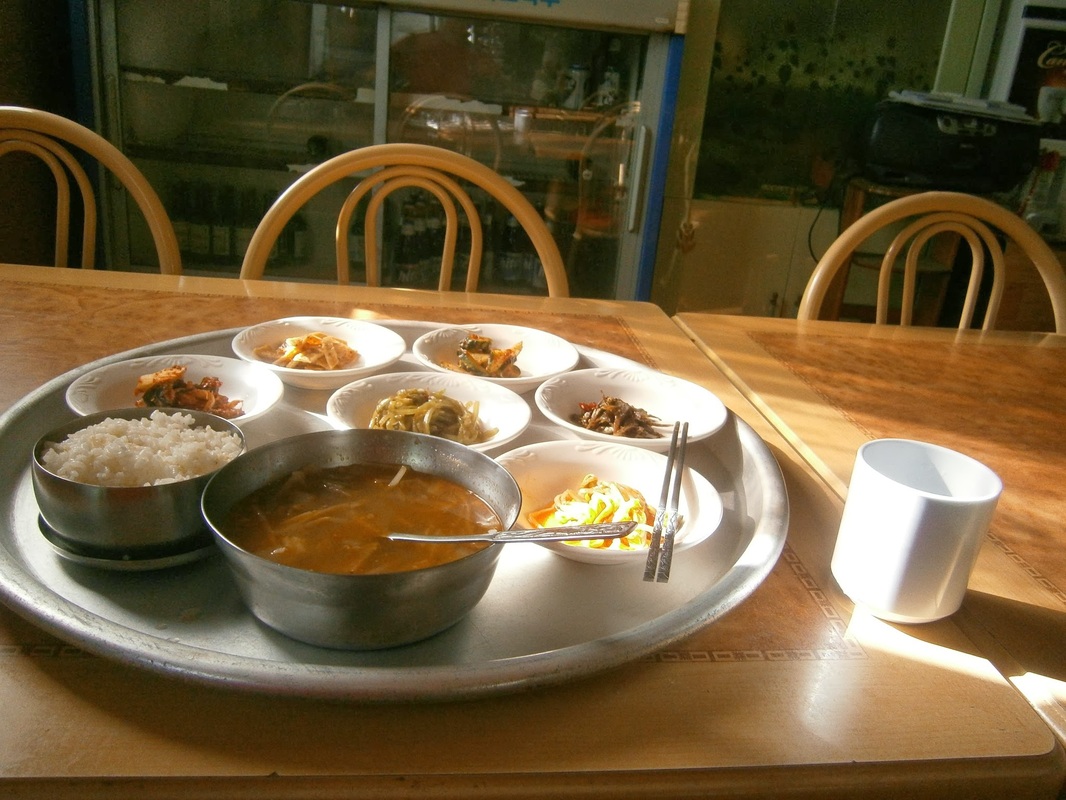
Two middle-aged women, one very old woman, one middle-aged man, and one young man were inside. I soon got the feeling that all were related. Before long, this materialized on the table in front of me:

Picture

My meal at Yukship Pass — Beef(?) soup, rice, and vegetable side dishes with water

I’ve rarely had a meal with so many “side dishes” (banchan, 반찬) before. This one had six. At first, I thought the meal was entirely side dishes. Only about halfway through did I realize that the soup was the main dish. It had beef in it, I think. I ate it eagerly, having eaten little that day. After finishing  the food far too quickly, I stayed at the table and leafed through the guidebook a little, to know what was on the horizon next. It was about 4:00 PM, so two hours of good daylight left. 

I paid 6,000 Won ($5.50) for this meal. In the front, they have a small “store” area with snack foods, chips, cookies, lots of types of ramen, and other things like tuna cans. I bought pound-cake bread and crackers, total 4,000 Won. Off I went again into the forest:

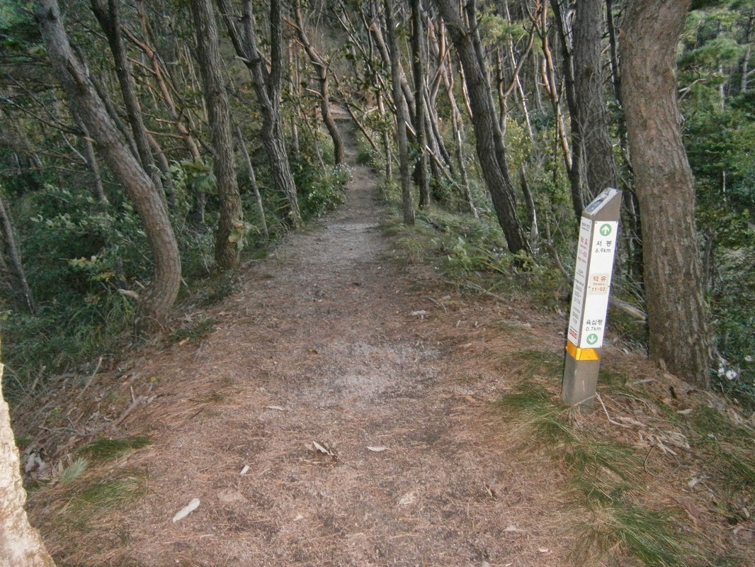
Picture

The trail, north of Yukship Pass

I decided to make camp as soon as I found a good place. I found one and, still hungry, I had a second dinner of peanut butter slathered on my crackers and pound cake:
It hadn’t been windy at all that day. After night fell, though, the wind suddenly picked up. I was glad I was safe in my tent and not outside. The next day, the wind would still be there as I made my toward Halmi Peak (see post-155)….


[This was mostly written in a motel at Chupung Pass on October 16th and finished on October 25th in Jeomchon]

bookmark_borderPost-162: On a Foggy Mountain Top in Korea

A third attempt at video-making a part of my hike (the first two: post-158 and post-157).

It was a rainy and eerily-foggy October 10th. When the rain let up for a while and the fog lifted, it looked like this:

Try to imagine what it was like on this particular day–
Imagine steady rain, cold, thick fog causing low visibility, and imagine your clothes wet, your body wet from rain (despite a raincoat) yet sweating. No fun. I spent a lot of time that day trying to find cover on the exposed ridge, mostly failing (though I succeeded in keeping the contents of my backpack dry). Navigating the trail was hard due to slippery rocks.

By now, a general rule for hiking that I’ve learned is this: “The harder the conditions, the better the views”.

The views over the foggy valleys you see here are an example. Without the misery of that day’s hike, the views would’ve been…uhh…less dramatic, or less vivid, or something. I remember reaching this little overview area, which I think is named Sambongsan [삼봉산] or Deogyusambong [덕유삼봉]. The view hit me with the force of a bucket of ice water dumped on the head on a sizzling August day.

Note: This was along the cross-country Baekdu-Daegan Trail (백두대간) in Korea, which I’ve been hiking since mid-September. It was along the trail northeast of a place called Bbae-Jae (“Bone Pass”, 빼재), and east of Deogyusan National Park (덕유산), and southwest of 소사곡개 (Sosa Pass).


Whoever is reading this, I hope you enjoy(ed) this video. I hope it gives a small taste of what my long hike has been like. Thanks for watching/reading.

bookmark_borderPost-159: In Jeomchon

I spent the weekend of October 19th-20th in Jeomchon [점촌, 문경시] in Geyongsang Province, taking a break from hiking. I was happy to find a large Homeplus there to stock up on supplies. They even had a pretty-good potato salad.

Here are some pictures of Jeomchon:

Picture

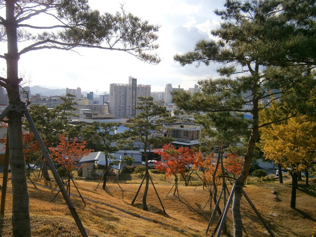
A view of Jeomchon from Jungang Park
Picture

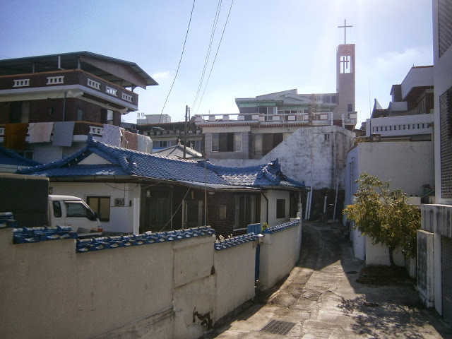
A street in Jeomchon
Picture

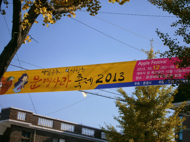
A banner for an “Apple Festival” in Mungyeong County, surrounding Jeomchon
At the train station:
Picture

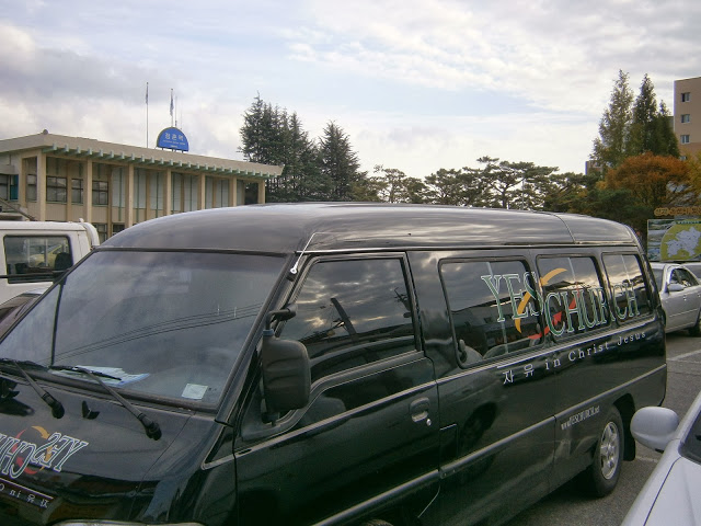
A church van in the parking lot in front of Jeomchon Train Station.
Note the combined use of Korean and English in the slogan: “자유 [Freedom] in Christ Jesus”.
Picture

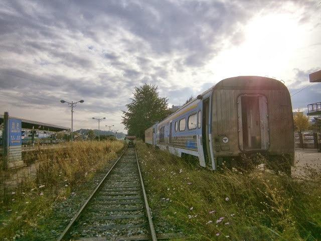
An old traincar open for looking around in, on a sidetrack at Jeomchon Station.
Also nearby were a large cage for two dogs visitors play with, many flowers,
walking paths, a small library, rest-area, and a “mini-KTX” train ride for kids.
The station almost feels like an amusement park!
Picture

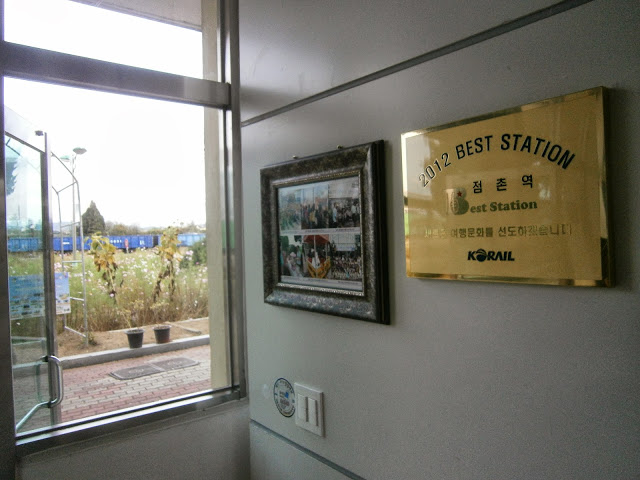
Jeomchon Station was awarded “Best Station” in 2012, and having walked around in it, I can see why…

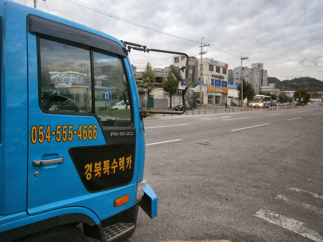
Elsewhere around town, I kept seeing phone numbers which included “555” or “666”, both combinations never-seen as phone numbers in the USA (for very different reasons). Here is one that includes both at once:

Picture

A truck with a “fake”-seeming phone number

Finally, a glimpse of the Four Rivers Cross-Country Bicycle Trail:

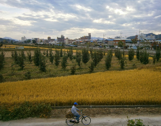
Picture

A bike rider on the outskirts of Jeomchon, and near the “Four-Rivers Bike Trail”
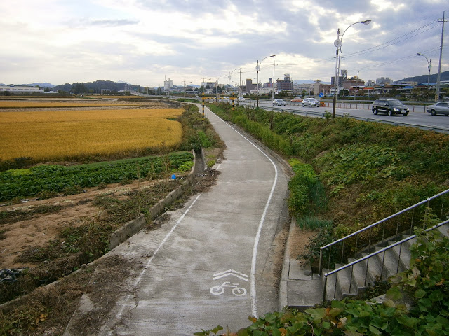
Picture

An unglamorous section of the Four Rivers Bicycle Trail in Jeomchon
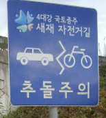
Picture

Four Rivers Bike Trail Sign

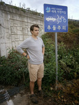
PictureMe in front of a sign
along the bike trail

I was interested especially in Jeomchon as a place to rest for because the so-called “Four Great Rivers Bicycle Trail” passes through it. In late 2011, South Korea completed its first long-distance bike trails, including the big one that will take you from Incheon and Seoul all the way to Busan on the southeast coast. The picture directly above is along that Incheon-Busan bike trail.

It’s funny to think that I could follow this off-street bicycle trail all the way to Seoul. (As it’s not a walking trail, though, I’m sure the bicyclists would be annoyed.)

Near where I found the bike trail, a reminder that Jeomchon is no big city:


Picture

Jeomchon Industry High School. A rice field is in in the foreground, adjacent to the school.
I don’t have any pictures of the $30-a-night motel I stayed in, from where I type these words, nor of the nearby giant Homeplus, where I spent $60 or so on food and other stuff. I am anxious to get back on the hiking trail while the weather is still pleasant…
Picture

Sunset, October 20th 2013, Jeomchon

bookmark_borderPost-158: Peering Over the Ledge at Geumsan [My Video]

Like post-157, here is another attempt at presenting, in video form, a moment in my ongoing long-distance hike.

From the top of (what’s left of) Mount Geumsan, near the town of Chupung Pass [추풍령]…..I hope you enjoy:


Some more information about Geumsan:
Geumsan [금산] means “Gold Mountain”. I imagine there are a lot of “Geumsans” in Korea.

Looking over the “ledge” at this Geumsan was intimidating, but it was one of the few good views of the day. The trail in this region is thickly-forested, offering good walking conditions but few views.

The town of Chupung you can see down below there straddles Chupung Pass. From the guidebook:

Chupung [Pass] has long been an important crossing…connecting southeastern Korea with Seoul since the Joseon era [1400s-1800s], and probably millennia before that, because of its low unobtrusive passage.

Like many other of the mountain passes on the Baekdu-Daegan Trail, I see that Chupung was on the border between Baekjae and Silla (two Korean kingdoms of the first milennium AD) and their predecessor-states.

It’s hard now to imagine the centuries of simmering, “Checkpoint-Charlie”-style tensions that must have occurred at this place, a place of such high traffic. Today, the tensions are gone but the traffic remains in the form of two highways (the Korean equivalents of an “interstate highway” and a “U.S. highway”) and a railroad. There’s not much going on in town, but even here there is a 24-hour convenience store.


[I post this from Jeomchon city., where I am resting I rejoin the trail again on Monday]

bookmark_borderPost-157: Where Three Provinces Meet…. [My Video]

A little video I took at the summit area of Samdo-Bong [삼도봉] (“Three-Province Peak”) and then edited together with text. You can adjust it to watch in HD, I think:


Summary and Explanation
This footage was taken by me on the early morning of October 13th at the summit area of Three-Province Peak [삼도봉] where I had camped the night before. More information about the peak below:
This was just after sunrise. It was cold up there. You can see that my hood is up.

The summit and monument are along the Baekdu-Daegan Trail [백두대간], a cross-country mountain hiking trail spanning the length of Korea. I’ve been hiking along it since mid-September.

The monument is the exact meeting point of political-borders of Jeolla, Gyeongsang, and Chungcheong Provinces [전라, 경상, 충청]. Each side of the triangular monument is in a different province, so my feet were planted in each one during this short video.

This is kind of a special place for Koreans, I think, because the three regions (roughly) have had a long history of rivalry and conflict going back thousands of years, which is still seen today. (The regional voting patterns in every election, including 2012, bear this out — the southeast [Jeolla] votes 90% for the “left-wing” party and the southwest [Gyeongsang] votes 90% for the “right-wing” party.)

Height: 1,176 meters above sea level.
Year of Monument Construction: 1990.
Weather Conditions: Cold but clear [on Oct. 13th, 2013]
Time Video Was Made: Around 6:30 AM
Other People at Summit Area: None
Other Features of the Summit Area: Explanatory sign; helipad [0:32] (outlined in white); benches; direction markers leading to three other trails, (1) to the Mulhan Valley [물한계곡], (2) to another peak in the area, or (3) Further along the Baekdu-Daegan Trail.

NOTE: The helipad is visible in the distance at 0:32 in the video. It is constructed on a partly-artificially-raised, broad, flat, dirt surface, creating a four-foot-high dirt wall to the north. I camped just below that “wall” to block some of the wind. It was cold at 1,176 meters above sea level (3,860 feet) that morning.