bookmark_borderPost-163: At Hwaryeong

If you go to a place called Hwareyong [화령재] along Korea’s Baekdu-Daegan Trail, you’ll see something about like this:
Picture

Me at the Baekdu-Daegan Hwaryeong Stele
(Camera on 12-second delay, resting against a rock on the ground)

Following are more pictures of the area around this giant stele [seven meters (23 feet) in height] and comments:
It says this stele was erected in September 2007. The various monuments and steles like this of the Baekdu-Daegan were mostly erected in the past ten years (according to their inscriptions), in my experience.
I made my tent and slept in that pavilion (or jeongja) overnight, as is acceptable practice among Korean hikers. (I wouldn’t have done this had I not observed Koreans doing it before several times.) It was very comfortable and dry.
Picture

Dawn at Hwaryeong

That is dawn the next day, and soon I was on my way. The road here, crossing this low pass, was well-frequented by buses (at least one every ten minutes, it felt like) till even after 7 PM, which in rural Korea is about equivalent to the midnight hour in Seoul. There is a town a few kilometers away. The vehicles that stopped at the pull-over area in front of the stele seemed to be lost drivers checking their maps and one guy who used the toilet and then sped off again.

Finding the trail was a little hard north of here, and I got lost on false trails leading to many tombs. That cost me about an hour. Soon I was back on track again, and headed north towards Songni National Park [속리산],…


[I write this from a Jeomchon motel. My trip is ending soon. This is my final anticipated “comfort accommodation” until I return to Seoul next week. I bought a lot of food here. I expect to update next from Seoul in a week’s time.]

bookmark_borderPost-162: On a Foggy Mountain Top in Korea

A third attempt at video-making a part of my hike (the first two: post-158 and post-157).

It was a rainy and eerily-foggy October 10th. When the rain let up for a while and the fog lifted, it looked like this:

Try to imagine what it was like on this particular day–
Imagine steady rain, cold, thick fog causing low visibility, and imagine your clothes wet, your body wet from rain (despite a raincoat) yet sweating. No fun. I spent a lot of time that day trying to find cover on the exposed ridge, mostly failing (though I succeeded in keeping the contents of my backpack dry). Navigating the trail was hard due to slippery rocks.

By now, a general rule for hiking that I’ve learned is this: “The harder the conditions, the better the views”.

The views over the foggy valleys you see here are an example. Without the misery of that day’s hike, the views would’ve been…uhh…less dramatic, or less vivid, or something. I remember reaching this little overview area, which I think is named Sambongsan [삼봉산] or Deogyusambong [덕유삼봉]. The view hit me with the force of a bucket of ice water dumped on the head on a sizzling August day.

Note: This was along the cross-country Baekdu-Daegan Trail (백두대간) in Korea, which I’ve been hiking since mid-September. It was along the trail northeast of a place called Bbae-Jae (“Bone Pass”, 빼재), and east of Deogyusan National Park (덕유산), and southwest of 소사곡개 (Sosa Pass).


Whoever is reading this, I hope you enjoy(ed) this video. I hope it gives a small taste of what my long hike has been like. Thanks for watching/reading.

bookmark_borderPost-161: At Yukship Pass

I reached Yukship Pass [육십령] on the afternoon of October 4th, following my detour to Nongae Shrine (post-160).

These passes are often tunneled to preserve the integrity of the ridge-trail above:

Picture

Yukship Pass, Jeolla side

Like most of the southern half of the trail, Yukship Pass sits on a political boundary, dividing Gyeonsang Province from Jeolla Province. The two southern Korean regions have different accents and are in fact different in a lot of ways. It seems they’ve disliked each other for longer than Europeans have been Christian. (They had competing, rival states for a long time, until one of them was finally stamped out of existence by the other over a thousand years ago.)

I saw that there was a village on the Gyeongsang side of the pass, only a few hundred yards away from the border itself. Here’s what I want to know: Do the residents have “Gyeongsang accents”? Do they dislike Jeolla? I don’t know, but one indication of how strong the rivalry between Jeolla and Gyeongsang is (maybe), even at the border is this:

About 200 meters short of Yukship-ryeong, the trail forks, with both branches ultimately heading to the pass. The left trail, heading northwest, emerges on the Jeollabuk-do side of the pass, while the right trail heads northeast, leading to the Gyeongsangnam-do side of the pass. Both are on NH26 and are separated by about 100 meters of road.          [From the Trail Guidebook]

Neither side wanted the trail to only go through the other’s territory so they both carved out separate trail forks.

Along my hiking trip, I’ve always looked forward to reaching one of these semi-populated “passes”. It’s always good news when one is coming up. They have good facilities, food for sale, water. The guidebook promises the following:

On the western side [of Yukship Pass] is the large “Yukship-ryeong Hyugeso”, which has minbak rooms [simple rooms to sleep in], toilets, a good restaurant and a well stocked supermarket. Also in front of the hyugeso is a large two-story concrete jeongja [pavilion], which is suitable for sleeping in after sightseers have left. On the eastern side of the pass are a small supermarket and restaurant.

The writers went on their trip in September to November 2007, six years ago now. When I passed by in October 2013, the big place they talked-up so much, on the western (Jeolla Province) side was closed completely. It was a big let-down for someone as hungry as I was at the time. The building seemed abandoned and was boarded up:
Picture

The closed store and restaurant on the Jeolla side of Yukship Pass

I loitered for a while around the jeongja (a large, shaded pavilion raised off the ground, which Koreans seem to use for many purposes including overnight camping — I’ve seen Koreans doing it several times and now done it myself once). The jeongja is to the right of the building above, overlooking the valley in Jangsu County. It was empty.

I was waiting for something to happen. The store I’d anticipated buying thousands-of-calories-worth of food from was dead and showed no signs of coming to life. Maybe I expected the lights to spontaneously come on. It was not to be. The only thing happening in the large, nearly-empty parking lot was that a middle-aged man was watching a dog running around. I got the idea that the man was “looking after” the closed store/restaurant. I think he was actually “just a guy”, though, using the place as a big dog park. I asked him if camping was allowed around there. He replied that it wasn’t. No store. No restaurant. No camping. No water. A big disappointment.

I made by way off to the eastern (Gyeongsang) side of the pass, where there was said to be another “huygeso” or rest-area (store, restaurant, and more). On my way to the tunnel and the other side stood a memorial. It was to the South Korean soldiers killed in the anti-communist-guerrilla campaign fought in this area during the Korean War:

Picture

A memorial at Yukship Pass to South Korean soldiers who died fighting pro-communist guerrillas

(The government chose the Jeolla side for this memorial commemorating [in effect] the large-scale killings of pro-communist civilians, when those communist-sympathizers disproportionately came from Jeolla [as I understand it] — I’d speculate that this choice of location may be the handiwork of the Gyeongsang circle that ruled South Korea for thirty years beginning with General Park Chung-Hee in ’61 (whose daughter is now president).

These are thoughts that occur to me long after the fact. At the time I snapped the above picture, I was really hungry and out of food (except peanut butter and some “gorp”). I staggered on to the Gyeongsang side of the pass. On the Gyeongsang side, a smaller and decrepit-looking store/restaurant was (at least nominally) open for business:

Picture

Small store and restaurant at Yukship Pass, Gyeongsang side

I was so hungry.

I walked in, said hello, and clumsily asked “Is this a restaurant?” in my poor Korean. I really wasn’t sure whether it was a restaurant. I couldn’t see a menu anywhere. Maybe you just “had to know” what was on the menu.

Two middle-aged women, one very old woman, one middle-aged man, and one young man were inside. I soon got the feeling that all were related. Before long, this materialized on the table in front of me:

Picture

My meal at Yukship Pass — Beef(?) soup, rice, and vegetable side dishes with water

I’ve rarely had a meal with so many “side dishes” (banchan, 반찬) before. This one had six. At first, I thought the meal was entirely side dishes. Only about halfway through did I realize that the soup was the main dish. It had beef in it, I think. I ate it eagerly, having eaten little that day. After finishing  the food far too quickly, I stayed at the table and leafed through the guidebook a little, to know what was on the horizon next. It was about 4:00 PM, so two hours of good daylight left. 

I paid 6,000 Won ($5.50) for this meal. In the front, they have a small “store” area with snack foods, chips, cookies, lots of types of ramen, and other things like tuna cans. I bought pound-cake bread and crackers, total 4,000 Won. Off I went again into the forest:

Picture

The trail, north of Yukship Pass

I decided to make camp as soon as I found a good place. I found one and, still hungry, I had a second dinner of peanut butter slathered on my crackers and pound cake:
It hadn’t been windy at all that day. After night fell, though, the wind suddenly picked up. I was glad I was safe in my tent and not outside. The next day, the wind would still be there as I made my toward Halmi Peak (see post-155)….


[This was mostly written in a motel at Chupung Pass on October 16th and finished on October 25th in Jeomchon]

bookmark_borderPost-160: At Nongae’s Birthplace

Nongae

I veered off the trail on Friday, October 4th to visit a nearby (impressive) shrine to a minor Korean historical figure called Nongae [주논개]. It was near her birthplace in Jangsu, Jeolla Province.

The shrine was mostly empty at midday on a non-holiday Friday, which was good; it was also free, which was better still. The grounds were very large and well-kept.
__________________________________________________
Who was Nongae? She was a patriotic assassin.

The Japanese, it seems, conquered the Korean city of Jinju in 1593. Afterwards, they held a victory celebration, and they compelled the local gisaeng to join in (a gisaeng was a Korean female entertainer like a Japanese geisha). One of these, named Ju Nongae, won the affection of a top Japanese general. During the victory festivities, the general and his entourage (including Nongae) moved to a scenic spot on a high rock overlooking the river. Suddenly, Nongae embraced the conquering general around the neck and threw herself over the edge, which took him down as well. They both drowned.

Earlier this year, I also happen to have visited the very rock on which this murder-suicide happened. The rock is called “Uiam” within Jinju Fortress. (Nongae is given the title “Uiam” in honor of her act.)

Nongae is a symbol of patriotic loyalty for Koreans.
__________________________________________________

Here are some pictures from the large, open grounds of the shrine:


Nongae2

Nongae Statue in the middle of the Nongae Shrine/Park

Picture

Nongae Shrine

Picture

Nongae Museum

What I found interesting is that Jinju historical authorities and Jangsu historical authorities disagree on who she was.

Everyone agrees that Nongae killed the Japanese general by jumping off the high rock in Jinju in 1593 (when she was only 19 years old), but Jinju historical markers and explanatory signs, as I recall, said she was just a lowly gisaeng motivated by spontaneous patriotism. The explanatory messages in Jangsu, though (her birthplace-shrine, pictured above) say she was a married woman who disguised herself as a gisaeng  in order to carry out the assassination.

The Jangsu shrine really gives the impression that Nongae was a saintly yangban aristocratic married woman, the archetype of Korean female virtue. The Jangsu Shrine signs I read, in English translation, said that she felt enraged when her husband died in the battle for Jinju and thus began preparations for the assassination. (Actually, one sign I saw in her birthplace-shrine claimed that her husband hadn’t died in the battle. He had survived the onslaught, it said, but committed suicide at the end rather than surrender. — If you’re going to deify this hypothetical husband, he can’t have simply been “killed by the Japs”, now, can he? He’d have to have been too good, too pure, for such a crude ending.)

The Jangsu version seems — forgive me, Korean readers (if any), for I mean no offense by this, but — It seems to be a case of “a hometown referee calling the game”, if that makes sense. This saintly-yangban Nongae image, with the husband too noble to have died by Japanese hands…It’s creeping closer and closer to that kind of purely self-serving nationalistic mythologizing/deification that the Kim Il-Sung “mythology-apparatus” cranks out in the North...


I liked the hour or so I spent at the Nongae Shrine. I spent very little of the day on the trail, though. Mostly I was straddling the yellow line on rural roads in Jangsu, walking to and away from the Nongae Shrine. It looked like this:
Picture

A sign pointing to the Nongae birthplace shrine

Picture

A Jangsu farmer at work near Nongae birthplace


After leaving the shrine, I continued walking on the roads to rejoin the trail at Yukship Pass. On the way, I saw this:
A Brazilian-Korean joint business venture, in one of the ruralest parts of South Korea! Doing what? I don’t know.

Closer to the pass, I saw construction workers fencing-off a rocky area above a road:

All along many of the roads here, they’ve blanketed the hillsides with a mesh netting to stop any possible rockfalls, and put up a huge fence down below besides. It seems very thorough, and very possibly overkill, but it gives construction crews something to do.

Road-walking is easier on the leg muscles but can be harder on the nerves, as cars and trucks whiz by. A little past the construction scene above, a man pulled alongside and offered me a ride for the final few kilometers to Yukship Pass, I accepted. After getting some food at the pass, I was soon back into the nether regions of the Baekdu-Daegan Trail….

[This was written at a motel in Chupung Pass on October 16th and finished on October 25th in Jeomchon]

bookmark_borderPost-159: In Jeomchon

I spent the weekend of October 19th-20th in Jeomchon [점촌, 문경시] in Geyongsang Province, taking a break from hiking. I was happy to find a large Homeplus there to stock up on supplies. They even had a pretty-good potato salad.

Here are some pictures of Jeomchon:

Picture

A view of Jeomchon from Jungang Park
Picture

A street in Jeomchon
Picture

A banner for an “Apple Festival” in Mungyeong County, surrounding Jeomchon
At the train station:
Picture

A church van in the parking lot in front of Jeomchon Train Station.
Note the combined use of Korean and English in the slogan: “자유 [Freedom] in Christ Jesus”.
Picture

An old traincar open for looking around in, on a sidetrack at Jeomchon Station.
Also nearby were a large cage for two dogs visitors play with, many flowers,
walking paths, a small library, rest-area, and a “mini-KTX” train ride for kids.
The station almost feels like an amusement park!
Picture

Jeomchon Station was awarded “Best Station” in 2012, and having walked around in it, I can see why…

Elsewhere around town, I kept seeing phone numbers which included “555” or “666”, both combinations never-seen as phone numbers in the USA (for very different reasons). Here is one that includes both at once:

Picture

A truck with a “fake”-seeming phone number

Finally, a glimpse of the Four Rivers Cross-Country Bicycle Trail:

Picture

A bike rider on the outskirts of Jeomchon, and near the “Four-Rivers Bike Trail”
Picture

An unglamorous section of the Four Rivers Bicycle Trail in Jeomchon
Picture

Four Rivers Bike Trail Sign

PictureMe in front of a sign
along the bike trail

I was interested especially in Jeomchon as a place to rest for because the so-called “Four Great Rivers Bicycle Trail” passes through it. In late 2011, South Korea completed its first long-distance bike trails, including the big one that will take you from Incheon and Seoul all the way to Busan on the southeast coast. The picture directly above is along that Incheon-Busan bike trail.

It’s funny to think that I could follow this off-street bicycle trail all the way to Seoul. (As it’s not a walking trail, though, I’m sure the bicyclists would be annoyed.)

Near where I found the bike trail, a reminder that Jeomchon is no big city:


Picture

Jeomchon Industry High School. A rice field is in in the foreground, adjacent to the school.
I don’t have any pictures of the $30-a-night motel I stayed in, from where I type these words, nor of the nearby giant Homeplus, where I spent $60 or so on food and other stuff. I am anxious to get back on the hiking trail while the weather is still pleasant…
Picture

Sunset, October 20th 2013, Jeomchon

bookmark_borderPost-158: Peering Over the Ledge at Geumsan [My Video]

Like post-157, here is another attempt at presenting, in video form, a moment in my ongoing long-distance hike.

From the top of (what’s left of) Mount Geumsan, near the town of Chupung Pass [추풍령]…..I hope you enjoy:


Some more information about Geumsan:
Geumsan [금산] means “Gold Mountain”. I imagine there are a lot of “Geumsans” in Korea.

Looking over the “ledge” at this Geumsan was intimidating, but it was one of the few good views of the day. The trail in this region is thickly-forested, offering good walking conditions but few views.

The town of Chupung you can see down below there straddles Chupung Pass. From the guidebook:

Chupung [Pass] has long been an important crossing…connecting southeastern Korea with Seoul since the Joseon era [1400s-1800s], and probably millennia before that, because of its low unobtrusive passage.

Like many other of the mountain passes on the Baekdu-Daegan Trail, I see that Chupung was on the border between Baekjae and Silla (two Korean kingdoms of the first milennium AD) and their predecessor-states.

It’s hard now to imagine the centuries of simmering, “Checkpoint-Charlie”-style tensions that must have occurred at this place, a place of such high traffic. Today, the tensions are gone but the traffic remains in the form of two highways (the Korean equivalents of an “interstate highway” and a “U.S. highway”) and a railroad. There’s not much going on in town, but even here there is a 24-hour convenience store.


[I post this from Jeomchon city., where I am resting I rejoin the trail again on Monday]

bookmark_borderPost-157: Where Three Provinces Meet…. [My Video]

A little video I took at the summit area of Samdo-Bong [삼도봉] (“Three-Province Peak”) and then edited together with text. You can adjust it to watch in HD, I think:


Summary and Explanation
This footage was taken by me on the early morning of October 13th at the summit area of Three-Province Peak [삼도봉] where I had camped the night before. More information about the peak below:
This was just after sunrise. It was cold up there. You can see that my hood is up.

The summit and monument are along the Baekdu-Daegan Trail [백두대간], a cross-country mountain hiking trail spanning the length of Korea. I’ve been hiking along it since mid-September.

The monument is the exact meeting point of political-borders of Jeolla, Gyeongsang, and Chungcheong Provinces [전라, 경상, 충청]. Each side of the triangular monument is in a different province, so my feet were planted in each one during this short video.

This is kind of a special place for Koreans, I think, because the three regions (roughly) have had a long history of rivalry and conflict going back thousands of years, which is still seen today. (The regional voting patterns in every election, including 2012, bear this out — the southeast [Jeolla] votes 90% for the “left-wing” party and the southwest [Gyeongsang] votes 90% for the “right-wing” party.)

Height: 1,176 meters above sea level.
Year of Monument Construction: 1990.
Weather Conditions: Cold but clear [on Oct. 13th, 2013]
Time Video Was Made: Around 6:30 AM
Other People at Summit Area: None
Other Features of the Summit Area: Explanatory sign; helipad [0:32] (outlined in white); benches; direction markers leading to three other trails, (1) to the Mulhan Valley [물한계곡], (2) to another peak in the area, or (3) Further along the Baekdu-Daegan Trail.

NOTE: The helipad is visible in the distance at 0:32 in the video. It is constructed on a partly-artificially-raised, broad, flat, dirt surface, creating a four-foot-high dirt wall to the north. I camped just below that “wall” to block some of the wind. It was cold at 1,176 meters above sea level (3,860 feet) that morning.


bookmark_borderPost-156: No Time to Write

I am now in Gimcheon, not far from the train station. This city, or this part of it, seems to be dominated by students: Everywhere I’ve looked, at all times of day (in my two days here), they’ve been loitering or walking or talking or eating or whatever else. I can only guess why.

I regret that I haven’t had the opportunity to post much during this trip, due to lack of computer access (though I have kept notes in a notebook). I’ve only written two substantive posts on my hiking trip as it’s developed so far, though I could’ve written many more. 

At the “PC Room” in which I now sit, I’ve majorly revised and updated post-155, “The Mystery of the Halmi Holes (Or, Finding North Korean Foxholes in the Mountains). I’m not certain that what I found are North Korean in origin, but I think there’s a compelling case to be made for it. I’m open to all suggestions and I think it’s an interesting subject.

I have to pay by the hour to use the Internet at these “PC Rooms”. This one costs 1,200 Won ($1.00 U.S.) per hour. I’ll leave here soon and try to find the E-Mart in this city. It’s my only hope, I think, to find some peanut butter to make sandwiches for the next big leg of the hike.

One way or another, I’ll return to Seoul around November 1st. Thanks for reading.

bookmark_borderPost-155: Mystery of the Holes of Halmi (Or, Finding North Korean Foxholes in the Mountains)

The following is the story of how I came to ask myself:“What would foxholes dug in 1950, abandoned for sixty years, look like today?”  I’d found what I suspect(ed) were North-Korean-made foxholes near the trail. It was October 5th.

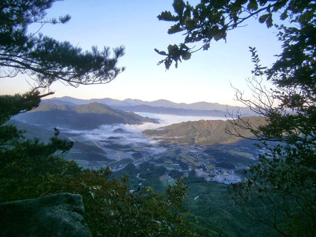
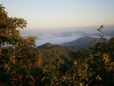
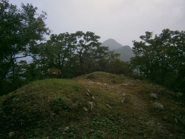
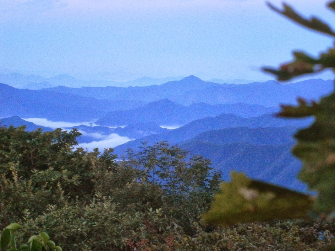
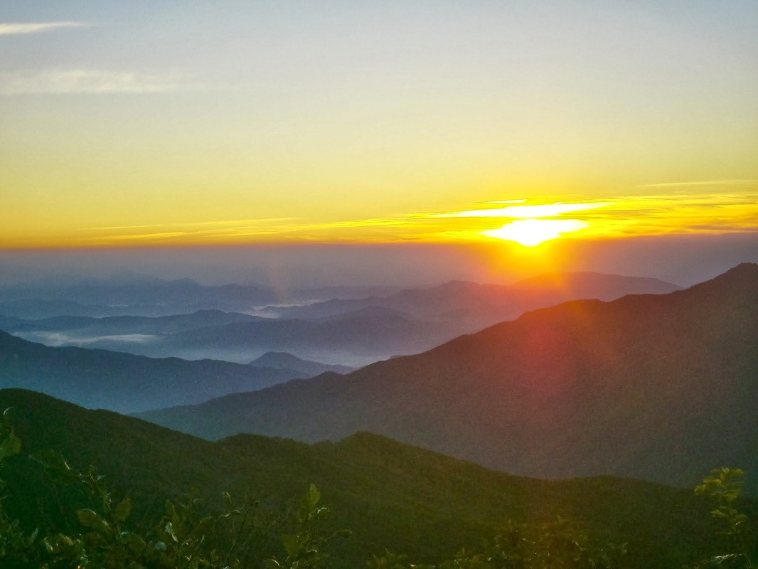
October 5th is the day I reached Halmi Peak [할미봉], with its spectacular views:
Halmibong

The view from Halmi Peak, Korea

Picture
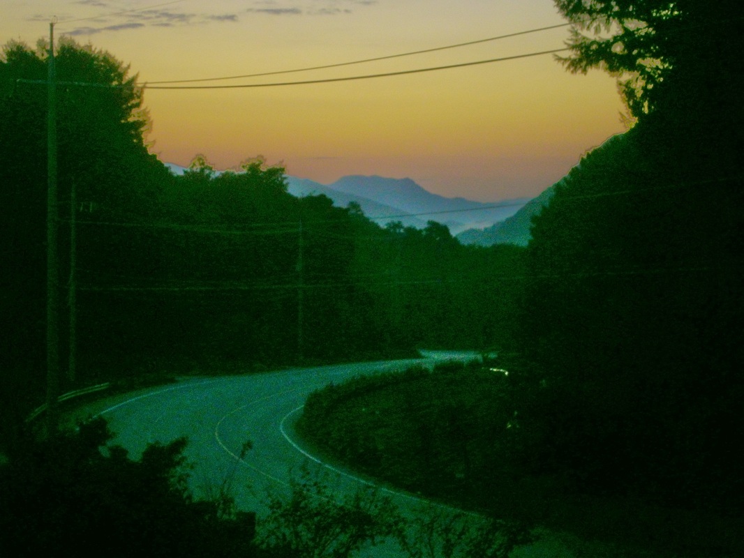
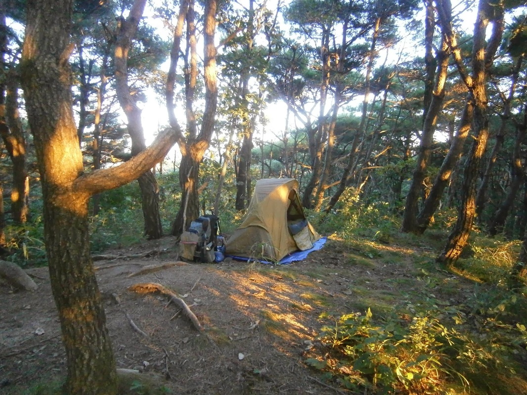
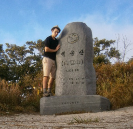
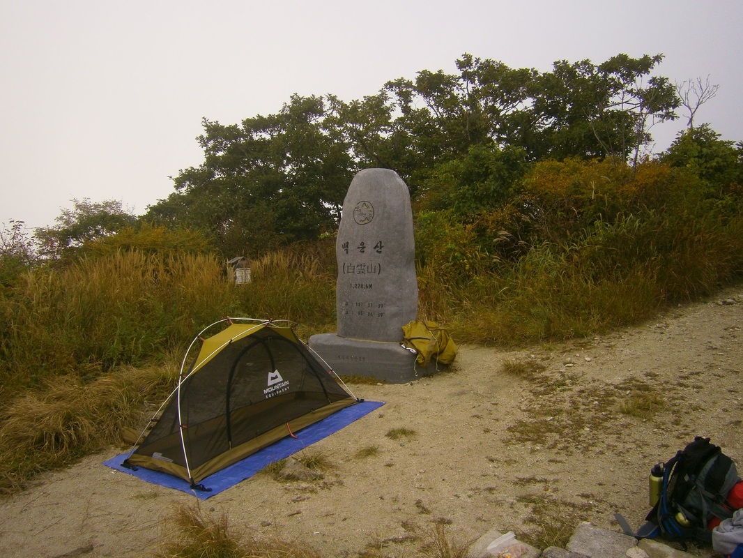
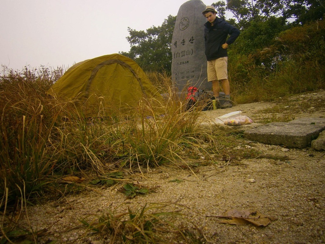
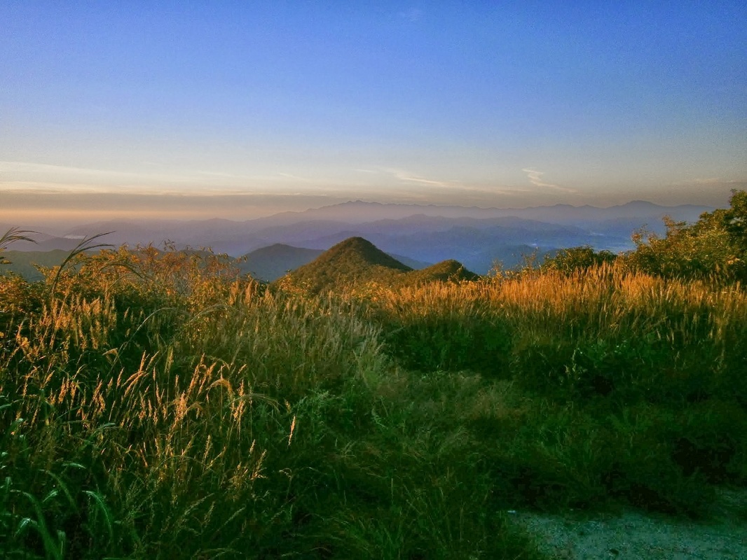
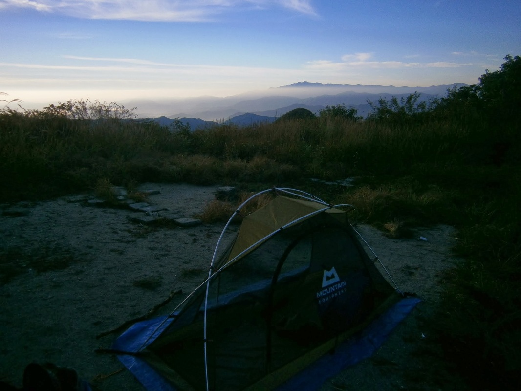
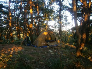
Campsite one km or so south of Yuship Pass

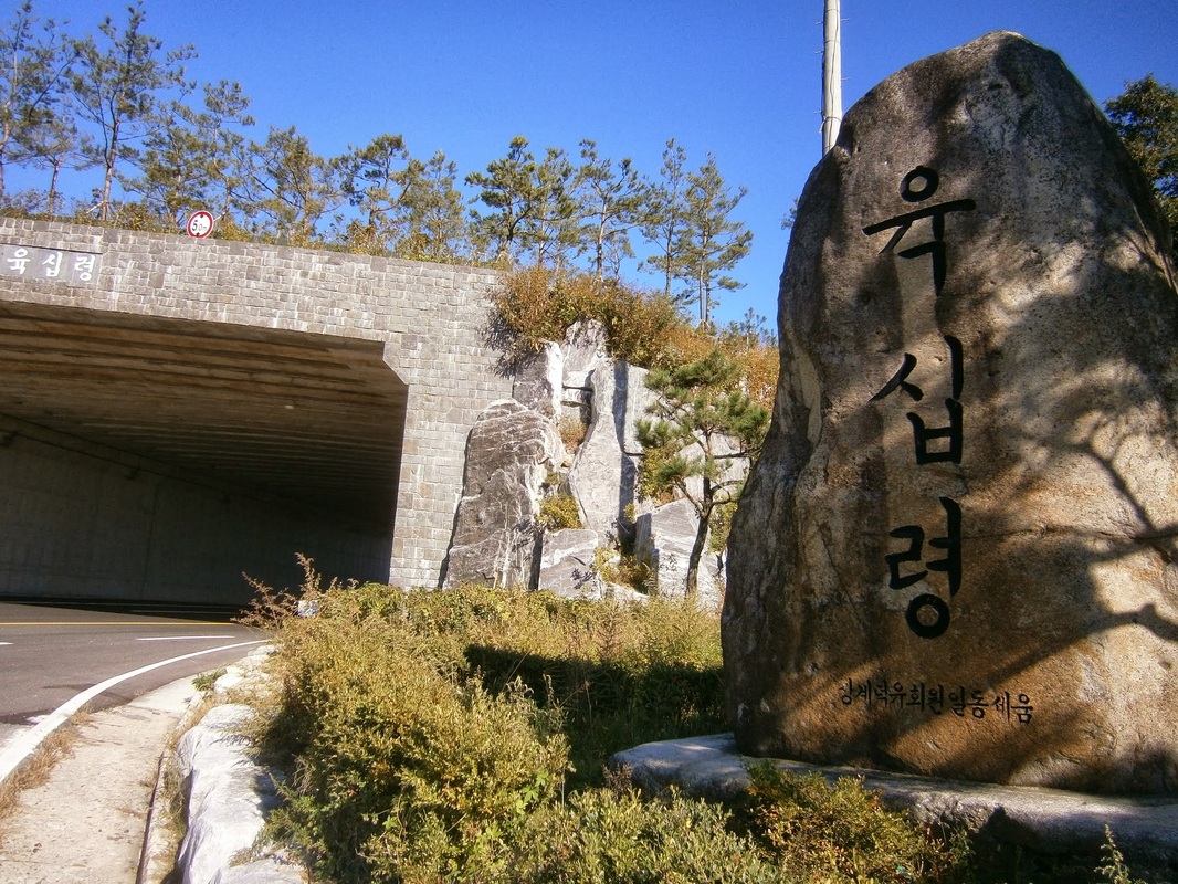
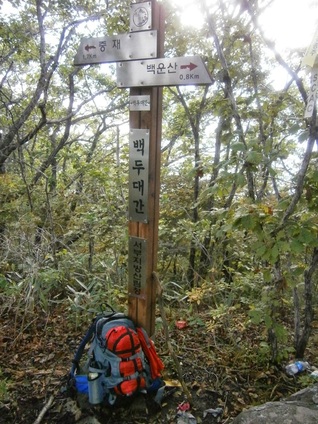
My day began on a seldom-visited stretch of trail north of Yukship Pass (육십령), still a few miles south of Deogyusan National Park (덕유산). I’d camped the night before. It was windy all night.

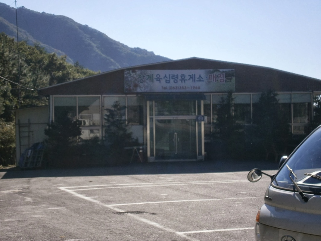
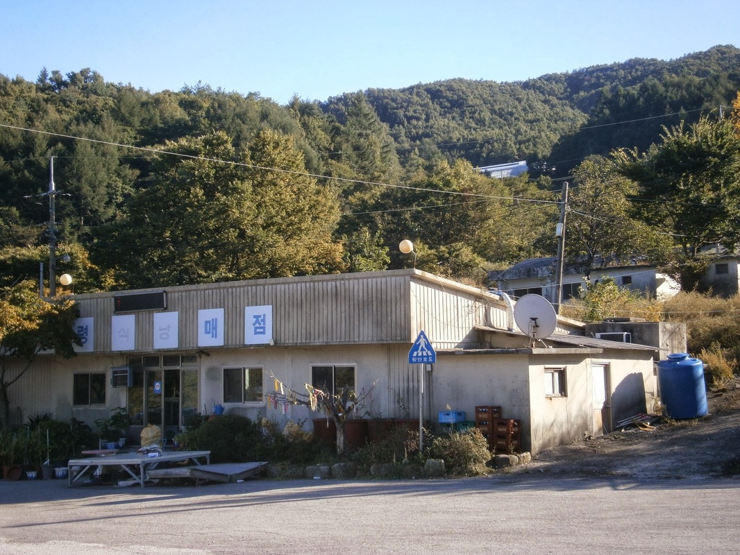
As I was packing up in the morning, a solitary thru-hiker came through, another middle-aged Korean man. He’d slept at Yukship Pass and he asked me something [in Korean]. I’m about 80% sure that he asked me why I’d camped in the forest and not down at Yukship Pass. (The afternoon before, I’d asked a guy sitting in front of the closed grocery store at Yukship if I could camp there, and the guy had said “No” [in Korean], so I moved on. I have no idea who he was or by what authority he’d said ‘No’.)

The man was soon on his way. This all happened before 6:30 AM. We were both headed north, approaching Halmi Peak (Or Halmi-bong [할미봉]) and from there entering Deogyu National Park.

This was the view along the way:


Picture

En route to Halmi Peak (할미봉)

Shortly after the above photo was taken, I reached an unremarkable, unnamed 922-meter-high summit with no views. It was here that my wild speculation about North Korean guerrillas began. This was it:
Picture

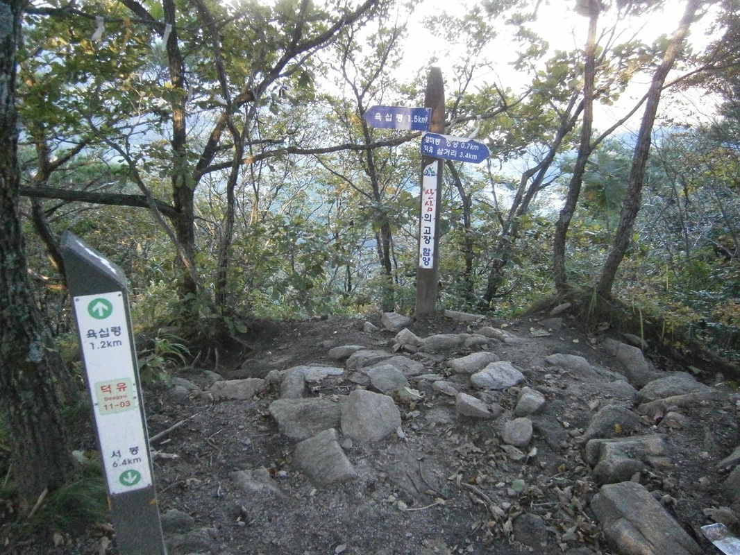
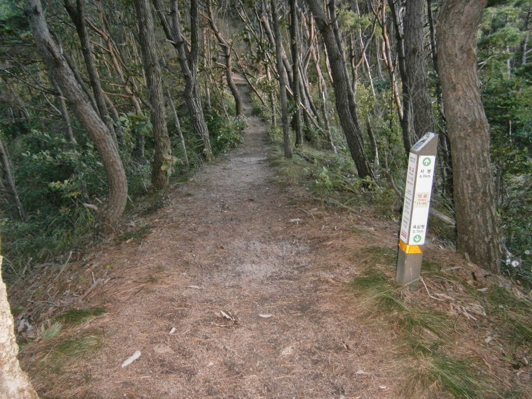
The unnamed 922-meter peak near Halmi Peak. [Note: Two trail markers give different distances to Yukship Pass [육십령], one saying 1.5 km and one saying 1.2 km. I suspect the shorter of these is “as the crow flies”]

I wouldn’t have thought twice about this place, if not for what the BD-Trail guidebook writers (two men from New Zealand) mention:

If you move a little east from the trail, you may be able to see a symmetrical, manmade hole [actually two] that has been drilled into one of the rocks on this unnamed peak, which could very well be from an iron spike driven into the peak during the years of Japanese occupation as a symbolic gesture of Japanese dominance over the sacred mountains of the Baekdu-Daegan. Then again, it could be anything . the hole is well weathered.

The writers’ speculation — that the Japanese bored these holes to assert political dominance — really makes little sense to me. That motivation may (or may not) be plausible, but why would they choose an unnamed, unknown, unspectacular, insignificant peak in the middle of nowhere? There must be thousands of peaks higher than this one in Korea. This summit (such as it is) is even in the shadow of the much-bigger Halmi Peak nearby, actually. The location makes no sense, given the writers’ conjectured-motivation. And, as the guidebook notes, it’s not even on the main area of this summit, but off to the side.

It seemed very unlikely, to me, that Japan did this for the reason the guidebook writers speculated on.

Naturally, I wanted to see the holes for myself. There were two. I located them, but unfortunately failed to take the time to get a good picture of the holes in proper perspective. Here is the best I could do:

Picture

“Halmi Hole” (bottom right)

Picture

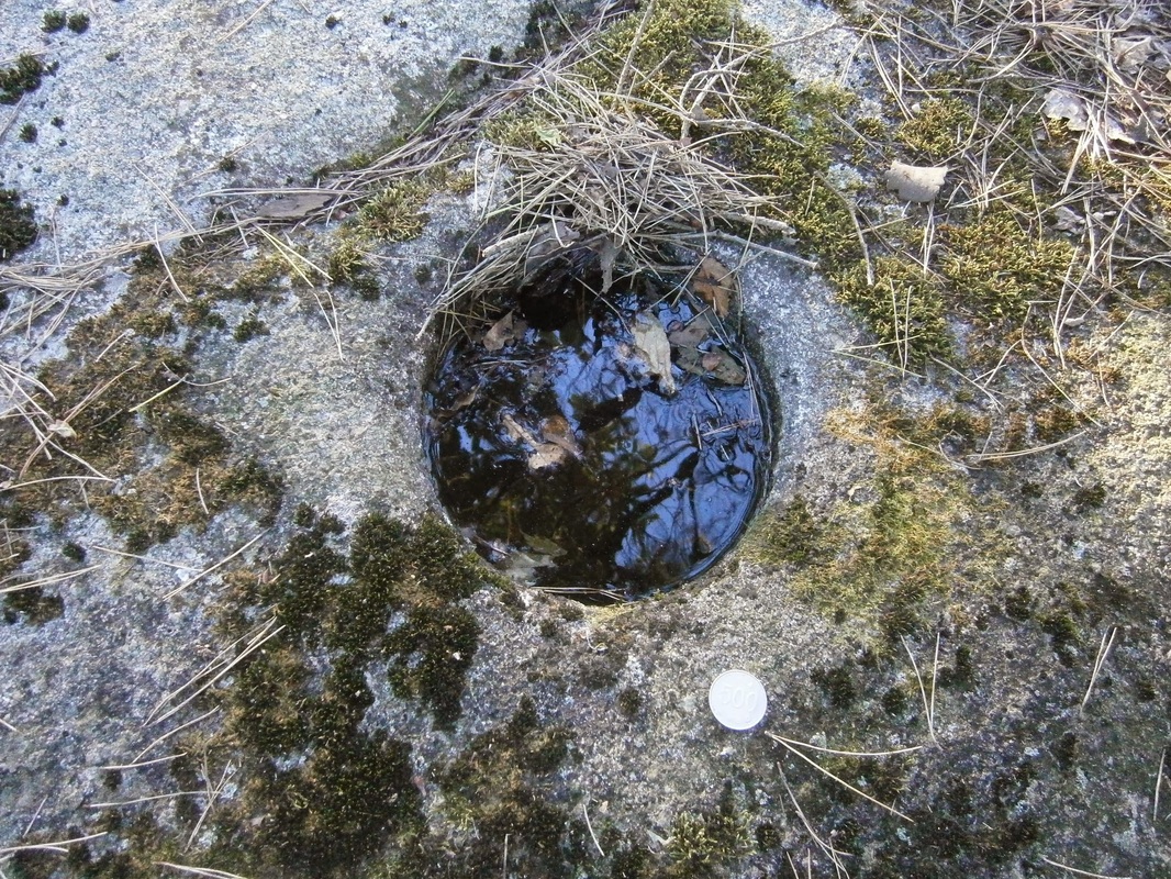
Close-up of one of the “Halmi holes”. The coin is a 500-Won piece, a bit bigger than a U.S. quarter.

The depth of the holes was a few inches, I think. They were filled with water, of course, from rain.

I’d like to hear ideas about what these holes could be; who made them; when; why.

Here is my own idea: I noticed, on this section of the trail, a number of well-weathered “foxholes” (i.e., circular pits dug to provide cover for combatants firing at enemies), actually including one right next to the holes in question. They are similar in shape and size to the foxholes you can find in the Paju area near the DMZ (not to mention of WWII movies), except that these in the Deogyu Mountains look older, more time-worn, neither made nor maintained anytime in recent decades, I suppose. Here is a shot of the “foxhole” next to the mystery holes:

Picture

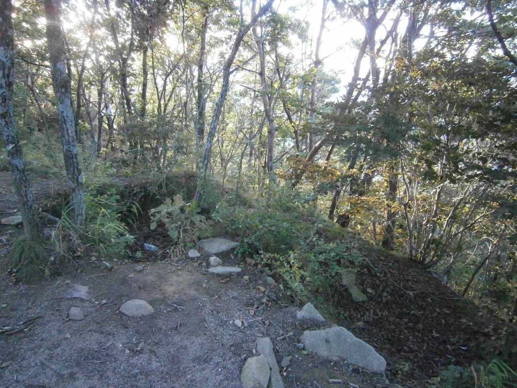
A well-weathered foxhole(?) near Halmi Peak. The holes are off to the left a few yards away.

This is not a great picture, either, but I assure you that that the pit there,  with three trees now growing in it now, looks manmade and very similar to military “foxholes”. Compare this to foxholes dug in 1944 [photographed in 2011]. [Link]

On the ascent up to this unnamed summit, there were several other long-given-back-nature foxholes. I saw a few more later on in southern Deogyu Mountains. The above foxhole, given different tree-cover, could’ve covered a wide “field of fire”. The other ones in this area I saw were also similarly placed.

It is reasonable to assume that whoever dug the foxholes must’ve made the circular boreholes, too, though for what purpose I don’t know. Some military apparatus must have made both the foxholes and the boreholes.

What would defensive foxholes be doing on this anonymous, seldom-visited summit in south-central Korea?  There are four possibilities, as I see it:

Potential Diggers of the Holes
(1) The Japanese military could have made them (during the colonial period) before 1945, it’s true. But, why? There was no need for them to defend such a place. They never fought any hostile armies on Korean soil in WWII.

(2) The wartime ROK [South Korean] Army or U.S. Army could have made them in August 1950, when they were retreating through this area, to defend against the North Korean advance. This seems also highly unlikely, as the U.S. strategy was to conduct a long delaying action until the Pusan Perimeter. (The location of these holes is far to the west of that perimeter.) Foxholes atop mountains like this do not fit. There was no retreat from here.

(3) Could the post-war ROK Army have made them? Why? For defense seems really implausible. This area is very far from the DMZ. I suppose it’s possible the ROK-Army (or U.S. Army) made them as training. The holes look decades old.

(4) [The only theory that I find really plausible]  There is only one group in the 20th century that ever defended terrain in this area, North Korean guerrillas (and/or pro-communist South Korean guerrillas). They may have dug them. Thousands famously “hid” in the Jiri Mountains, and some were also present in the Deogyu Mountains from Summer 1950 onward. They had mountain bases they. It took many major operations to “flush them all out”, some holding-out even until after the war was over. I’d speculate that they dug these foxholes to guard their mountain hideouts/bases.

Actually, related to (4), it’s also possible that the ROK Army made them during one of their many counter-insurgency operations against the guerrillas during the war. General Paik, in his book From Pusan to Panmunjom, wrote about one called “Operation Rat-Killer” in 1951 or ’52 which he led. The South Koreans may have determined that pro-communist guerrillas were active in moving through this area, so they established strongpoints ate key locations and manned them,  to limit guerrilla movement. I suppose this qualifies as either (4a), or (2a), or (5).

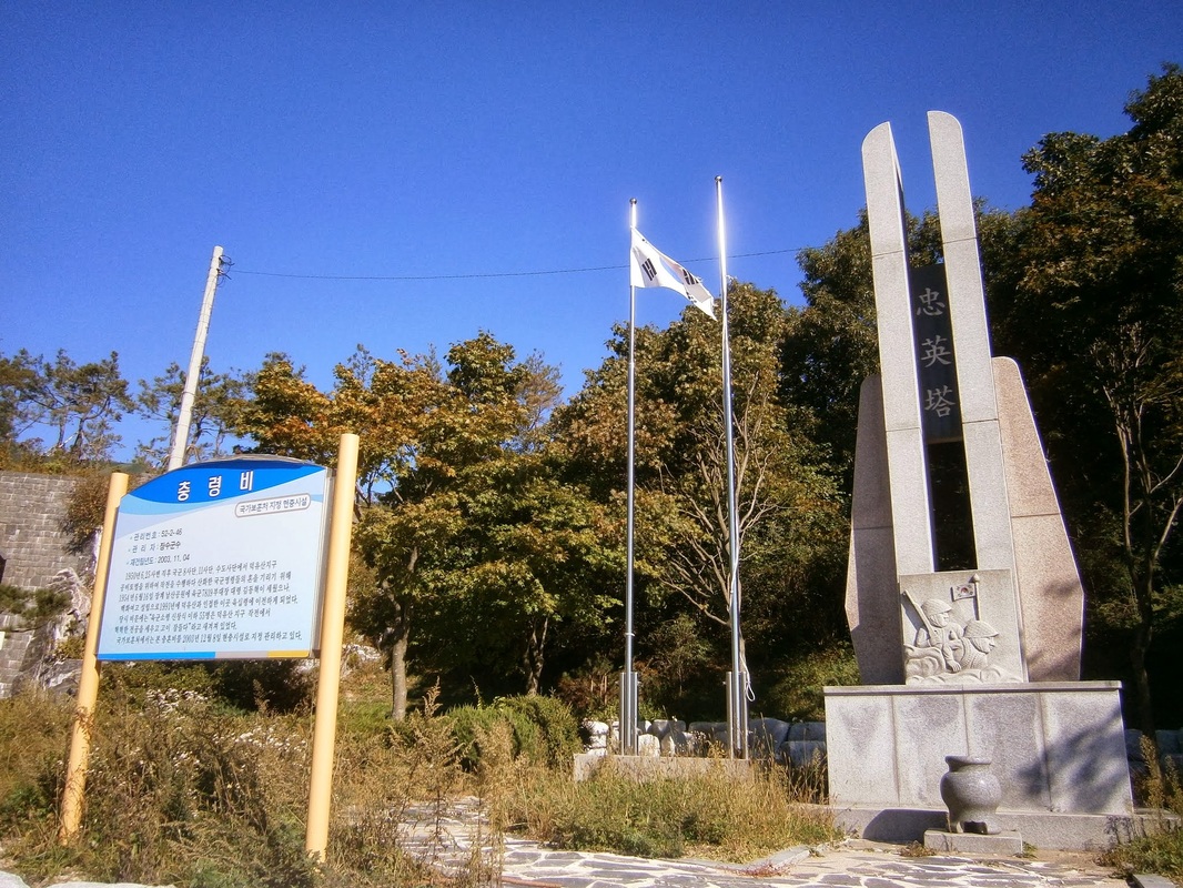
(A monument at Yukship Pass stands in honor of the ROK soldiers who died fighting North-Korean guerrillas operating from bases in the Deogyu Mountains during the war. The BD-Trail guidebook itself notes this just a few pages earlier. This unnamed-922-meter-peak is only a mile or so north of that monument.)

The origin of the circular borehole I’m still uncertain about, but it must be connected to who was manning these foxholes, which very likely was North Koreans. Even if it was ROK counter-insurgency soldiers, it’s still proof that the North Korean guerrillas used the very paths on which I’ve been treading in south-central Korea, and their strongpoints/bases were at least nearby; that is certain. It hadn’t hit me before.


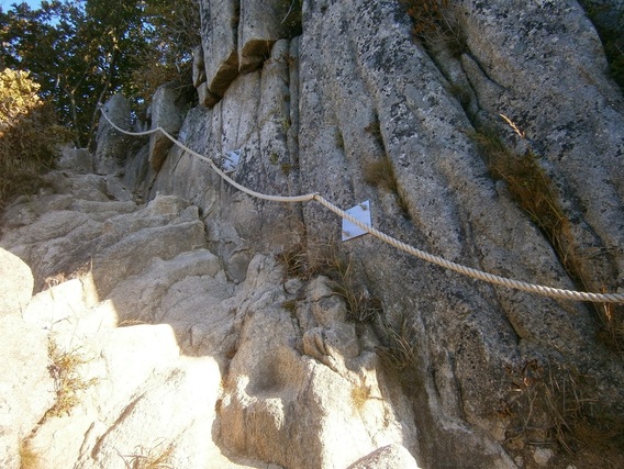
All these thoughts hazily occurred to me that morning as I walked on towards Halmi Peak itself, to the north. The  thoughts I’ve outlined above faded from my mind soon, as the ascent to Halmi quickly demanded my full mental concentration. It is very steep on both sides, and so was physically quite hard to reach:
Picture

On the way up to Halmi Peak

The view from the summit of Halmi Peak itself looked great:
The view from Halmi-bong

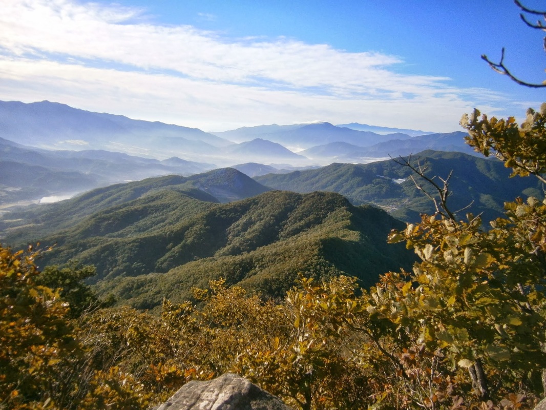
The view from Halmi Peak (할미봉)

My physical exhaustion, as well as the persistent wind, prevented full appreciation. Imagine a panting holder of the camera here, with a sweat-soaked shirt (something I’ve now gotten well used to).
Picture

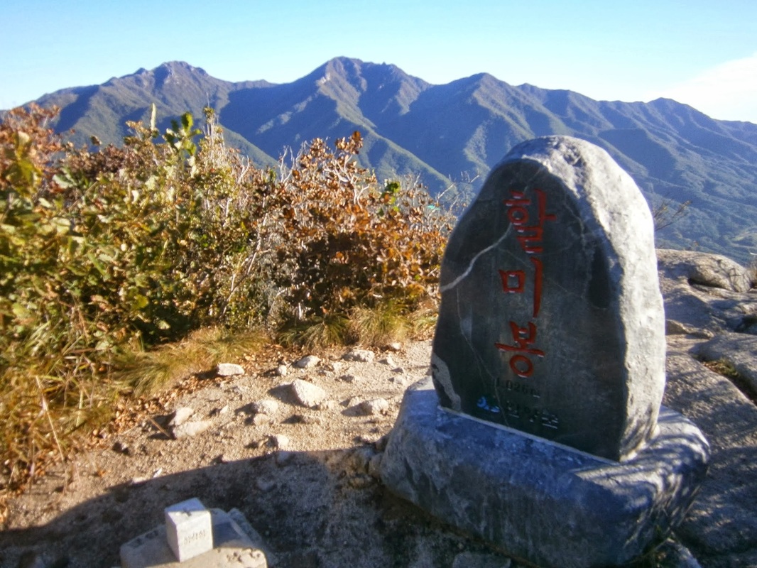
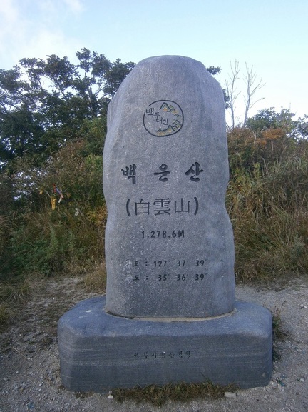
The stele atop Halmi Peak

Then came the physically-difficult steep descent after the peak:
Down from Halmi-bong

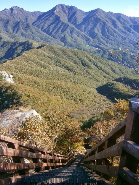
Down from Halmi Peak; a steep staircase going north

Picture

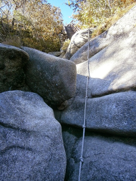
A several-meter vertical drop, on the descent after Halmi Peak, going north

So much for Halmi Peak. I kept going north, descending into Deogyu National Park. (I luckily avoided paying the entrance fee because I went in along the trail, the “back way”.)

Back to the “Halmi Holes Mystery”: Having done it, I cannot imagine trying to move through the Halmi Peak area without the handiwork of the Korean Forest Service — i.e. the staircase and ropes, the above being two examples of many in that area. I think it would’ve been near-impossible in the 1950, and almost-definitely-impossible as a large military operation with heavy equipment to move through the area. The difficulty of the terrain would’ve made it a good choice for a guerrilla base, which leads me to favor the “North Korean Guerrilla” idea rather than the “ROK Counter-Insurgency” idea. Only a narrow southern avenue of approach would’ve needed to be defended, which is the way all the foxholes faced.

(I’d like to think this is the solution to the Halmi Hole Mystery, but in fact I’m just speculating, too, and I’m willing to hear any other opinions.)

Here is somebody else’s post about long-abandoned foxholes in South Korea: Nojeok Hill: My view from the Top —  the Berlin Wall, the Korean War, Foxoles, and Korean Unification.


[I wrote this in a PC Room on the morning of October 10th in Geochang, where I was forced to return after a typhoon closed Deogyusan National Park.] [Updated: October 16th]

bookmark_borderPost-154: On White Cloud Mountain

PictureThe view from White Cloud Mountain

I think it’s no exaggeration to say that it felt a lot, to me, like “being in a cloud” to be on the summit of White Cloud Mountain (Baegunsan in Hamyang County, Korea [함양군 백운산)]).

I was 1,279 meters above sea level, and totally alone.

I reached the top on October 2nd, about 5:30 PM, or 45-60 minutes before navigable daylight was gone for the day. (I’d worried I might not be able to make the steep ascent before sunset; that I did make it was cause for celebration.) I’d come from Jung-Jae Pass.

White Cloud Mountain rises from 695 meters above sea level at Jung-Jae Pass to 1,279 meters above sea level at its summit and the guidebook writers warn how hard it is. I’d just come off of two days’ rest in Hamyang, lucky for me, so it wasn’t too bad.


Picture

Trail marker between Jung-Jae Pass and “White Cloud” Mountain

Along the way, I was pleased to see the red hiking ribbon of the Koreans I’d met a few days earlier. Many Korean hikers have a tradition of putting these kinds of ribbons along the route they’ve hiked. It helps to mark the trails properly outside the national parks, so they’re quite useful. These kinds of ribbons have helped me a lot on this trip.
Picture

A hiking ribbon on the trail leading to Baegunsan

Near the peak, there were some mounds that Koreans traditionally use as graves. The guidebook comments:

….the trail turns to the east and onto a rocky surface for about 500 meters before reaching a flat, cleared area that houses two tombs — whose occupants must have had very good friends to carry them up to this majestic resting place!

And here they are:
Picture

Tombs near White Cloud Mountain

You may be able to see the trail continuing to the right. It’s a short way to the cleared summit area. The summit was deserted, of course. I hadn’t seen anyone since leaving the bus at Junggi Village (중기마을) a few hours earlier.

At the summit:

Summit of White Cloud Mountain

The summit of White Cloud Mountain. (Camera on 12-second delay).
The area with the graves is to the rear of the photo behind the slight rise.
The trail descends from there hundreds of vertical meters.

Just off to the right in the above picture is a big rock, a “stele”, that had some writing in Korean noting the peak’s name:
Picture

Stele at top of White Cloud Mountain (백운산)

On the back of this stone, it explains (according to the guidebook translation) that there are over thirty peaks with the name White Cloud Mountain (백운산) in Korea, but that this one is highest.
With the Stele

Me With the “White Cloud Mountain” Stele

The top of White Cloud Mountain would be my campsite.

Another attempted auto-timer self-portrait, the camera standing on a rock:
Campsite2

Campsite Self-Portrait, White Cloud Mountain

Here is a little from the guidebook about White Cloud Mountain and the area photographed directly above:

As you break from the tree cover, you walk out onto a grassy area where the grass is, in some parts, slashed down to ground level. If this is the case, then the large summit area will provide you with a great place to camp on what is a 360-degree-view mountain top. No water is found near the summit, so you should carry your own if you wish to camp. A large stone stele stands in the cleared area, celebrating the peak and the Baekdu-Daegan. It states that Baegun-san means “White Cloud Mountain”, and that there are always snow and clouds on this mountain, where feeder streams of the Nakdong-gang and Seomjin-gang rivers originate.

There was no snow on the top (that must be a misprint — Korea has too hot/long summers for snow to last on any peak), but there were clouds. The clouds dramatically and mysteriously covered the valleys below, something out of a fantasy movie.

It was the clouds surrounding the summit that were really astonishing. Looking back on these pictures, as I sit in the Internet Cafe in the small city of Geochang five days later (near a man who arrived at 8 AM on a Monday to play “Starcraft”), I think I’ve failed to capture how the scene really looked. I’m not a good enough photographer.

Here is one shot that was sort of successful:

Picture

A view from the summit of White Cloud Mountain

It got quite cold that night. I got up before 6:00 AM to check out the sunrise. What better place?

Here it is, or “was”:

The guidebook again:

…If you sleep on Baegun-san, get up early and catch the sunrise, and see how the mountain lives up to its name as low fog and clouds seep through the valleys below like an incoming tide.

Foggy Valleys

Foggy valleys below, a view from White Cloud Mountain in the morning

It looks good, but you have to imagine a shivering person shakily clutching the camera as this shot was taken. (Maybe that’s why most of the many pictures I tried to take don’t look good: my hands were shivering a lot.) The sleeping bag I bought here is quite good, but getting out of the tent was intimidatingly chilly. I wonder how much lower the temperature was on this 1,279-meter summit than in the valleys below, like back in Hamyang (elev. 170 meters).
Picture

Morning on White Cloud Mountain

As it was so cold, I broke camp only slowly. A picture of my tent half-taken-down:
Picture

Breaking camp, 7 AM hour, White Cloud Summit

I was almost ready to go when I saw someone coming up from the way I’d come the day before. It was around 7:45 AM. He was a thru-hiker, a man in his 40s or maybe early 50s, also hiking alone. He said he was from Yongin, a city near Seoul. I recognized the name of the city because of “Everland”, the enormous amusement park near there. We talked for a few minutes, and he had switched to totally-English by the end. Like all the thru-hikers I’ve met, he was in a terrific hurry to make his day’s objectives on this tough trail.

I told him I was going off the other way to find the supposedly-nearby temple. (One side-benefit: All temple have constant sources of pure, flowing, highly-drinkable water.) The guidebook says this about the temple:

[The temple called] Sangyon-dae, meaning “sitting on the lotus” temple , was established in 924, near the end of the Shilla Dyntasy, as people believed that the mother of the great Confucian/Daoist sage “Go-Un” Choe Chi-won prayed here before conceiving him.

This Choe Chi-won guy seems pretty famous around here. Hamyang was full of references to him doing this and that. I must’ve taken the wrong path, though, because after several hours I failed to find the temple. I suspected I was on the wrong track because signs mentioned “Baekun Temple”. I assumed that was an alternate name for the strange-sounding “Sangyon-dae”, but perhaps that is wrong.

I backtracked. I started along the path that Mr. Yongin had gone hours earlier. I was on the way to Muryeong-Gogae Pass (무령고개), whose name I wrote in my notebook as “Karaoke Pass” (“노래방재”). The man who runs the small restaurant at that pass has a karaoke machine and plays along with his guitar. Reaching there the next day was a half-step back into modern Korea (a kind of rustic “singing room” or noraebang at the pass) compared to the afternoon hiking up to White Cloud Mountain, and then the mysterious, shivering morning atop it.


[This was written in a PC Room (Internet Cafe) in Geochang on Monday, October 7th.]

bookmark_borderPost-153: In Hamyang

On October 1st, I woke up in Hamyang, marking two weeks that I’ve been on this hiking trip.

Walking around Hamyang reminds me of Forest City, Iowa (near my father’s hometown). They are similar in size, both have clear main streets, and despite being small they are “the city” for their respective counties.

Hamyang Population and Density Comparison
In post-150, I wrote:

I am now in a small city called Hamyang (pop. 20,000 in the city [읍] another 20,000 in the surrounding 250-square-mile county [군]), making the county area very rural — 80 people per square mile versus Seoul’s 45,000 per square mile. As I am resting in Hamyang the next two days, I have the time to relate the.. [….]

On second thought, the city population must be less than 20,000. That number is for the “eup”  [읍], and the “eup”  includes the area around the city proper, too. The city, the area of densest development, doesn’t much exceed one mile by one mile (1.5 km x 1.5 km), but the “eup”  is 27 sq.mi. Korean administrative units are confusing.

I see that Hamyang County has a population density of 145 per square mile, equal to New Hampshire‘s in the USA. This is way below the South Korea average of 1,300 per square mile, not to mention Seoul’s intimidating 45,000 per square mile. (My home, Arlington County in Virginia, is now over 8,000 per square mile, but was about 6,500-7,000 per square mile when I was growing up — or so I calculate from Wikipedia just now).

Hamyang County [함양군] outside the Town of Hamyang [함양읍] has a population density of only 80 per square mile, which is, fittingly, about equal to West Virginia‘s in the USA. I rode a bus through rural Hamyang County after I emerged from some days in the mountains (where I had met and traveled with one, and then three, friendly and helpful Korean hikers in their 40s who fed me and took care of me. That great story must wait for another time).

Speaking of West Virginia, a park ranger in Jiri National Park asked me where I was from. I said “Virginia”. He began talking about how much he liked West Virginia. I think he believed “Virginia” to be short for “West Virginia”.

Around Hamyang
Here’s a map Hamyang City, “such as it is”. Zoom out to see where it fits:
(I hiked south, west, and northwest of here the past two weeks.)

Hamyang City proper (the dense, gridded area above) is easy to see on foot, in its entirety, in a couple of hours, I think, even at a very leisurely pace. An express tour could be done in an hour flat.

Most of Hamyang City consists of high-density low-rise houses but also a few 14-storey apartments. There is a business district centered on the main street. I was a little surprised to find several “chain businesses” in this “small town”: Dunkin Donuts, Pizza School, and Lotteria (a Korean McDonald’s) all on that street. There is actually even a “hagwon building” with three English institutes and several other hagwon (private educational institutes) housed inside. I don’t know why they put them all in one building.

 You can almost feel like you are in Seoul in a very narrow corridor of Hamyang Main Street. I know I did, as I ate the 5,000-Won, 1,800-calorie pepperoni pizza from Pizza School (a chain that some of my foreign coworkers loved). Off main street, there are other businesses, but few (if any) chains. It feels much poorer.

Here are three Hamyang businesses near the Intercity Bus Terminal, so far off from Main Street. On the left, there is a restaurant that says it specializes in “Korean Beef” [한우] (as in, the cow was born on Korean soil, not imported meat — Korean-beef is more expensive) and “Black Pig” [흑돼지]. The next is selling Buddhist trinkets (recognizable by the swastika), and the third may be a job-placement center:

Hamyang, Near Bus Terminal

Businesses in Hamyang near the Intercity Bus Terminal

I have many more pictures of interesting things in Hamyang, but this cheap ten-year-old computer in the motel can’t handle the camera’s USB for some reason, so I cannot upload them now. I can write about them, though:
It appears that Hamyang has put some money recently into sprucing up. There are brand-new-looking historical signs all over the place with impeccable English translations, and a big recreational riverside park in the west seems brand new. A wooden bridge across the river, from that park to the artificial forest, was just completed  on September 17th 2013, the placard says, the very first day of my hike!

Hamyang History Tidbits
There is a very-old jeongja [정자] (a shaded, elevated resting pavilion) on Main Street across from the town hall. The historical marker implies, in flawless English, that a jeongja has existed here since the 800s AD, when a scholar named Choe Chiwon (b. 857) used it to write poetry. The present one is from the 1600s, it says.

There is an artificial forest on the riverbank, planted around 900 AD and still standing, also the initiative of this Choe Chiwon. It was designed to help stop flooding, it says, and is today recreational (and probably was then, too).

A faded stone monument stands inside the artificial forest, erected in 1871, and called the “Hamyang Anti-Compromise Stele”. It’s written in Chinese characters (Hanja). Here is the text of the English explanatory sign:

This stone monument is one of many erected by the government across the country [Korea] in April 1871 in order to warn the nation [against] friendly relations with foreign countries, after it defeated the French army in 1866 and the American army in 1871. It reads in large Chinese characters in front, “Unless we fight while the Western pirates invade us, we are forced to enter into friendly relations with them. Insisting on doing it is like selling the nation.” On the left side in small Chinese characters it reads, “We warn all the generations ahead. Composed in 1866 and erected in 1871.”

Korea has changed a lot in 150 years, of course, but this kind of thinking is very much still accepted or even dominant. I can’t forget when, in late 2011, a bright student I liked a lot, railed in class against the then-controversial Free Trade Agreement with the USA. “It would make Korea an American colony”, he said. I saw the brainstorming he did on his paper in Korean, and he’d written “Yankee Colony” in Korean. Koreans use “Yankee” as an ethnic-slur against White-Americans. He was only in sixth grade at the time, I think. He got his opinions from the adults around him.

Finally, speaking of politics: Hamyang seems to be the site of an alleged massacre of hundreds pro-Communist civilians (“85% women, children, and the elderly”, somebody wrote on Wikiepdia) by the South Korean Army in 1951. I didn’t see this mentioned on the “History of Hamyang” sign I saw near the town hall. 

I am suspicious of the details and scope of this alleged incident, because the source may be former South Korean General Choi Duk-Shin [최덕신] who defected to North Korea in the 1980s. He thus had incentive to say how bad the South’s regime was.

(This Choi Duk-Shin was quite a character. Who’s ever heard of a South Korean official defecting to North Korea? He was the South Korean Foreign Minister under the early years of General [President] Park Chung-Hee in the 1960s.)

That many killings of civilians occurred in that war (and especially in this region of the country) is certain, though. This mountainous area of the central-south became a stronghold/hideout for North Koreans, after their units began to fall apart in September 1950 following the Incheon Landing. Perhaps tens of thousands of North Koreans spent time in these villages and mountains to wage their partisan war. They were supposedly supported by many local people, especially in Jeolla Province. 

Major operations to defeat the Communist guerrillas involved burning down entire villages, it seems. I passed right through one such place last week (Nochi Village [노치마을]), which had a historical marker saying it was burned entirely in such an operation in the war. It had a great freshwater spring.


[Pictures to be added later when at a better computer]

bookmark_borderPost-152: A Bus Ride Across Hamyang County

Here is a picture I took Saturday, Hamyang County [함양군], Baekjeon District [백전면], Unsan Village [운산리].
Picture

A house in Unsan Village

I caught the bus from near this spot in Unsan-ri to Hamyang Bus Terminal at about 7:10 AM. There were no marked bus stops anywhere in Unsan Village, causing me confusion. A Korean man, in his 50s or 60s, with an old-style hat was out for a walk that morning. I tried to ask where the bus stop was. He answered with the Korean version of “Huh?” , so I repeated slowly. “Buh-seuh”. He got it that time. The man seemed to say that the bus would be coming around such and such a place in a few minutes and turning, and so I should just wait in the intersection and wave it down, not that I understand most of his words, but I think that was about it. I thanked him and he walked away, and the bus was already visible in the distance, winding its way towards us. The man’s suggested method is exactly the one I used to get on the bus, and so began my ride away from Unsan Village.
Unsan-ri

The core of Unsan Village (of Hamyang County, Gyeonsang Province, South Korea) / September 2013
[운산리, 백전면, 함양군, 경상도]

Note the church on the left. I once had the idea that Christianity was mostly urban/urbane in South Korea, with rural people being more Buddhist or something, but small towns and villages also have their own churches. In the small city of Hamyang, I later saw several churches, and one woman even handed me a church leaflet and small free gift (a very typical thing to happen in the Seoul area). I didn’t see a comparable Buddhist icon in the village.

Speaking of Buddhists, the bus driver was a bit fat, quite bald, and had a round Buddha-like head. His voice surprised me; it was a baritone radio-announcer voice. This baritone Buddha bus-driver was involved in a conversation at length, for most of the forty minutes from when I got on to when she got off near Hamyang City, with a woman passenger who sat in the front seat. 

I was surprised to see that the bus already had about six passengers when I got on, because I knew from my trail guidebook that there was only one stop before mine, at Junggi Hamlet [중기마을] to the west of Unsan and at the very end of the county road. Mountains were all around it. That hamlet is near Jung-jae Pass [중재 or 중치], the place I had emerged from the mountains the day before.

The bus ride cost 2,000 Won ($1,85). Only cash was accepted. There seemed to be a machine for reading electronic cards, but nobody, of the two dozen or more who got on and off, used it. It must have been just for show!

Of the other passengers, all but two were elderly or nearly so. Many seemed to know each other, of course. I think the bus passed through the districts of Baekjeon and Byeonggok (백전면, 병곡면), the total population of both being 3,000 according to Korean Wikipedia. I presume many or most of these riders have been living there since birth.

People got off almost wherever they wanted; they’d just ask the driver and he’d stop. Most were “going to town” to take care of some business or other, and got off in the city. I got out at the County Bus Terminal (시내터미널), close to the Intercity Bus Terminal (시외터미널). Here is the Intercity Bus Terminal, looking very North Korean:

Picture

Hamyang Intercity Bus Terminal

Here is a shot of the inside of the Intercity Bus Station, with characteristically-elderly people loitering. I think the man standing was some kind of station manager.
Inside of Hamyang Intercity Terminal

The Inside of Hamyang Intercity Bus Terminal

I was in Hamyang.