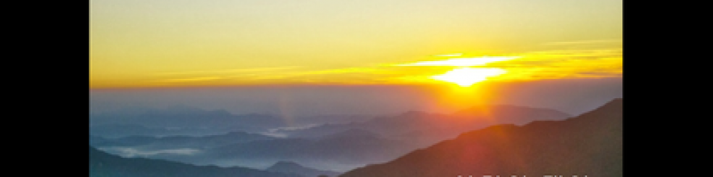
Walking around Hamyang reminds me of Forest City, Iowa (near my father’s hometown). They are similar in size, both have clear main streets, and despite being small they are “the city” for their respective counties.
Hamyang Population and Density Comparison
In post-150, I wrote:
I am now in a small city called Hamyang (pop. 20,000 in the city [읍] another 20,000 in the surrounding 250-square-mile county [군]), making the county area very rural — 80 people per square mile versus Seoul’s 45,000 per square mile. As I am resting in Hamyang the next two days, I have the time to relate the.. [….]
I see that Hamyang County has a population density of 145 per square mile, equal to New Hampshire‘s in the USA. This is way below the South Korea average of 1,300 per square mile, not to mention Seoul’s intimidating 45,000 per square mile. (My home, Arlington County in Virginia, is now over 8,000 per square mile, but was about 6,500-7,000 per square mile when I was growing up — or so I calculate from Wikipedia just now).
Hamyang County [함양군] outside the Town of Hamyang [함양읍] has a population density of only 80 per square mile, which is, fittingly, about equal to West Virginia‘s in the USA. I rode a bus through rural Hamyang County after I emerged from some days in the mountains (where I had met and traveled with one, and then three, friendly and helpful Korean hikers in their 40s who fed me and took care of me. That great story must wait for another time).
Speaking of West Virginia, a park ranger in Jiri National Park asked me where I was from. I said “Virginia”. He began talking about how much he liked West Virginia. I think he believed “Virginia” to be short for “West Virginia”.
Here’s a map Hamyang City, “such as it is”. Zoom out to see where it fits:
Hamyang City proper (the dense, gridded area above) is easy to see on foot, in its entirety, in a couple of hours, I think, even at a very leisurely pace. An express tour could be done in an hour flat.
Most of Hamyang City consists of high-density low-rise houses but also a few 14-storey apartments. There is a business district centered on the main street. I was a little surprised to find several “chain businesses” in this “small town”: Dunkin Donuts, Pizza School, and Lotteria (a Korean McDonald’s) all on that street. There is actually even a “hagwon building” with three English institutes and several other hagwon (private educational institutes) housed inside. I don’t know why they put them all in one building.
You can almost feel like you are in Seoul in a very narrow corridor of Hamyang Main Street. I know I did, as I ate the 5,000-Won, 1,800-calorie pepperoni pizza from Pizza School (a chain that some of my foreign coworkers loved). Off main street, there are other businesses, but few (if any) chains. It feels much poorer.
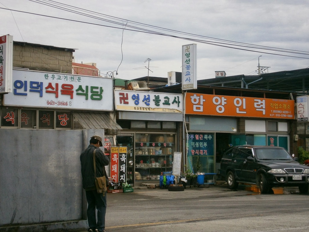
Here are three Hamyang businesses near the Intercity Bus Terminal, so far off from Main Street. On the left, there is a restaurant that says it specializes in “Korean Beef” [한우] (as in, the cow was born on Korean soil, not imported meat — Korean-beef is more expensive) and “Black Pig” [흑돼지]. The next is selling Buddhist trinkets (recognizable by the swastika), and the third may be a job-placement center:
Hamyang History Tidbits
There is a very-old jeongja [정자] (a shaded, elevated resting pavilion) on Main Street across from the town hall. The historical marker implies, in flawless English, that a jeongja has existed here since the 800s AD, when a scholar named Choe Chiwon (b. 857) used it to write poetry. The present one is from the 1600s, it says.
There is an artificial forest on the riverbank, planted around 900 AD and still standing, also the initiative of this Choe Chiwon. It was designed to help stop flooding, it says, and is today recreational (and probably was then, too).
A faded stone monument stands inside the artificial forest, erected in 1871, and called the “Hamyang Anti-Compromise Stele”. It’s written in Chinese characters (Hanja). Here is the text of the English explanatory sign:
This stone monument is one of many erected by the government across the country [Korea] in April 1871 in order to warn the nation [against] friendly relations with foreign countries, after it defeated the French army in 1866 and the American army in 1871. It reads in large Chinese characters in front, “Unless we fight while the Western pirates invade us, we are forced to enter into friendly relations with them. Insisting on doing it is like selling the nation.” On the left side in small Chinese characters it reads, “We warn all the generations ahead. Composed in 1866 and erected in 1871.”
I am suspicious of the details and scope of this alleged incident, because the source may be former South Korean General Choi Duk-Shin [최덕신] who defected to North Korea in the 1980s. He thus had incentive to say how bad the South’s regime was.
(This Choi Duk-Shin was quite a character. Who’s ever heard of a South Korean official defecting to North Korea? He was the South Korean Foreign Minister under the early years of General [President] Park Chung-Hee in the 1960s.)
That many killings of civilians occurred in that war (and especially in this region of the country) is certain, though. This mountainous area of the central-south became a stronghold/hideout for North Koreans, after their units began to fall apart in September 1950 following the Incheon Landing. Perhaps tens of thousands of North Koreans spent time in these villages and mountains to wage their partisan war. They were supposedly supported by many local people, especially in Jeolla Province.
Major operations to defeat the Communist guerrillas involved burning down entire villages, it seems. I passed right through one such place last week (Nochi Village [노치마을]), which had a historical marker saying it was burned entirely in such an operation in the war. It had a great freshwater spring.
[Pictures to be added later when at a better computer]