 The view from White Cloud Mountain
I think it’s no exaggeration to say that it felt a lot, to me, like “being in a cloud” to be on the summit of White Cloud Mountain (
Baegunsan in Hamyang County, Korea [함양군 백운산)]).
I was 1,279 meters above sea level, and totally alone.
I reached the top on October 2nd, about 5:30 PM, or 45-60 minutes before navigable daylight was gone for the day. (I’d worried I might not be able to make the steep ascent before sunset; that I did make it was cause for celebration.) I’d come from Jung-Jae Pass.
White Cloud Mountain rises from 695 meters above sea level at Jung-Jae Pass to 1,279 meters above sea level at its summit and the guidebook writers warn how hard it is. I’d just come off of two days’ rest in Hamyang, lucky for me, so it wasn’t too bad.
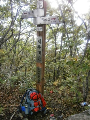
Trail marker between Jung-Jae Pass and “White Cloud” Mountain
Along the way, I was pleased to see the red hiking ribbon of the Koreans I’d met a few days earlier. Many Korean hikers have a tradition of putting these kinds of ribbons along the route they’ve hiked. It helps to mark the trails properly outside the national parks, so they’re quite useful. These kinds of ribbons have helped me a lot on this trip.
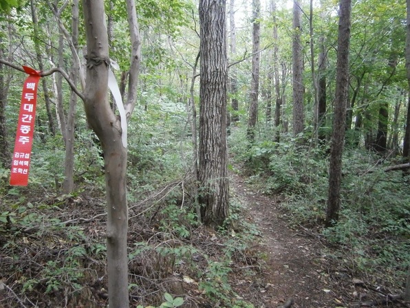
A hiking ribbon on the trail leading to Baegunsan
Near the peak, there were some mounds that Koreans traditionally use as graves. The guidebook comments:
….the trail turns to the east and onto a rocky surface for about 500 meters before reaching a flat, cleared area that houses two tombs — whose occupants must have had very good friends to carry them up to this majestic resting place!
And here they are:
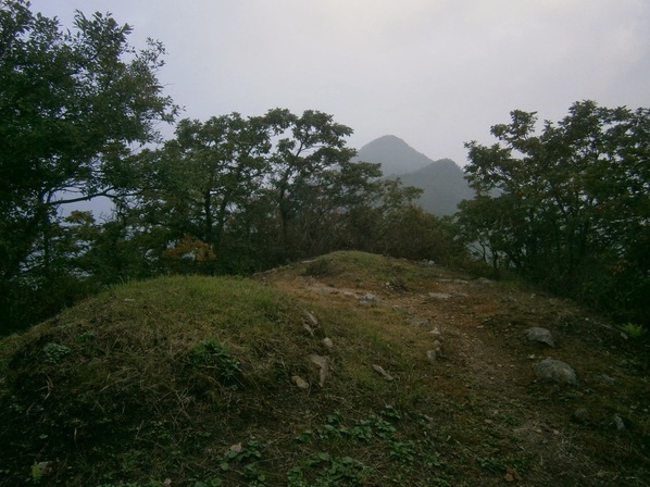
Tombs near White Cloud Mountain
You may be able to see the trail continuing to the right. It’s a short way to the cleared summit area. The summit was deserted, of course. I hadn’t seen anyone since leaving the bus at Junggi Village (중기마을) a few hours earlier.
At the summit:
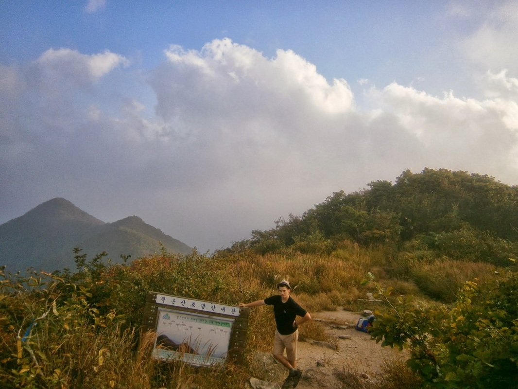
The summit of White Cloud Mountain. (Camera on 12-second delay).
The area with the graves is to the rear of the photo behind the slight rise.
The trail descends from there hundreds of vertical meters.
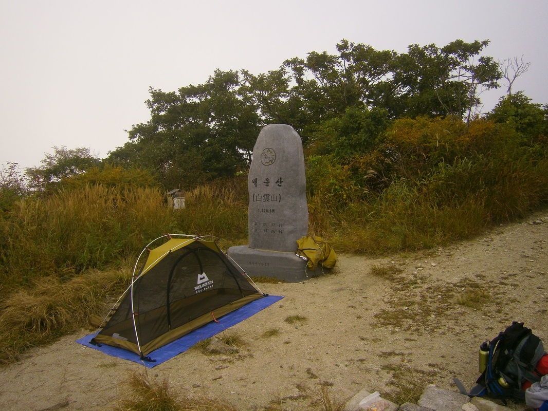
Just off to the right in the above picture is a big rock, a “stele”, that had some writing in Korean noting the peak’s name:
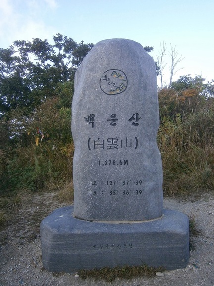
Stele at top of White Cloud Mountain (백운산)
On the back of this stone, it explains (according to the guidebook translation) that there are over thirty peaks with the name White Cloud Mountain (백운산) in Korea, but that this one is highest.
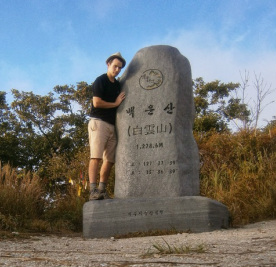
Me With the “White Cloud Mountain” Stele
The top of White Cloud Mountain would be my campsite.
Another attempted auto-timer self-portrait, the camera standing on a rock:
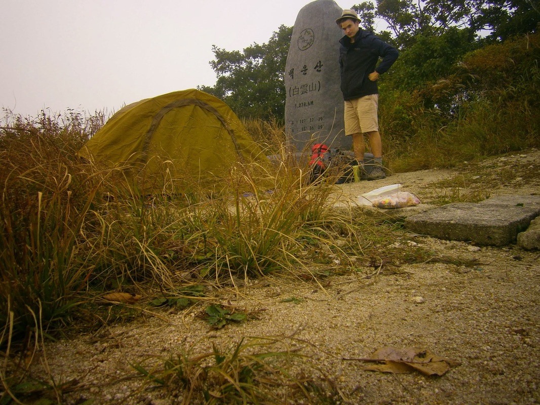
Campsite Self-Portrait, White Cloud Mountain
Here is a little from the guidebook about White Cloud Mountain and the area photographed directly above:
As you break from the tree cover, you walk out onto a grassy area where the grass is, in some parts, slashed down to ground level. If this is the case, then the large summit area will provide you with a great place to camp on what is a 360-degree-view mountain top. No water is found near the summit, so you should carry your own if you wish to camp. A large stone stele stands in the cleared area, celebrating the peak and the Baekdu-Daegan. It states that Baegun-san means “White Cloud Mountain”, and that there are always snow and clouds on this mountain, where feeder streams of the Nakdong-gang and Seomjin-gang rivers originate.
There was no snow on the top (that must be a misprint — Korea has too hot/long summers for snow to last on any peak), but there
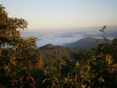
were clouds. The clouds dramatically and mysteriously covered the valleys below, something out of a fantasy movie.
It was the clouds surrounding the summit that were really astonishing. Looking back on these pictures, as I sit in the Internet Cafe in the small city of Geochang five days later (near a man who arrived at 8 AM on a Monday to play “Starcraft”), I think I’ve failed to capture how the scene really looked. I’m not a good enough photographer.
Here is one shot that was sort of successful:
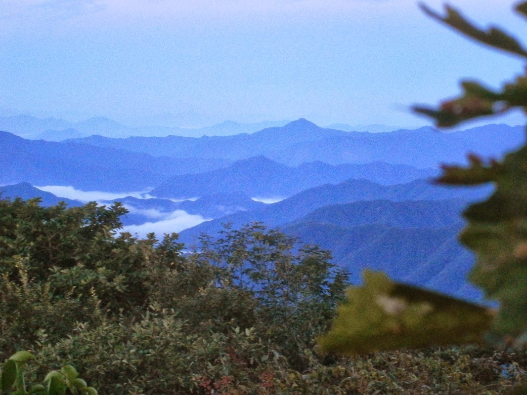
A view from the summit of White Cloud Mountain
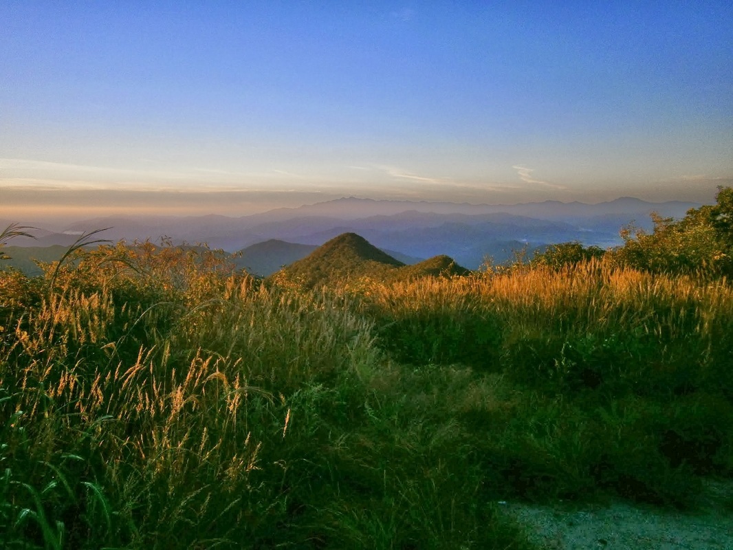
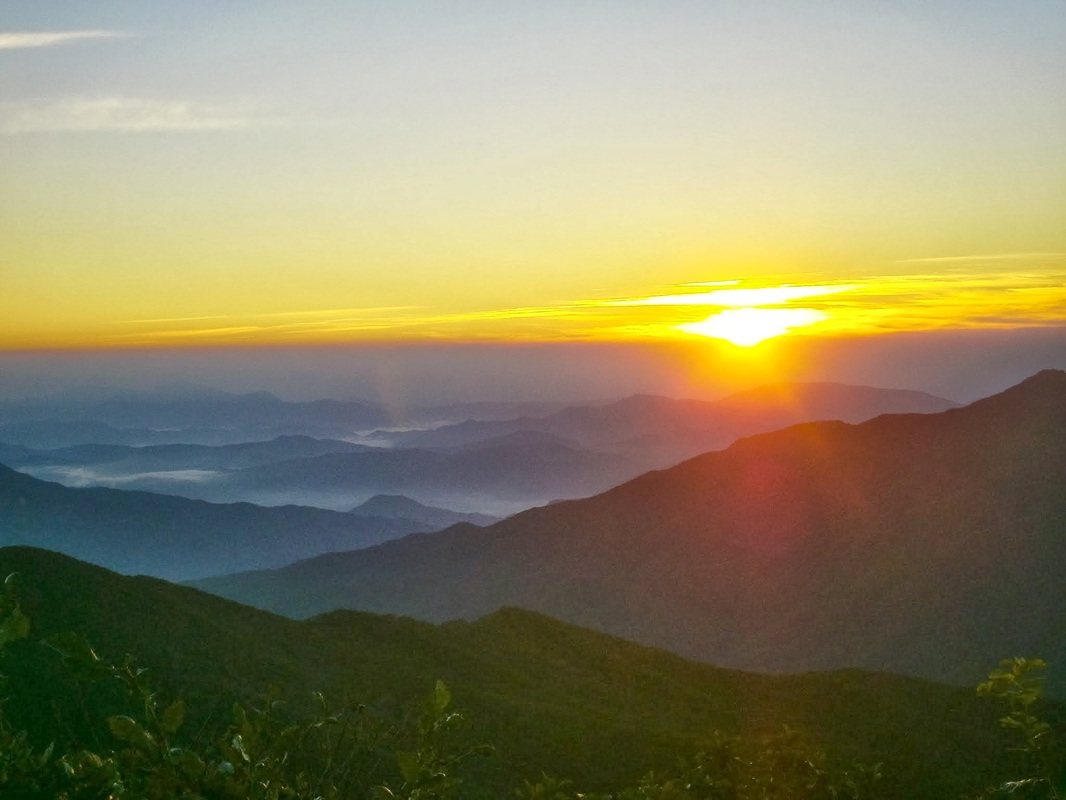
It got quite cold that night. I got up before 6:00 AM to check out the sunrise. What better place?
Here it is, or “was”:
The guidebook again:
…If you sleep on Baegun-san, get up early and catch the sunrise, and see how the mountain lives up to its name as low fog and clouds seep through the valleys below like an incoming tide.

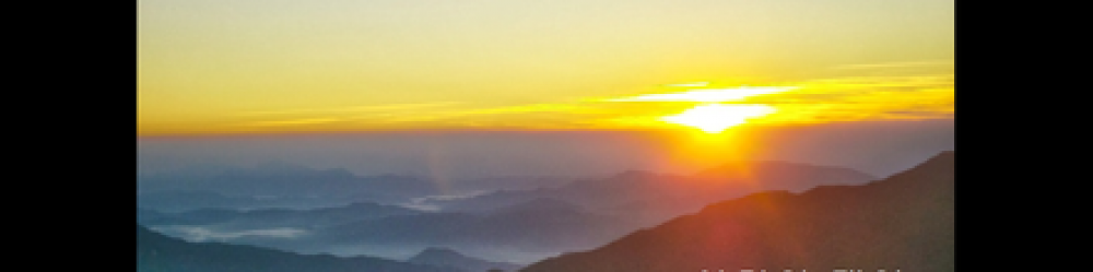
Foggy valleys below, a view from White Cloud Mountain in the morning
It looks good, but you have to imagine a shivering person shakily clutching the camera as this shot was taken. (Maybe that’s why most of the many pictures I tried to take don’t look good: my hands were shivering a lot.) The sleeping bag I bought here is quite good, but getting out of the tent was intimidatingly chilly. I wonder how much lower the temperature was on this 1,279-meter summit than in the valleys below, like back in Hamyang (elev. 170 meters).
Morning on White Cloud Mountain
As it was so cold, I broke camp only slowly. A picture of my tent half-taken-down:
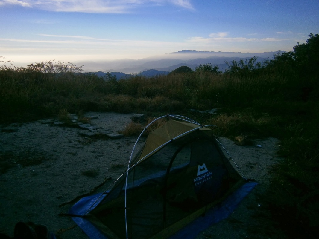
Breaking camp, 7 AM hour, White Cloud Summit
I was almost ready to go when I saw someone coming up from the way I’d come the day before. It was around 7:45 AM. He was a thru-hiker, a man in his 40s or maybe early 50s, also hiking alone. He said he was from Yongin, a city near Seoul. I recognized the name of the city because of “Everland”, the enormous amusement park near there. We talked for a few minutes, and he had switched to totally-English by the end. Like all the thru-hikers I’ve met, he was in a terrific hurry to make his day’s objectives on this tough trail.
I told him I was going off the other way to find the supposedly-nearby temple. (One side-benefit: All temple have constant sources of pure, flowing, highly-drinkable water.) The guidebook says this about the temple:
[The temple called] Sangyon-dae, meaning “sitting on the lotus” temple , was established in 924, near the end of the Shilla Dyntasy, as people believed that the mother of the great Confucian/Daoist sage “Go-Un” Choe Chi-won prayed here before conceiving him.
This Choe Chi-won guy seems pretty famous around here.
Hamyang was full of references to him doing this and that. I must’ve taken the wrong path, though, because after several hours I failed to find the temple. I suspected I was on the wrong track because signs mentioned “Baekun Temple”. I assumed that was an alternate name for the strange-sounding “Sangyon-dae”, but perhaps that is wrong.
I backtracked. I started along the path that Mr. Yongin had gone hours earlier. I was on the way to Muryeong-Gogae Pass (무령고개), whose name I wrote in my notebook as “Karaoke Pass” (“노래방재”). The man who runs the small restaurant at that pass has a karaoke machine and plays along with his guitar. Reaching there the next day was a half-step back into modern Korea (a kind of rustic “singing room” or noraebang at the pass) compared to the afternoon hiking up to White Cloud Mountain, and then the mysterious, shivering morning atop it.
[This was written in a PC Room (Internet Cafe) in Geochang on Monday, October 7th.]
The photos in this blog entry are stunning!. I remember being “in the clouds” at Shenandoah National Park in Virginia a few years ago–it was like a dense fog with almost no visibility. With your higher elevation you were above the clouds with spectacular views. Another memory is from when I was backpacking with other Girls Scout leaders in Naples, NY–many years ago in May. It was bitterly cold overnight and in the early morning there was snow on the ground. When I tried to light a fire to warm us up, it seem to take forever due to my hands shaking from the cold. Packing a small thermometer into your backpack may be another way to record aspects of this trip. Good luck in the next segment! Have fun!!
Thanks for the comment. A thermometer is a good idea, but as I don’t have one now, I don’t think it will happen.
There must be a way to calculate the temperature of a mountain summit at a given altitude if you know the temperature at the base of the mountain and know the elevation, but I don’t have time to look into it now. I checked the weather here and it says it will get down to 3 C [high 30s F] tonight near sea-level…
Seeing this brings back some good memories of my own. I lived in Ham Yang in the mid to late 90s and loved to hike the mountains and trails all throughout that whole area. Thanks for sharing your great photos and anecdotes.