bookmark_borderPost-156: No Time to Write

I am now in Gimcheon, not far from the train station. This city, or this part of it, seems to be dominated by students: Everywhere I’ve looked, at all times of day (in my two days here), they’ve been loitering or walking or talking or eating or whatever else. I can only guess why.

I regret that I haven’t had the opportunity to post much during this trip, due to lack of computer access (though I have kept notes in a notebook). I’ve only written two substantive posts on my hiking trip as it’s developed so far, though I could’ve written many more. 

At the “PC Room” in which I now sit, I’ve majorly revised and updated post-155, “The Mystery of the Halmi Holes (Or, Finding North Korean Foxholes in the Mountains). I’m not certain that what I found are North Korean in origin, but I think there’s a compelling case to be made for it. I’m open to all suggestions and I think it’s an interesting subject.

I have to pay by the hour to use the Internet at these “PC Rooms”. This one costs 1,200 Won ($1.00 U.S.) per hour. I’ll leave here soon and try to find the E-Mart in this city. It’s my only hope, I think, to find some peanut butter to make sandwiches for the next big leg of the hike.

One way or another, I’ll return to Seoul around November 1st. Thanks for reading.

bookmark_borderPost-155: Mystery of the Holes of Halmi (Or, Finding North Korean Foxholes in the Mountains)

The following is the story of how I came to ask myself:“What would foxholes dug in 1950, abandoned for sixty years, look like today?”  I’d found what I suspect(ed) were North-Korean-made foxholes near the trail. It was October 5th.

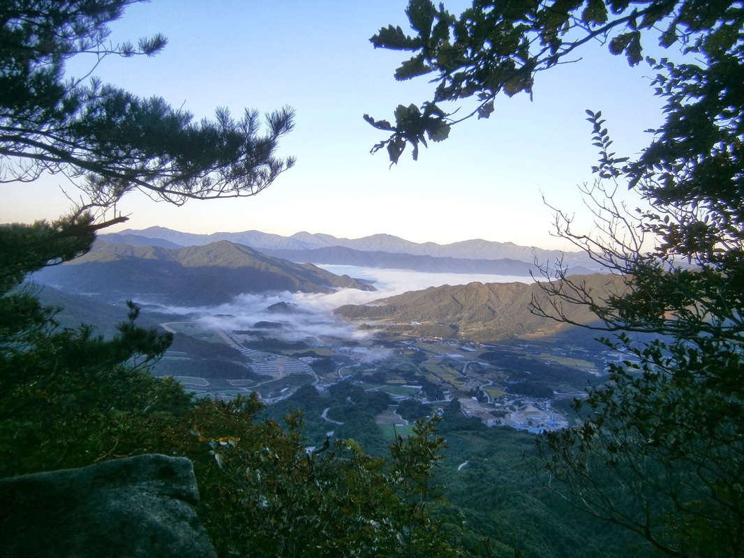
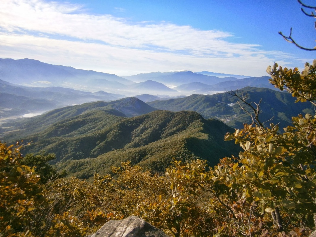
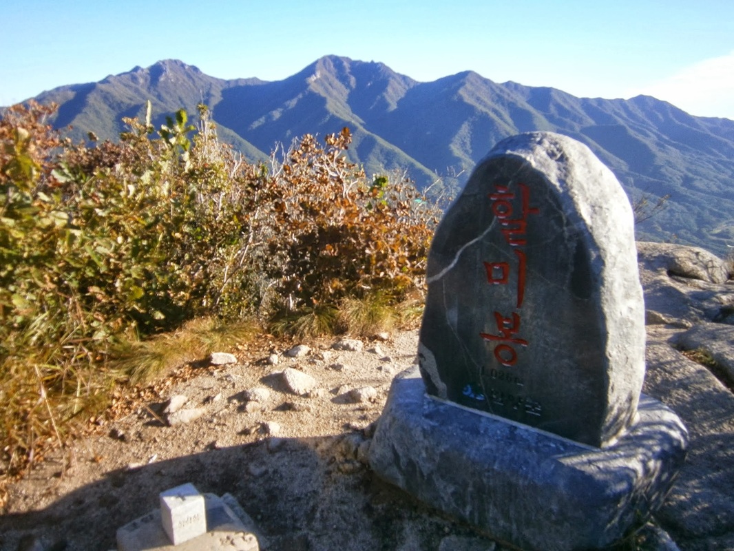
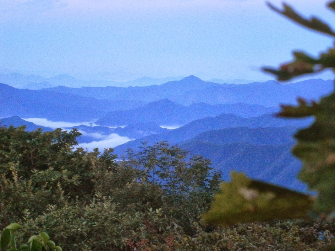
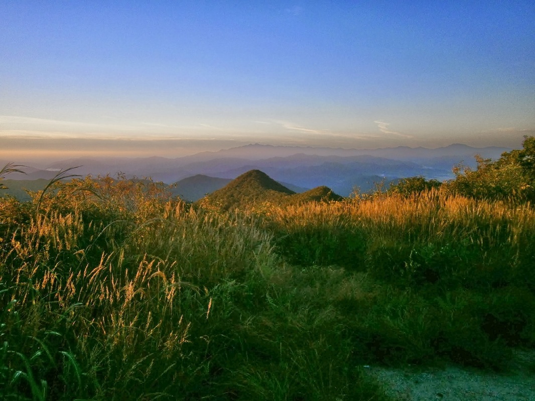
October 5th is the day I reached Halmi Peak [할미봉], with its spectacular views:
Halmibong

The view from Halmi Peak, Korea

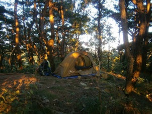
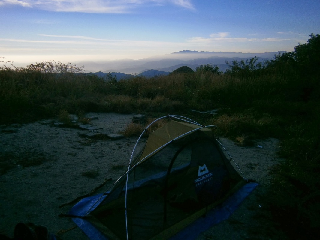
PictureCampsite one km or so south of Yuship Pass

My day began on a seldom-visited stretch of trail north of Yukship Pass (육십령), still a few miles south of Deogyusan National Park (덕유산). I’d camped the night before. It was windy all night.

As I was packing up in the morning, a solitary thru-hiker came through, another middle-aged Korean man. He’d slept at Yukship Pass and he asked me something [in Korean]. I’m about 80% sure that he asked me why I’d camped in the forest and not down at Yukship Pass. (The afternoon before, I’d asked a guy sitting in front of the closed grocery store at Yukship if I could camp there, and the guy had said “No” [in Korean], so I moved on. I have no idea who he was or by what authority he’d said ‘No’.)

The man was soon on his way. This all happened before 6:30 AM. We were both headed north, approaching Halmi Peak (Or Halmi-bong [할미봉]) and from there entering Deogyu National Park.

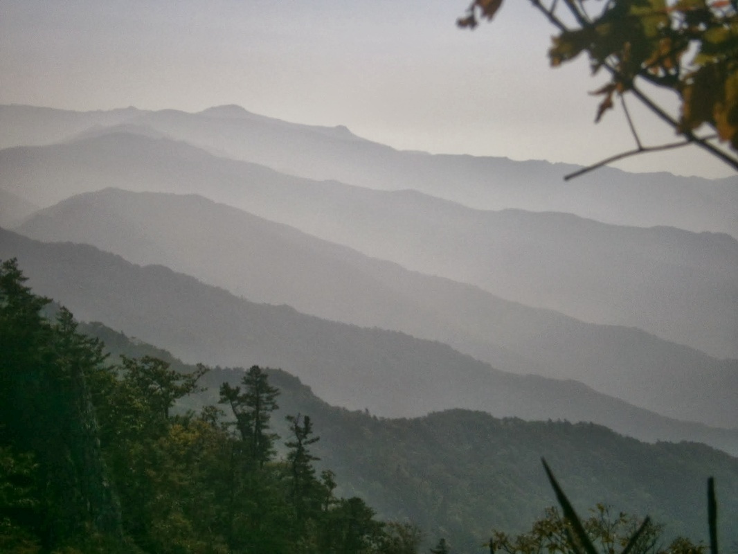
This was the view along the way:


Picture

En route to Halmi Peak (할미봉)

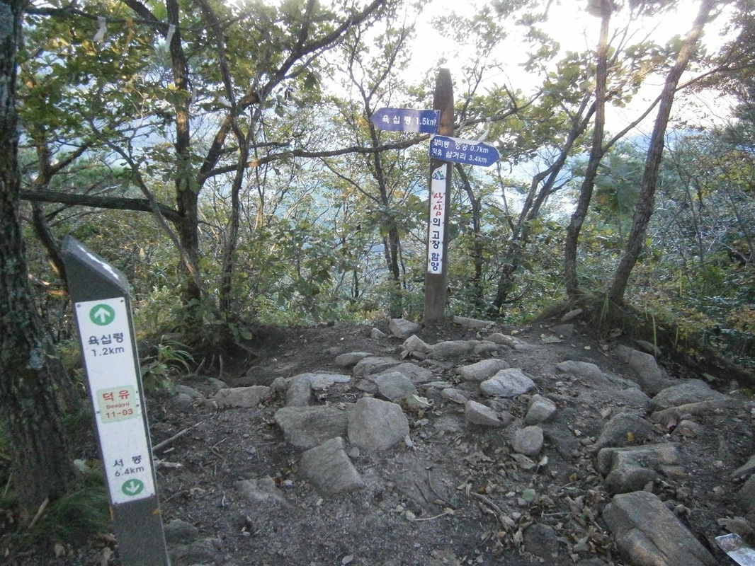
Shortly after the above photo was taken, I reached an unremarkable, unnamed 922-meter-high summit with no views. It was here that my wild speculation about North Korean guerrillas began. This was it:
Picture

The unnamed 922-meter peak near Halmi Peak. [Note: Two trail markers give different distances to Yukship Pass [육십령], one saying 1.5 km and one saying 1.2 km. I suspect the shorter of these is “as the crow flies”]

I wouldn’t have thought twice about this place, if not for what the BD-Trail guidebook writers (two men from New Zealand) mention:

If you move a little east from the trail, you may be able to see a symmetrical, manmade hole [actually two] that has been drilled into one of the rocks on this unnamed peak, which could very well be from an iron spike driven into the peak during the years of Japanese occupation as a symbolic gesture of Japanese dominance over the sacred mountains of the Baekdu-Daegan. Then again, it could be anything . the hole is well weathered.

The writers’ speculation — that the Japanese bored these holes to assert political dominance — really makes little sense to me. That motivation may (or may not) be plausible, but why would they choose an unnamed, unknown, unspectacular, insignificant peak in the middle of nowhere? There must be thousands of peaks higher than this one in Korea. This summit (such as it is) is even in the shadow of the much-bigger Halmi Peak nearby, actually. The location makes no sense, given the writers’ conjectured-motivation. And, as the guidebook notes, it’s not even on the main area of this summit, but off to the side.

It seemed very unlikely, to me, that Japan did this for the reason the guidebook writers speculated on.

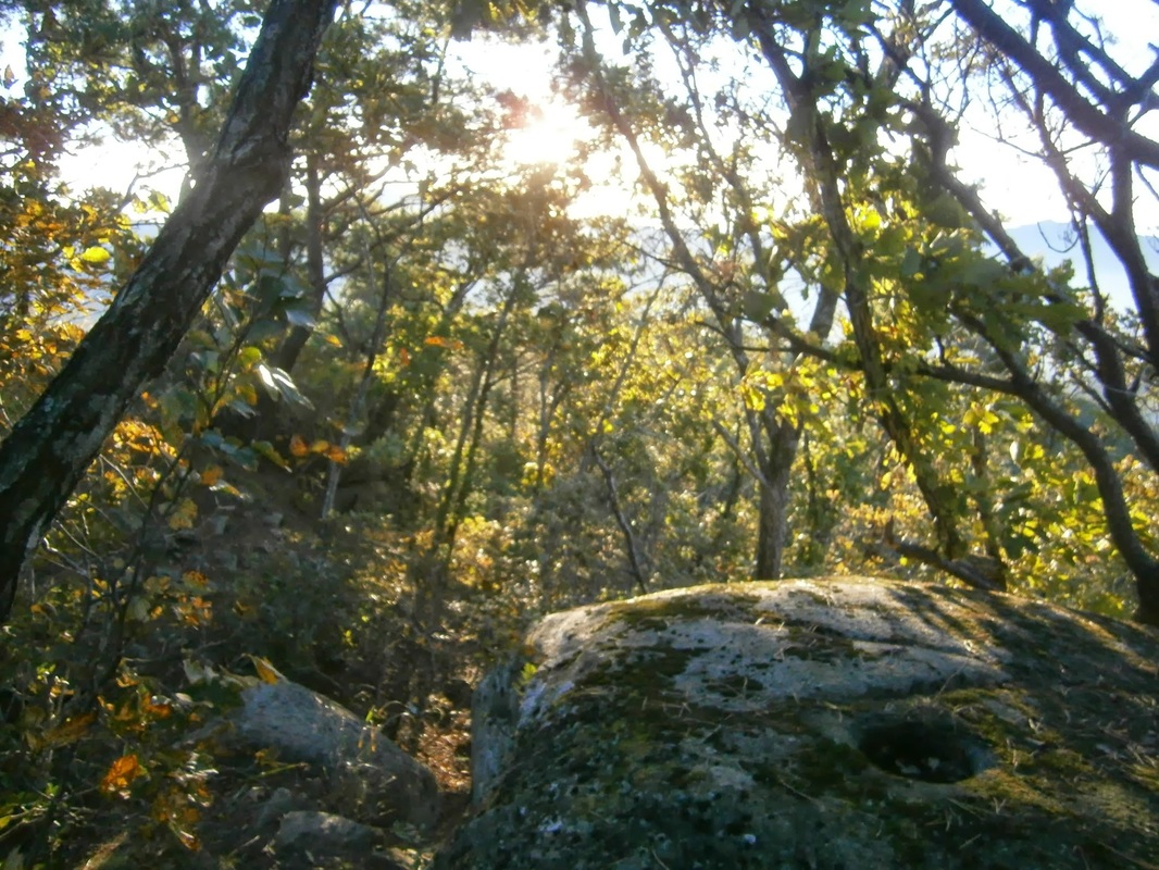
Naturally, I wanted to see the holes for myself. There were two. I located them, but unfortunately failed to take the time to get a good picture of the holes in proper perspective. Here is the best I could do:

Picture

“Halmi Hole” (bottom right)

Picture

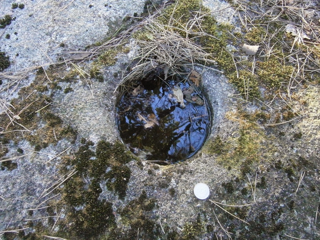
Close-up of one of the “Halmi holes”. The coin is a 500-Won piece, a bit bigger than a U.S. quarter.

The depth of the holes was a few inches, I think. They were filled with water, of course, from rain.

I’d like to hear ideas about what these holes could be; who made them; when; why.

Here is my own idea: I noticed, on this section of the trail, a number of well-weathered “foxholes” (i.e., circular pits dug to provide cover for combatants firing at enemies), actually including one right next to the holes in question. They are similar in shape and size to the foxholes you can find in the Paju area near the DMZ (not to mention of WWII movies), except that these in the Deogyu Mountains look older, more time-worn, neither made nor maintained anytime in recent decades, I suppose. Here is a shot of the “foxhole” next to the mystery holes:

Picture

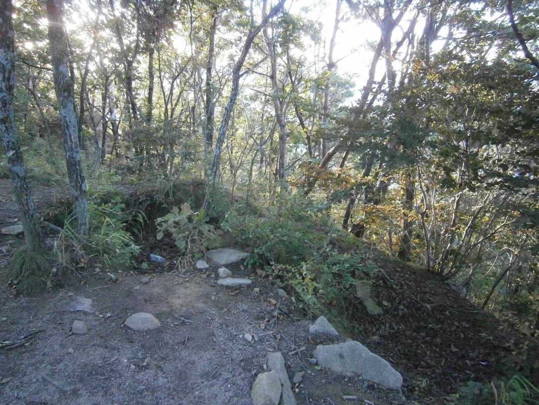
A well-weathered foxhole(?) near Halmi Peak. The holes are off to the left a few yards away.

This is not a great picture, either, but I assure you that that the pit there,  with three trees now growing in it now, looks manmade and very similar to military “foxholes”. Compare this to foxholes dug in 1944 [photographed in 2011]. [Link]

On the ascent up to this unnamed summit, there were several other long-given-back-nature foxholes. I saw a few more later on in southern Deogyu Mountains. The above foxhole, given different tree-cover, could’ve covered a wide “field of fire”. The other ones in this area I saw were also similarly placed.

It is reasonable to assume that whoever dug the foxholes must’ve made the circular boreholes, too, though for what purpose I don’t know. Some military apparatus must have made both the foxholes and the boreholes.

What would defensive foxholes be doing on this anonymous, seldom-visited summit in south-central Korea?  There are four possibilities, as I see it:

Potential Diggers of the Holes
(1) The Japanese military could have made them (during the colonial period) before 1945, it’s true. But, why? There was no need for them to defend such a place. They never fought any hostile armies on Korean soil in WWII.

(2) The wartime ROK [South Korean] Army or U.S. Army could have made them in August 1950, when they were retreating through this area, to defend against the North Korean advance. This seems also highly unlikely, as the U.S. strategy was to conduct a long delaying action until the Pusan Perimeter. (The location of these holes is far to the west of that perimeter.) Foxholes atop mountains like this do not fit. There was no retreat from here.

(3) Could the post-war ROK Army have made them? Why? For defense seems really implausible. This area is very far from the DMZ. I suppose it’s possible the ROK-Army (or U.S. Army) made them as training. The holes look decades old.

(4) [The only theory that I find really plausible]  There is only one group in the 20th century that ever defended terrain in this area, North Korean guerrillas (and/or pro-communist South Korean guerrillas). They may have dug them. Thousands famously “hid” in the Jiri Mountains, and some were also present in the Deogyu Mountains from Summer 1950 onward. They had mountain bases they. It took many major operations to “flush them all out”, some holding-out even until after the war was over. I’d speculate that they dug these foxholes to guard their mountain hideouts/bases.

Actually, related to (4), it’s also possible that the ROK Army made them during one of their many counter-insurgency operations against the guerrillas during the war. General Paik, in his book From Pusan to Panmunjom, wrote about one called “Operation Rat-Killer” in 1951 or ’52 which he led. The South Koreans may have determined that pro-communist guerrillas were active in moving through this area, so they established strongpoints ate key locations and manned them,  to limit guerrilla movement. I suppose this qualifies as either (4a), or (2a), or (5).

(A monument at Yukship Pass stands in honor of the ROK soldiers who died fighting North-Korean guerrillas operating from bases in the Deogyu Mountains during the war. The BD-Trail guidebook itself notes this just a few pages earlier. This unnamed-922-meter-peak is only a mile or so north of that monument.)

The origin of the circular borehole I’m still uncertain about, but it must be connected to who was manning these foxholes, which very likely was North Koreans. Even if it was ROK counter-insurgency soldiers, it’s still proof that the North Korean guerrillas used the very paths on which I’ve been treading in south-central Korea, and their strongpoints/bases were at least nearby; that is certain. It hadn’t hit me before.


All these thoughts hazily occurred to me that morning as I walked on towards Halmi Peak itself, to the north. The  thoughts I’ve outlined above faded from my mind soon, as the ascent to Halmi quickly demanded my full mental concentration. It is very steep on both sides, and so was physically quite hard to reach:
Picture

On the way up to Halmi Peak

The view from the summit of Halmi Peak itself looked great:
The view from Halmi-bong

The view from Halmi Peak (할미봉)

My physical exhaustion, as well as the persistent wind, prevented full appreciation. Imagine a panting holder of the camera here, with a sweat-soaked shirt (something I’ve now gotten well used to).
Picture

The stele atop Halmi Peak

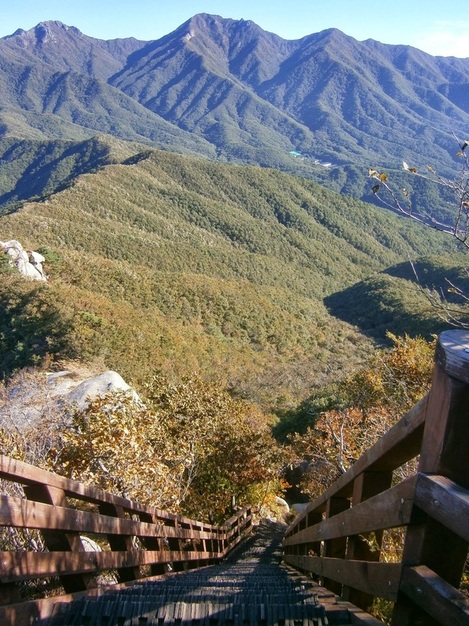
Then came the physically-difficult steep descent after the peak:
Down from Halmi-bong

Down from Halmi Peak; a steep staircase going north

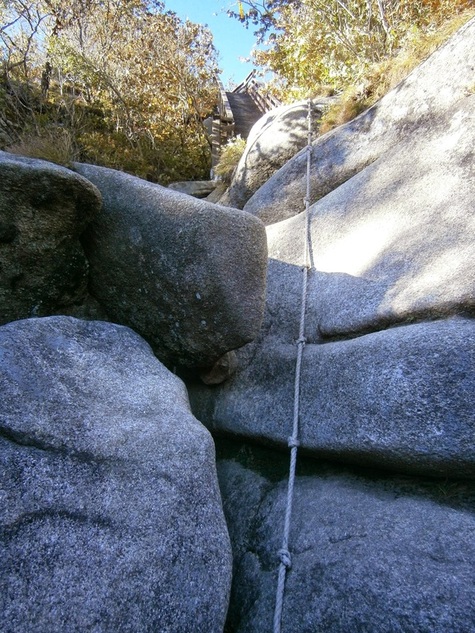
Picture

A several-meter vertical drop, on the descent after Halmi Peak, going north

So much for Halmi Peak. I kept going north, descending into Deogyu National Park. (I luckily avoided paying the entrance fee because I went in along the trail, the “back way”.)

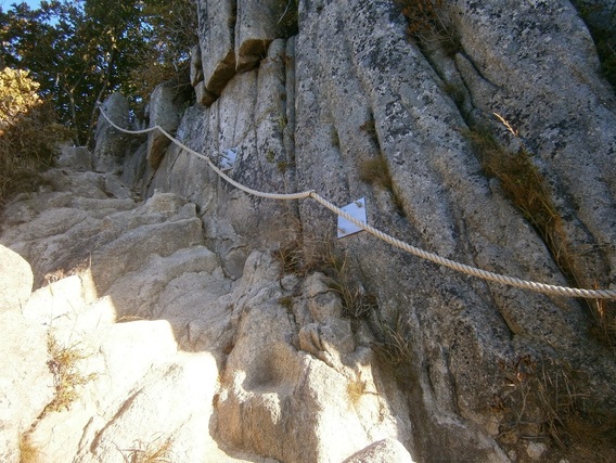
Back to the “Halmi Holes Mystery”: Having done it, I cannot imagine trying to move through the Halmi Peak area without the handiwork of the Korean Forest Service — i.e. the staircase and ropes, the above being two examples of many in that area. I think it would’ve been near-impossible in the 1950, and almost-definitely-impossible as a large military operation with heavy equipment to move through the area. The difficulty of the terrain would’ve made it a good choice for a guerrilla base, which leads me to favor the “North Korean Guerrilla” idea rather than the “ROK Counter-Insurgency” idea. Only a narrow southern avenue of approach would’ve needed to be defended, which is the way all the foxholes faced.

(I’d like to think this is the solution to the Halmi Hole Mystery, but in fact I’m just speculating, too, and I’m willing to hear any other opinions.)

Here is somebody else’s post about long-abandoned foxholes in South Korea: Nojeok Hill: My view from the Top —  the Berlin Wall, the Korean War, Foxoles, and Korean Unification.


[I wrote this in a PC Room on the morning of October 10th in Geochang, where I was forced to return after a typhoon closed Deogyusan National Park.] [Updated: October 16th]

bookmark_borderPost-154: On White Cloud Mountain

PictureThe view from White Cloud Mountain

I think it’s no exaggeration to say that it felt a lot, to me, like “being in a cloud” to be on the summit of White Cloud Mountain (Baegunsan in Hamyang County, Korea [함양군 백운산)]).

I was 1,279 meters above sea level, and totally alone.

I reached the top on October 2nd, about 5:30 PM, or 45-60 minutes before navigable daylight was gone for the day. (I’d worried I might not be able to make the steep ascent before sunset; that I did make it was cause for celebration.) I’d come from Jung-Jae Pass.

White Cloud Mountain rises from 695 meters above sea level at Jung-Jae Pass to 1,279 meters above sea level at its summit and the guidebook writers warn how hard it is. I’d just come off of two days’ rest in Hamyang, lucky for me, so it wasn’t too bad.


Picture

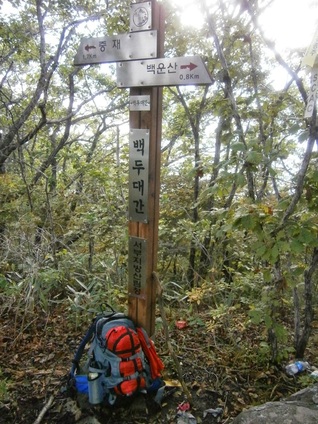
Trail marker between Jung-Jae Pass and “White Cloud” Mountain

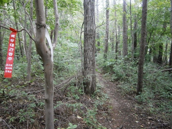
Along the way, I was pleased to see the red hiking ribbon of the Koreans I’d met a few days earlier. Many Korean hikers have a tradition of putting these kinds of ribbons along the route they’ve hiked. It helps to mark the trails properly outside the national parks, so they’re quite useful. These kinds of ribbons have helped me a lot on this trip.
Picture

A hiking ribbon on the trail leading to Baegunsan

Near the peak, there were some mounds that Koreans traditionally use as graves. The guidebook comments:

….the trail turns to the east and onto a rocky surface for about 500 meters before reaching a flat, cleared area that houses two tombs — whose occupants must have had very good friends to carry them up to this majestic resting place!

And here they are:
Picture

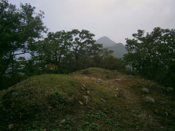
Tombs near White Cloud Mountain

You may be able to see the trail continuing to the right. It’s a short way to the cleared summit area. The summit was deserted, of course. I hadn’t seen anyone since leaving the bus at Junggi Village (중기마을) a few hours earlier.

At the summit:

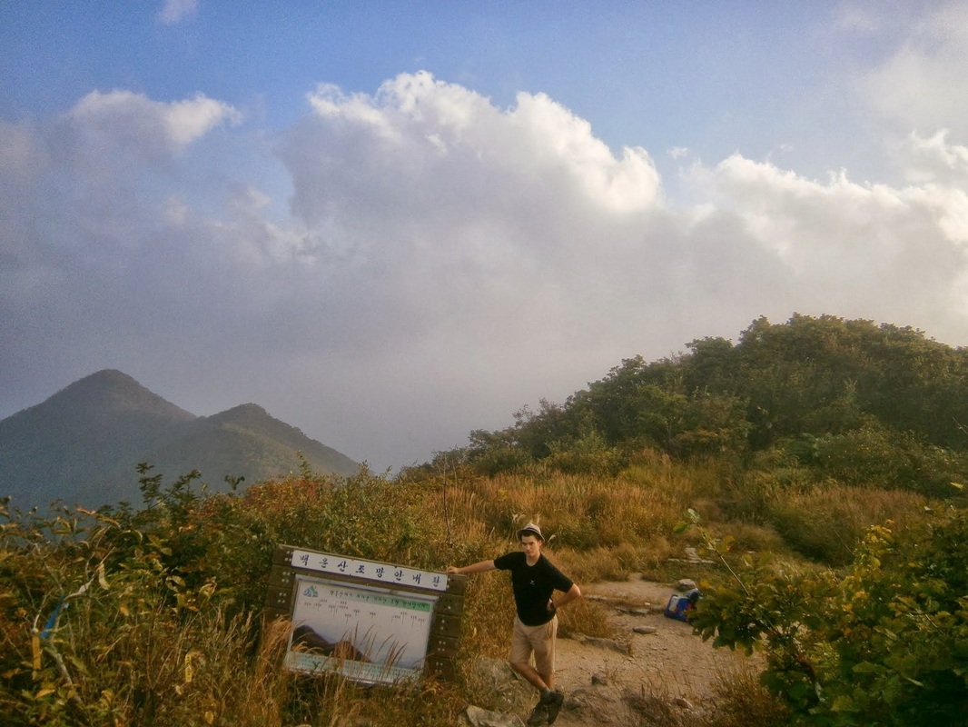
Summit of White Cloud Mountain

The summit of White Cloud Mountain. (Camera on 12-second delay).
The area with the graves is to the rear of the photo behind the slight rise.
The trail descends from there hundreds of vertical meters.

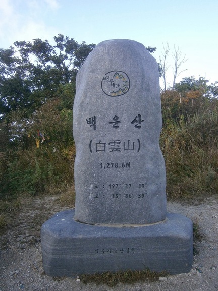
Just off to the right in the above picture is a big rock, a “stele”, that had some writing in Korean noting the peak’s name:
Picture

Stele at top of White Cloud Mountain (백운산)

On the back of this stone, it explains (according to the guidebook translation) that there are over thirty peaks with the name White Cloud Mountain (백운산) in Korea, but that this one is highest.
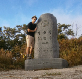
With the Stele

Me With the “White Cloud Mountain” Stele

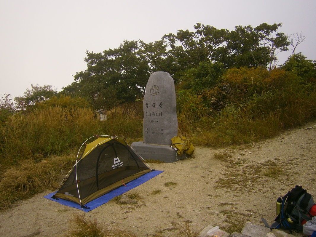
The top of White Cloud Mountain would be my campsite.

Another attempted auto-timer self-portrait, the camera standing on a rock:
Campsite2

Campsite Self-Portrait, White Cloud Mountain

Here is a little from the guidebook about White Cloud Mountain and the area photographed directly above:

As you break from the tree cover, you walk out onto a grassy area where the grass is, in some parts, slashed down to ground level. If this is the case, then the large summit area will provide you with a great place to camp on what is a 360-degree-view mountain top. No water is found near the summit, so you should carry your own if you wish to camp. A large stone stele stands in the cleared area, celebrating the peak and the Baekdu-Daegan. It states that Baegun-san means “White Cloud Mountain”, and that there are always snow and clouds on this mountain, where feeder streams of the Nakdong-gang and Seomjin-gang rivers originate.

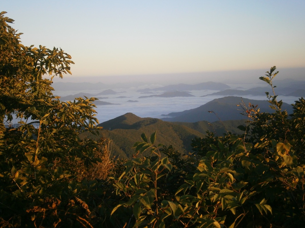
There was no snow on the top (that must be a misprint — Korea has too hot/long summers for snow to last on any peak), but there were clouds. The clouds dramatically and mysteriously covered the valleys below, something out of a fantasy movie.

It was the clouds surrounding the summit that were really astonishing. Looking back on these pictures, as I sit in the Internet Cafe in the small city of Geochang five days later (near a man who arrived at 8 AM on a Monday to play “Starcraft”), I think I’ve failed to capture how the scene really looked. I’m not a good enough photographer.

Here is one shot that was sort of successful:

Picture

A view from the summit of White Cloud Mountain

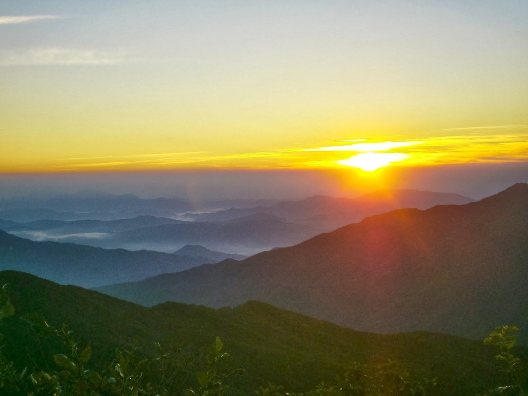
It got quite cold that night. I got up before 6:00 AM to check out the sunrise. What better place?

Here it is, or “was”:

The guidebook again:

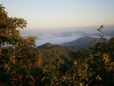
…If you sleep on Baegun-san, get up early and catch the sunrise, and see how the mountain lives up to its name as low fog and clouds seep through the valleys below like an incoming tide.

Foggy Valleys

Foggy valleys below, a view from White Cloud Mountain in the morning

It looks good, but you have to imagine a shivering person shakily clutching the camera as this shot was taken. (Maybe that’s why most of the many pictures I tried to take don’t look good: my hands were shivering a lot.) The sleeping bag I bought here is quite good, but getting out of the tent was intimidatingly chilly. I wonder how much lower the temperature was on this 1,279-meter summit than in the valleys below, like back in Hamyang (elev. 170 meters).
Picture

Morning on White Cloud Mountain

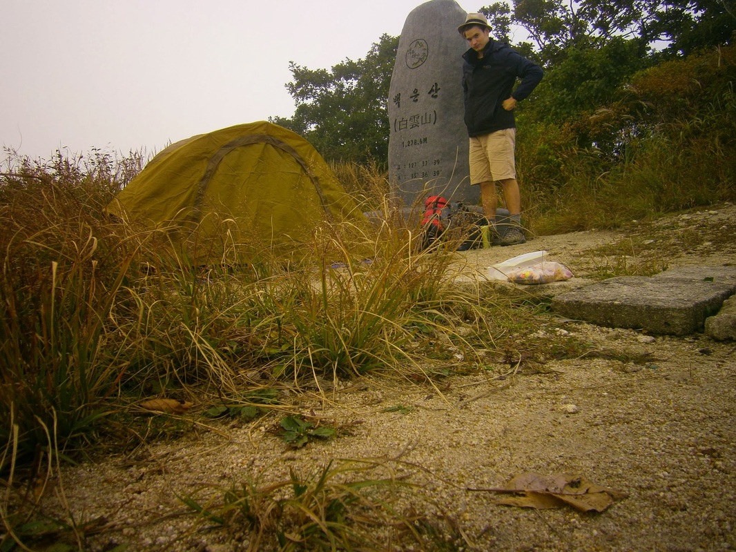
As it was so cold, I broke camp only slowly. A picture of my tent half-taken-down:
Picture

Breaking camp, 7 AM hour, White Cloud Summit

I was almost ready to go when I saw someone coming up from the way I’d come the day before. It was around 7:45 AM. He was a thru-hiker, a man in his 40s or maybe early 50s, also hiking alone. He said he was from Yongin, a city near Seoul. I recognized the name of the city because of “Everland”, the enormous amusement park near there. We talked for a few minutes, and he had switched to totally-English by the end. Like all the thru-hikers I’ve met, he was in a terrific hurry to make his day’s objectives on this tough trail.

I told him I was going off the other way to find the supposedly-nearby temple. (One side-benefit: All temple have constant sources of pure, flowing, highly-drinkable water.) The guidebook says this about the temple:

[The temple called] Sangyon-dae, meaning “sitting on the lotus” temple , was established in 924, near the end of the Shilla Dyntasy, as people believed that the mother of the great Confucian/Daoist sage “Go-Un” Choe Chi-won prayed here before conceiving him.

This Choe Chi-won guy seems pretty famous around here. Hamyang was full of references to him doing this and that. I must’ve taken the wrong path, though, because after several hours I failed to find the temple. I suspected I was on the wrong track because signs mentioned “Baekun Temple”. I assumed that was an alternate name for the strange-sounding “Sangyon-dae”, but perhaps that is wrong.

I backtracked. I started along the path that Mr. Yongin had gone hours earlier. I was on the way to Muryeong-Gogae Pass (무령고개), whose name I wrote in my notebook as “Karaoke Pass” (“노래방재”). The man who runs the small restaurant at that pass has a karaoke machine and plays along with his guitar. Reaching there the next day was a half-step back into modern Korea (a kind of rustic “singing room” or noraebang at the pass) compared to the afternoon hiking up to White Cloud Mountain, and then the mysterious, shivering morning atop it.


[This was written in a PC Room (Internet Cafe) in Geochang on Monday, October 7th.]

bookmark_borderPost-152: A Bus Ride Across Hamyang County

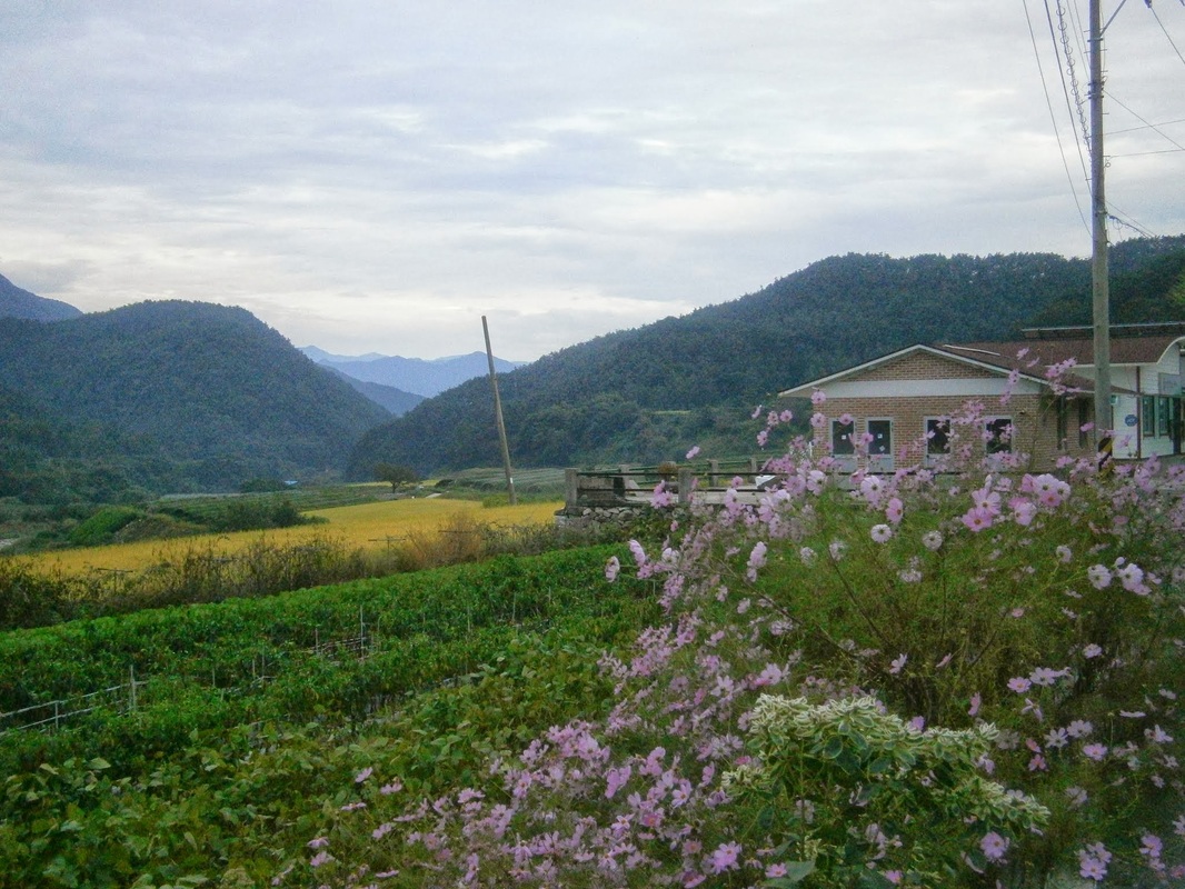
Here is a picture I took Saturday, Hamyang County [함양군], Baekjeon District [백전면], Unsan Village [운산리].
Picture

A house in Unsan Village

I caught the bus from near this spot in Unsan-ri to Hamyang Bus Terminal at about 7:10 AM. There were no marked bus stops anywhere in Unsan Village, causing me confusion. A Korean man, in his 50s or 60s, with an old-style hat was out for a walk that morning. I tried to ask where the bus stop was. He answered with the Korean version of “Huh?” , so I repeated slowly. “Buh-seuh”. He got it that time. The man seemed to say that the bus would be coming around such and such a place in a few minutes and turning, and so I should just wait in the intersection and wave it down, not that I understand most of his words, but I think that was about it. I thanked him and he walked away, and the bus was already visible in the distance, winding its way towards us. The man’s suggested method is exactly the one I used to get on the bus, and so began my ride away from Unsan Village.
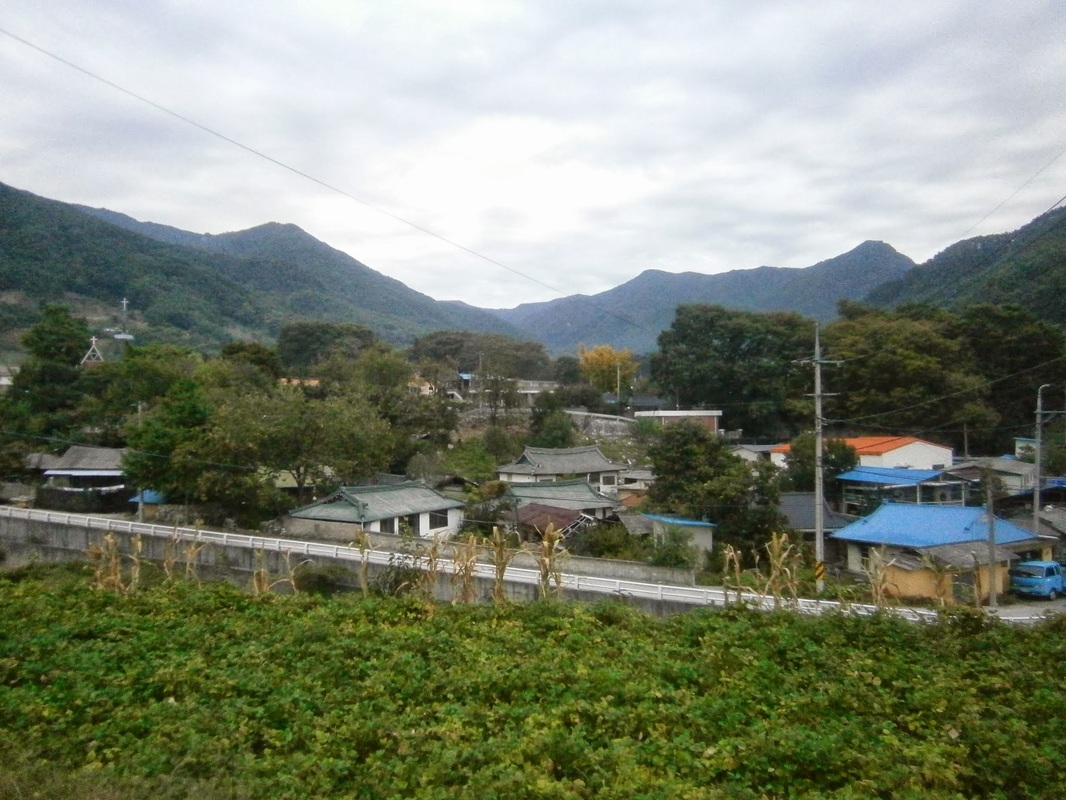
Unsan-ri

The core of Unsan Village (of Hamyang County, Gyeonsang Province, South Korea) / September 2013
[운산리, 백전면, 함양군, 경상도]

Note the church on the left. I once had the idea that Christianity was mostly urban/urbane in South Korea, with rural people being more Buddhist or something, but small towns and villages also have their own churches. In the small city of Hamyang, I later saw several churches, and one woman even handed me a church leaflet and small free gift (a very typical thing to happen in the Seoul area). I didn’t see a comparable Buddhist icon in the village.

Speaking of Buddhists, the bus driver was a bit fat, quite bald, and had a round Buddha-like head. His voice surprised me; it was a baritone radio-announcer voice. This baritone Buddha bus-driver was involved in a conversation at length, for most of the forty minutes from when I got on to when she got off near Hamyang City, with a woman passenger who sat in the front seat. 

I was surprised to see that the bus already had about six passengers when I got on, because I knew from my trail guidebook that there was only one stop before mine, at Junggi Hamlet [중기마을] to the west of Unsan and at the very end of the county road. Mountains were all around it. That hamlet is near Jung-jae Pass [중재 or 중치], the place I had emerged from the mountains the day before.

The bus ride cost 2,000 Won ($1,85). Only cash was accepted. There seemed to be a machine for reading electronic cards, but nobody, of the two dozen or more who got on and off, used it. It must have been just for show!

Of the other passengers, all but two were elderly or nearly so. Many seemed to know each other, of course. I think the bus passed through the districts of Baekjeon and Byeonggok (백전면, 병곡면), the total population of both being 3,000 according to Korean Wikipedia. I presume many or most of these riders have been living there since birth.

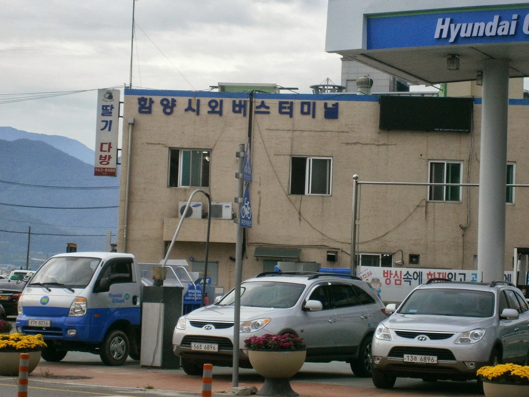
People got off almost wherever they wanted; they’d just ask the driver and he’d stop. Most were “going to town” to take care of some business or other, and got off in the city. I got out at the County Bus Terminal (시내터미널), close to the Intercity Bus Terminal (시외터미널). Here is the Intercity Bus Terminal, looking very North Korean:

Picture

Hamyang Intercity Bus Terminal

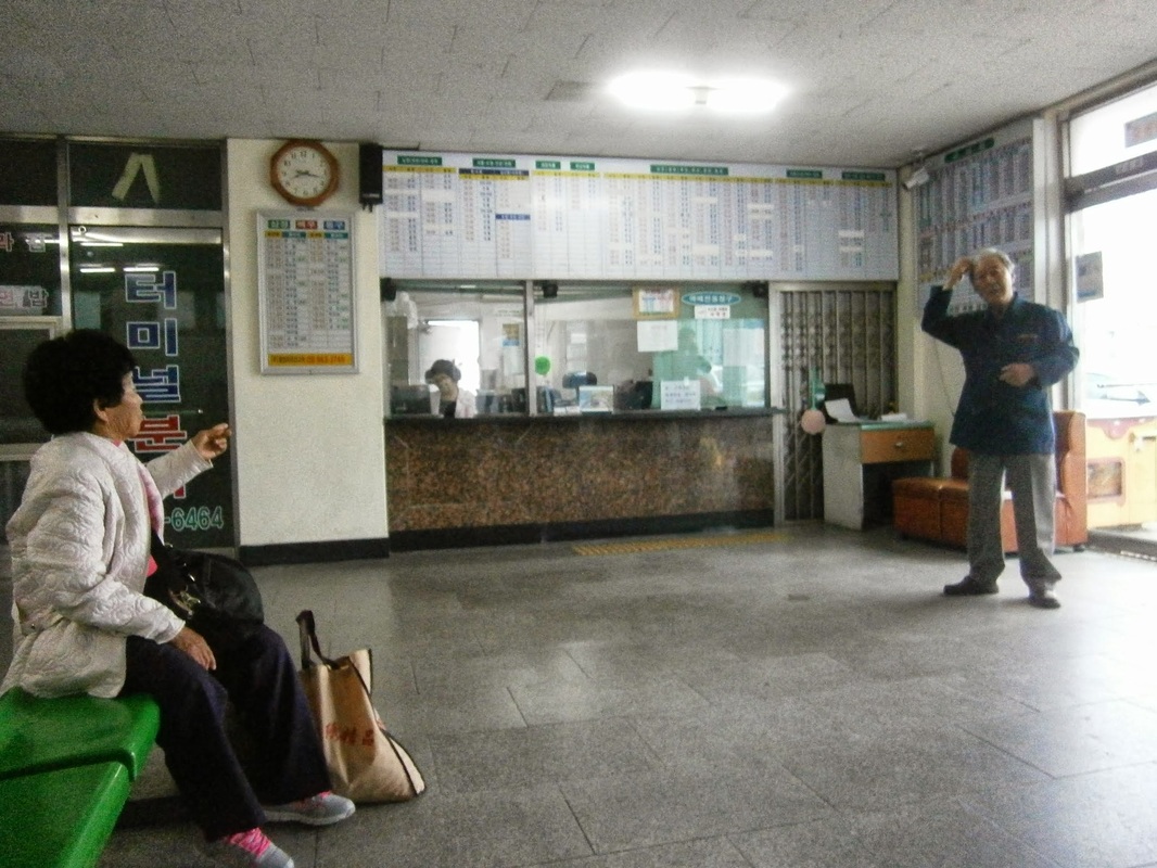
Here is a shot of the inside of the Intercity Bus Station, with characteristically-elderly people loitering. I think the man standing was some kind of station manager.
Inside of Hamyang Intercity Terminal

The Inside of Hamyang Intercity Bus Terminal

I was in Hamyang.

bookmark_borderPost-153: In Hamyang

On October 1st, I woke up in Hamyang, marking two weeks that I’ve been on this hiking trip.

Walking around Hamyang reminds me of Forest City, Iowa (near my father’s hometown). They are similar in size, both have clear main streets, and despite being small they are “the city” for their respective counties.

Hamyang Population and Density Comparison
In post-150, I wrote:

I am now in a small city called Hamyang (pop. 20,000 in the city [읍] another 20,000 in the surrounding 250-square-mile county [군]), making the county area very rural — 80 people per square mile versus Seoul’s 45,000 per square mile. As I am resting in Hamyang the next two days, I have the time to relate the.. [….]

On second thought, the city population must be less than 20,000. That number is for the “eup”  [읍], and the “eup”  includes the area around the city proper, too. The city, the area of densest development, doesn’t much exceed one mile by one mile (1.5 km x 1.5 km), but the “eup”  is 27 sq.mi. Korean administrative units are confusing.

I see that Hamyang County has a population density of 145 per square mile, equal to New Hampshire‘s in the USA. This is way below the South Korea average of 1,300 per square mile, not to mention Seoul’s intimidating 45,000 per square mile. (My home, Arlington County in Virginia, is now over 8,000 per square mile, but was about 6,500-7,000 per square mile when I was growing up — or so I calculate from Wikipedia just now).

Hamyang County [함양군] outside the Town of Hamyang [함양읍] has a population density of only 80 per square mile, which is, fittingly, about equal to West Virginia‘s in the USA. I rode a bus through rural Hamyang County after I emerged from some days in the mountains (where I had met and traveled with one, and then three, friendly and helpful Korean hikers in their 40s who fed me and took care of me. That great story must wait for another time).

Speaking of West Virginia, a park ranger in Jiri National Park asked me where I was from. I said “Virginia”. He began talking about how much he liked West Virginia. I think he believed “Virginia” to be short for “West Virginia”.

Around Hamyang
Here’s a map Hamyang City, “such as it is”. Zoom out to see where it fits:
(I hiked south, west, and northwest of here the past two weeks.)

Hamyang City proper (the dense, gridded area above) is easy to see on foot, in its entirety, in a couple of hours, I think, even at a very leisurely pace. An express tour could be done in an hour flat.

Most of Hamyang City consists of high-density low-rise houses but also a few 14-storey apartments. There is a business district centered on the main street. I was a little surprised to find several “chain businesses” in this “small town”: Dunkin Donuts, Pizza School, and Lotteria (a Korean McDonald’s) all on that street. There is actually even a “hagwon building” with three English institutes and several other hagwon (private educational institutes) housed inside. I don’t know why they put them all in one building.

 You can almost feel like you are in Seoul in a very narrow corridor of Hamyang Main Street. I know I did, as I ate the 5,000-Won, 1,800-calorie pepperoni pizza from Pizza School (a chain that some of my foreign coworkers loved). Off main street, there are other businesses, but few (if any) chains. It feels much poorer.

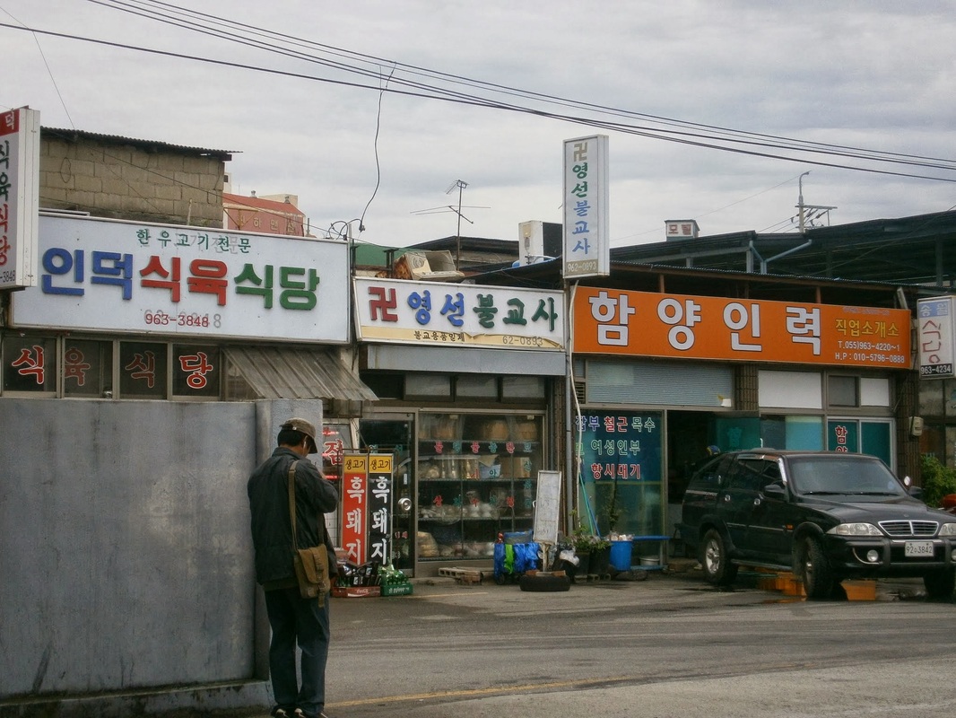
Here are three Hamyang businesses near the Intercity Bus Terminal, so far off from Main Street. On the left, there is a restaurant that says it specializes in “Korean Beef” [한우] (as in, the cow was born on Korean soil, not imported meat — Korean-beef is more expensive) and “Black Pig” [흑돼지]. The next is selling Buddhist trinkets (recognizable by the swastika), and the third may be a job-placement center:

Hamyang, Near Bus Terminal

Businesses in Hamyang near the Intercity Bus Terminal

I have many more pictures of interesting things in Hamyang, but this cheap ten-year-old computer in the motel can’t handle the camera’s USB for some reason, so I cannot upload them now. I can write about them, though:
It appears that Hamyang has put some money recently into sprucing up. There are brand-new-looking historical signs all over the place with impeccable English translations, and a big recreational riverside park in the west seems brand new. A wooden bridge across the river, from that park to the artificial forest, was just completed  on September 17th 2013, the placard says, the very first day of my hike!

Hamyang History Tidbits
There is a very-old jeongja [정자] (a shaded, elevated resting pavilion) on Main Street across from the town hall. The historical marker implies, in flawless English, that a jeongja has existed here since the 800s AD, when a scholar named Choe Chiwon (b. 857) used it to write poetry. The present one is from the 1600s, it says.

There is an artificial forest on the riverbank, planted around 900 AD and still standing, also the initiative of this Choe Chiwon. It was designed to help stop flooding, it says, and is today recreational (and probably was then, too).

A faded stone monument stands inside the artificial forest, erected in 1871, and called the “Hamyang Anti-Compromise Stele”. It’s written in Chinese characters (Hanja). Here is the text of the English explanatory sign:

This stone monument is one of many erected by the government across the country [Korea] in April 1871 in order to warn the nation [against] friendly relations with foreign countries, after it defeated the French army in 1866 and the American army in 1871. It reads in large Chinese characters in front, “Unless we fight while the Western pirates invade us, we are forced to enter into friendly relations with them. Insisting on doing it is like selling the nation.” On the left side in small Chinese characters it reads, “We warn all the generations ahead. Composed in 1866 and erected in 1871.”

Korea has changed a lot in 150 years, of course, but this kind of thinking is very much still accepted or even dominant. I can’t forget when, in late 2011, a bright student I liked a lot, railed in class against the then-controversial Free Trade Agreement with the USA. “It would make Korea an American colony”, he said. I saw the brainstorming he did on his paper in Korean, and he’d written “Yankee Colony” in Korean. Koreans use “Yankee” as an ethnic-slur against White-Americans. He was only in sixth grade at the time, I think. He got his opinions from the adults around him.

Finally, speaking of politics: Hamyang seems to be the site of an alleged massacre of hundreds pro-Communist civilians (“85% women, children, and the elderly”, somebody wrote on Wikiepdia) by the South Korean Army in 1951. I didn’t see this mentioned on the “History of Hamyang” sign I saw near the town hall. 

I am suspicious of the details and scope of this alleged incident, because the source may be former South Korean General Choi Duk-Shin [최덕신] who defected to North Korea in the 1980s. He thus had incentive to say how bad the South’s regime was.

(This Choi Duk-Shin was quite a character. Who’s ever heard of a South Korean official defecting to North Korea? He was the South Korean Foreign Minister under the early years of General [President] Park Chung-Hee in the 1960s.)

That many killings of civilians occurred in that war (and especially in this region of the country) is certain, though. This mountainous area of the central-south became a stronghold/hideout for North Koreans, after their units began to fall apart in September 1950 following the Incheon Landing. Perhaps tens of thousands of North Koreans spent time in these villages and mountains to wage their partisan war. They were supposedly supported by many local people, especially in Jeolla Province. 

Major operations to defeat the Communist guerrillas involved burning down entire villages, it seems. I passed right through one such place last week (Nochi Village [노치마을]), which had a historical marker saying it was burned entirely in such an operation in the war. It had a great freshwater spring.


[Pictures to be added later when at a better computer]

bookmark_borderPost-151: Progress Across South Korea After Two Weeks 

“To make it clear across this country, South Korea, on foot” was the goal (see post-146). A cross-country mountain hiking trail called the “Baekdu-Daegan” was the way. 

I’ve made progress, but it’s been really physically tough, and I realize I’m just not too good at this “trekking” thing. I’ve taken many rest days, including presently. 

I began walking from Jungsan-ri [중산리) on Tuesday, September 17th at about 7:20 AM. I passed through Jiri Mountain National Park over the next few days, staying in the efficiently-run mountain hostels at night (which are reservation-only), and then emerged into one of the highly-remote parts of the trail outside the national parks. 

I don’t have much time now to write. Here is a photo I took in Jiri Mountain National Park [지리산국립공원]:

Jirisan

Jiri Mountain National Park [Jirisan, 지리산], September 2013

It really does look like that, at the right time of day. An Google-Image search for “Jirisan” yields many more.

It’s now 9:00 AM on Tuesday, October 1st, or two weeks almost to the hour after my trip began. I am now in a town called Hamyang, a ways north of the Jiri Mountains.

bookmark_borderPost-150: The End Came on a Thursday

My last day was a Thursday. I expected it to be a Friday. That was two and a half weeks ago. 

Suddenly, it was over, my twenty-four months (about eleven of them good) at “Ava*** English” in Bucheon.


Looking Back on mid-September From Hamyang
I am now in a small city called Hamyang (pop. 20,000 in the city [읍] another 20,000 in the surrounding 250-square-mile county [군]), making the county area very rural — 80 people per square mile versus Seoul’s 45,000 per square mile. As I am resting in Hamyang the next two days, I have the time to relate the story of my last few days in Bucheon:

The new guy arrived on Tuesday, but was secluded and not introduced to me. Thursday was my surprise-last-day. Then came a few stressful days of harriedly packing my things, thoroughly cleaning the apartment, finding places to store my things (temporary and longer-term); frantically ferrying my bags back and forth between places; even finding a place to sleep was a challenge. I finally got going with my across-South-Korea travel plan (see post-146) on Monday evening. I’ve been very seldom on the Internet since then. This is my first post in nearly three weeks. 


Surprise: It’s Your Last Day
At about 5:00 PM on Thursday Sept. 12th, to my surprised-bemusement and disappointment, I was told to not to come in on Friday. (Note that I taught on Thursdays 5:20-10:00 PM; 10:00 being the “close of business” time; this meant that I had only twenty minutes’ warning that it was my last day). The new guy would do all my classes.

The reason this was disappointing was that on Fridays, I was to teach five classes (of 65 minutes each this semester), including LN, GA (both are high-level 6th-graders), and T3 (medium-high-level eighth and ninth graders studying “TOEFL“). Of the thirty or more students between those classes, I’d had nearly all over multiple semesters, and a couple of the older ones for nearly every semester since I started in September 2011. I had a lot of success with them. I fully expected, and told them, that my last day would be Friday Sept. 13th. 

I should explain that Fridays were my only “significant” day in the two to three weeks I spent there in Fall Semester 2013. What I mean is, the way the Fall schedule worked out, in all my other classes that week (Mondays through Thursdays), 90%+ of the students were either quite-new or brand-new to me (with perhaps a narrow majority being “brand new”), and classes were all low-level.. My saying goodbye to such classes meant little, both to them and to me. 

My schedule was designed for the new guy, and they planned to plant his foot firmly on the lowest rung of the ladder, regardless of any other consideration, because hierarchy must be enforced and people have to know their places. This means he was given the lowest-level and most problematic classes, I was a place-holder for the two to three weeks of Fall Semester till he arrived, except Fridays, when I still had some significant classes.


Such…Relentless…Antagonism
Being forbidden from saying goodbye to LN, GA, and T3 seems just cruel. This is exactly the kind of stunt the managers would often pull. Always cutting corners against us, cheating on money in small ways, lying, withholding information (why was I not told of this “plan” earlier? — The date of my last day seems important enough to merit some advance notice), social ostracism, and just any other miscellaneous bits of antagonism. 

[An aside: In the months leading up to the end, I began to see that the antagonism was probably is race-based on the part of certain managers. That is to say, they want(ed) to feel superior and want(ed) to express Korean racial pride, or something, by “screwing” us foreigners and so on. This sounds like a crude analysis, and is not “P.C.”, but I don’t care. Over two years at “Ava**n”, I accumulated some quite-specific reasons for believing this.]

Surprise Phone Call from Students

It wasn’t all bad, though. One manager, the only one who has been consistently kind to me, Elly, surprised me by calling me on the phone during her LN class (high-level sixth graders). The class spent at least ten minutes on the phone. She spoke some, they spoke in chorus some, and each student said something, things like that they would miss me and that they think I was a good teacher; one said she was sorry she didn’t work harder. Some students, I learned, had made some kind of cards which they had planned to give on my last day, but were now unable. Many seemed very sad, (I’m sure they would become attached to most people in my place who earnestly gave their full effort). 

I told them I was sad that I wasn’t able to see them on my last day. I told them, via speaker-phone, that their new foreign-teacher was good and they should listen to him (to which they replied in chorus “No!!” — That was touching but made me cringe for the new guy and don’t bear any grudge against him. In truth, I have no idea what that new guy is like, because they didn’t let me meet him; they kept him sealed-off in the other building and did not introduce us, and did not have him watch my classes. He is from Canada; in his 20s; his name is the same as the Biblical evangelist formerly known as Saul. I never learned his last name; he had some kind of trendy haircut.) They had just seen him about a half-hour earlier for his first class.

An Impromptu Goodbye Speech
That phone call came on a Friday about 5:30 PM, as I was packing my bags in the apartment. I’d left Ava**n (the name of the institute) at about 10:40 PM on Thursday. After 10:00 PM on Thursday, a cake materialized. I was asked to make a goodbye speech to the five Korean teachers in the second-floor building. I didn’t have anything planned.

What did I end up saying? I referenced the “farewell comedy routine” that my friend C.H. delivered in June 2012. [See post-73, final paragraph]. He actually delivered a list of jokes about the institute, something like Jay Leno or David Letterman would do. I also deliberately referenced M.R. (looks like Steve Jobs) who finished in June 2013 in my speech. Both of them also had problems at that place, and by mentioning them I was trying to get the coded message across of who I believe the good guys really were, or something like that. I don’t know if anyone understood that, except potentially C.R., the young California coworker sitting and listening to it.

The essence of my speech was that most of the Korean teachers had been kind to me (the real antagonists were not present, of course), and I wanted to thank them for it. I went home and started packing.


Vacating the Apartment
Why did I go home and immediately start packing? Because I was also told, in yet another “kick in the stomach as my foot was out the door”, that I had to vacate the apartment by Friday evening. (The institute controls the apartment.) Remember I was told this about 5:00 PM on Thursday.

Why not give a little more warning? My final work day was explicitly-stated in the contract as September 13th, but it was usual to remain a few days after one’s final day, to get affairs in order. I expected to leave at noon on Sunday.

The manager who engineered this, whom I have here in the past referred to as “Stringbean”, must have done this solely to antagonize me and “show me who was boss”. They always did things like that. But, as I said in the impromptu final speech on that Thursday, “It’s all over now”.

bookmark_borderPost-149: Visiting Chipyongni, 2013

I recently visited the battle site of Chipyongni, a three-day siege in February 1951 during the Korean War, when 5,000 Americans and French defeated 25,000 Chinese attackers. It was first successful defensive stand for the Americans against the Chinese in the Korean War.

I mentioned my visit in post-148 (“the Gettysburg of Korea“). I wrote:

In 2012, after reading “The Longest Winter”, I identified the location of the battle by figuring out its current name. What we wrote in English in the 1950s as “Chipyong” is now written as “Jipyeong” [Gee-pyuhng] (지평리 in Korean). Its suffix, ri or ni, means “village” in Korean. It has since been promoted to “myeon”, a slightly larger settlement than a ri/ni. The current name is thus Jipyeong-myeon (지평면).

[…] [Visiting the site] was one of the most significant excursions of my time in Korea. I feel blessed that it worked out the way it did. The word “Chipyongni” does not even appear in the tourist guidebook I have. It was something I independently discovered.


Below is the location of Chipyongni (now called Jipyeong-myeon, 지평면). You can  zoom-in on this map all the way. It is anchored on the site of the memorial, which is in the middle of the American defensive perimeter.
Across the Country By “Subway”
One of the amazing things about this excursion to Chipyongni is that I covered 95%+ of the distance to the battle site (the red marker above) using what is loosely called “the subway”. It has evolved into a cheap-and-easy Greater Seoul Rail Network. It has been gobbling-up legitimate (above-ground) train-lines for years, and continues to expand. There are now about twenty lines. I wrote about one such rail-line way back in post-9:

This rail line [“Gyeong-Hui”] still exists intact, today, It was incorporated into the ever-growing Greater Seoul urban rail network (still often loosely called a ‘subway’) in 2009. I remember when that happened, as I was living in Ilsan at the time, through which it passes.

I also rode the “subway” very-long distance to Chuncheon this year. See post-15. This most-recent Jipyeong-myeon/Chipyongni trip is another instance for which sarcastic quote-marks on “subway” are called for. I scanned-in with my transit card at Bucheon (west of Seoul), and stayed in the system all the way to Yongmun, the terminus of the “Jungang Line”. The trip involved 80 minutes of riding Line 7, then waiting around to transfer in east-Seoul, then another hour on the Jungang Line until Yongmun. The total cost for the subway trip, as the screen told me when I scanned my card out of the system at Yongmun, was an incredible 2,150 Won (less than $2.00 USD[!]). As you can see above, this was a trip near halfway across the country, east-to-west. The trip was not very pleasant, though, as I had to stand for almost all of those three hours, and it was generally crowded all the way. At $2.00, it becomes a “don’t look a gift horse in the mouth”  thing. South Korea is no longer a cheap place to live, but it still for transportation.
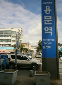
PictureYongmun Station, September 2013

At Yongmun
Saturday. Sometime before 10:00 AM, my traveling companion and I arrive at Yongmun Station, tired, groggy. For an “end-of-the-line station”, the atmosphere outside is downright “kinetic” this morning, though. Koreans in hiking gear are frolicking about. They are probably all going to the Yongmun Temple area.

In the 850-page travel guidebook on Korea I have, this entire region (Eastern Gyeonggi-Do) gets about a page and a half’s write-up. All that is mentioned is Yongmun Temple and its environs (“Yongmun-sa [temple] sits below Yongmun-san [mountain]. At 1,157 meters, this mountain is not the tallest in Gyeonggi-Do, but some say it’s the best-looking. Of its many hiking trails, the one that’s perhaps most often used goes over the….”). A few resorts are also mentioned.

In that guidebook, the word “Chipyongni” appears nowhere., though.


Eastward On Foot
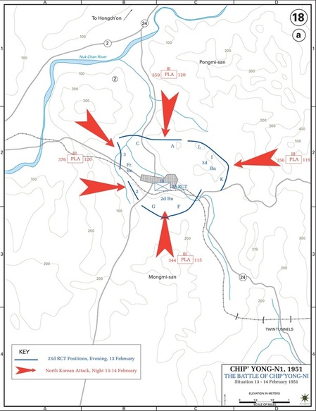
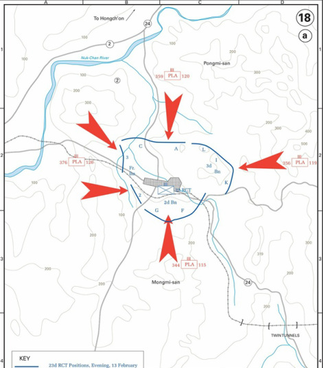
The original idea was to get out of the train station at Yongmun and proceed to Jipyeong on foot, only three miles away. I carried printouts of the battle history, downloaded from history.army.mil, which I read again on the train ride. Included was the following map:
Picture

Map of Battle of Chipyongni. Red are Chinese [PLA] attacks. Blue are U.S./French defensive positions.
Off to the west, along the railroad tracks and just off the map, is Yongmun Station. [See post-147 for battle history]

My idea was to use the landmarks on the above army-history map to try to find the U.S. and French defensive positions during the siege and walk along them. They defended low-lying hills around the village. I had little idea as to how I would find those exact hills. I just sort of hoped it would work out. I didn’t have any clue if there was any kind of memorial or anything.

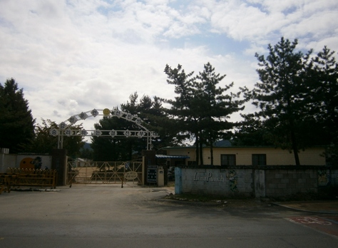
Walking through the town of Yongmun, we got some kimbap and a disappointingly-small plate of tteokpokki (떡볶이). Heading east towards Jipyeong, I saw a ROK Army base:
Picture

The entrance to an army base in the town of Yongmun. [Click to expand]

I couldn’t help but chuckle at the fact that this Korean Army base includes several “cute” things, a cartoon soldier with the word “Last Punch” (I don’t get it), and a yellow smiley-face on the sign.

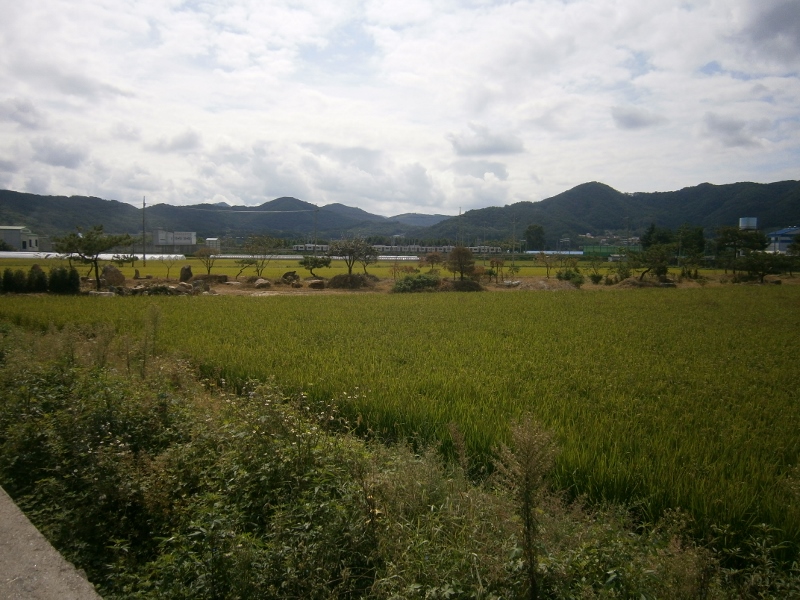
Minutes later, we were out of the town, and came upon this kind of scenery:
Picture

Scene between Yongmun and Jipyeong [Chipyongni], South Korea [September 2013]

This is the kind of thing that the veterans of the Korean War must remember, at least during autumn. It’s not how it looked during the Battle of Chipyongni, though, as the battle was in frigid February. Temperatures were below freezing and snow was on the ground. Walking through in the pleasant fall weather, and with the drenching-humidity of summer in very recent memory, it’s hard to imagine that this landscape will become “Siberia” in a few months. It will.
On to the Memorial
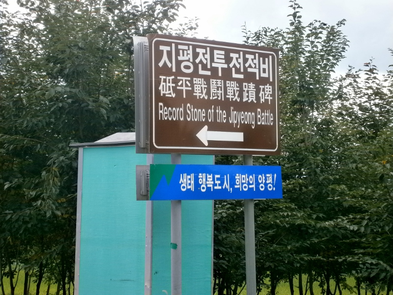
A snag in my ad-hoc plan presented itself after a while. It was necessary to cross a narrow mountain pass, but construction workers were obstructing it. We turned back. A taxi passed by, and we got in. I marveled at this good fortune. A taxi passing by such a road was lucky, exactly when it was needed. The friendly driver drove us the few miles to the Chipyongni Battle Memorial, dropping us off in front of the below sign. The ride cost 5,000 Won ($4.50).
Picture

Sign pointing out the “Record Stone of the Jipyeong Battle” [지평전투전적비]

The old tradition in Korea is to mark an important event with an inscribed stone. This was done for the dramatic battle of Chipyongni by a ROK Army division in 1957. That stone still stands. I later heard from a local resident that it used to be nearer the town hall, and was moved out to its present location some years ago. Both locations may be arbitrary when it comes to actual place-significance for the battle. The locals we spoke with later said this, something I’d already suspected. Here is the map, again, zoomed in. The red marker is the location of the battle memorial:
As best I can tell by comparing the maps, the American defensive perimeter in the north ran in a line from the larger of the two little blue lakes in the top right of this map, and straight west from there. It ran a bit west of the creek, then turned south, which was the French position.

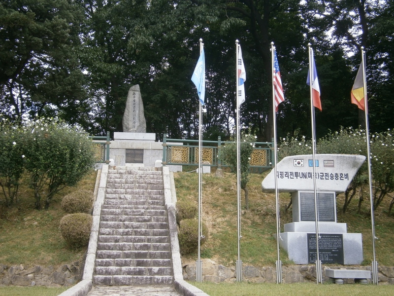
Here are some photos of the memorial:
Picture

Chipyongni Battle Memorial [September 2013].
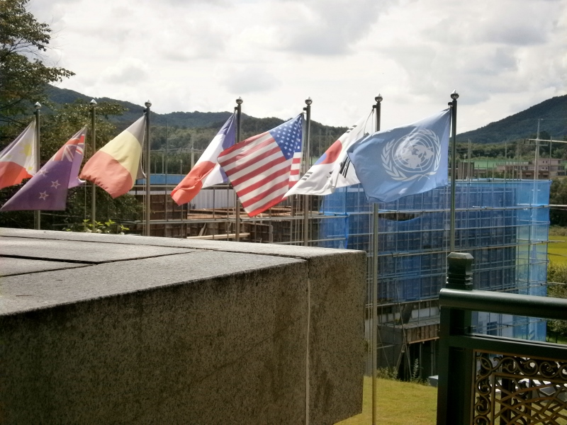
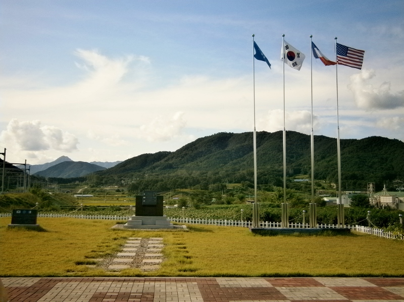
At the top of the stairs sits the “record stone”. The UN flag, ROK (South Korea) flag, U.S. flag, French flags fly.
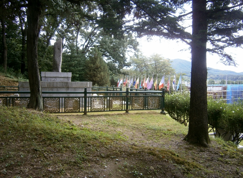
Picture

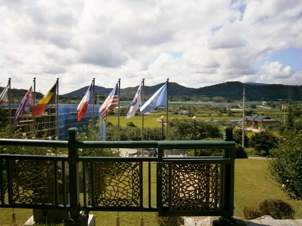
Another view of the record stone and flags. In the background on the right, construction has begun on a new museum
Picture

A view from the top of the hill that houses the record stone, looking southwest.
The village of Jipyeong [formerly Chipyong] is off to the left in the distance.

Museum Under Construction
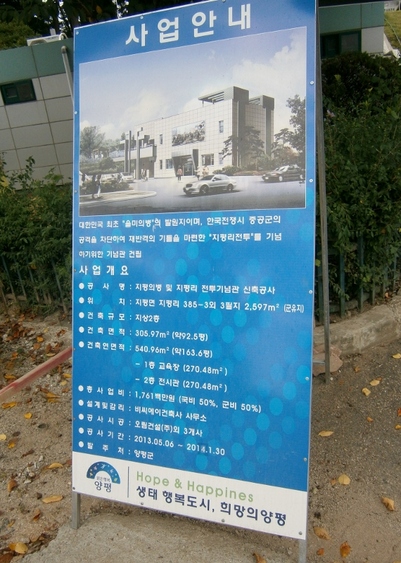
The building shrouded in blue will be a new museum. I found this sign in front of it:
Picture

Sign informing visitors that a new Chipyongni Battle Museum is being built, and will open in 2014.
(Locals were skeptical it would actually open then due to lack of money.)
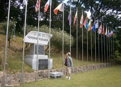
PictureMe looking at the plaque

The sign above says the cost of the museum project is 1,761 백만원, or $1,761,000 (if I converted that correctly), and that it will be completed on January 30th, 2014. The cost is being paid 50% by the army and 50% by the state. There will be two floors, one an education hall (교육장) and the other an war-exhibition room (전시관, I am not sure of this translation).

I spent a long time at the memorial. I read every word, though I already knew the history from my previous reading on the subject. As I hope the above pictures show, the atmosphere at this memorial site is very pleasant. There were no other visitors or passersby in the hour or more I was there, though I did see one construction worker.


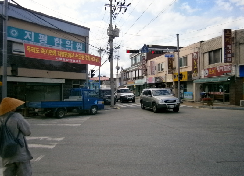
After leaving the memorial site, we walked south to the heart of downtown Jipyeong. Here it is. I don’t know why there is a woman dressed in old-fashioned garb:
Picture

“Downtown Jipyeong”: The only major intersection in town

Again,this is right in the center of the village, the most significant intersection. There were very few cars around.

The red banner there says “우리도 죽기전에 지평면에서 수도권 전철 타고 싶마”. I recognized enough words to understand that it was a slogan demanding that the Seoul urban rail network be extended to Jipyeong Station. It currently ends one station before Jipyeong, at Yongmun. This is a major inconvenience for Jipyeong residents. If they want the ultra-cheap way to get into and then around Seoul (see above), they have to go to Yongmun first. They can still ride the “normal trains”, but those are much more infrequent and more expensive. Maybe a bigger reason for this campaign is to put Jipyeong “on the map”. To Seoul-area dwellers, Jipyeong doesn’t exist. If it’s on the subway network, suddenly it exists, and more people would visit, and would spend money. These banners were all over Jipyeong.

Here is a wider shot of the intersection:

That blue structure is a bus-stop. About the time I took this picture, I was approached suddenly by a boy. He said something like “I have never seen a foreigner here before!” I think those were his first words. He spoke in English. His grammar and accent were both great. I asked if he’d been abroad, and he said he’d been in the Philippines. He informed me that he was in middle school, and he said the town had only 100 students. I don’t know if he meant 100 in the middle school, or if 100 was the total for the elementary, middle, and high schools combined. I could believe the latter. He wondered what I was doing. The boy was eager to please, so I asked him for help in my quest to walk the hills of the battle. I showed him my map print-out, and asked if he knew how I could find any of those hills. He puzzled over it for a while, trying to orient himself. Soon, a small gaggle of friends had joined him. Nobody knew anything. One girl identified “Pongmi-san” on this map, but nobody had heard of “Mongmi-san”. They wandered away.

This boy’s warm conversation, and (futile) attempts to help, was the first of many instances of kindness from Jipyeong people that really impressed me (the taxi driver was first, but he was a Yongmun person, I think. He undercharged me, knowing I was a foreigner visiting this historic site). Random “street” kindness to strangers, especially foreigners, is quite uncommon in Korea, and this boy’s kindness amazed me. Never once in Bucheon, in two years, has anything like this happened to me.

Continuing on, I resolved to try to find where the railroad crosses the major road east of town, that being where the 23rd Regiment’s 2nd Battalion was entrenched, according to the army-history map. I never made it that far. Walking a short was east, I found a town-hall. I had the idea to look for a map, but it was locked up. A bunch of men were loitering outside an adjacent building, and invited us in to eat. It was a dining hall. Before we knew it, this happened:
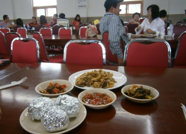
Picture

A free meal served by “New New Village Movement” (새새마을) at Jipyeong town hall, September 2013

Those tin-foil spherical objects are “rice balls” with a few other ingredients tossed in. This is commonly called “fist rice” (주먹밥). There are also side dishes (반찬) and fried mushrooms. All free. This was the second instance in which I was amazed at the Jipyeong people‘s generosity and hospitality. We weren’t entitled to this food, being non-residents. Again, in my experience in Korea, you don’t invite strangers in such a way as this, much less foreigners. (I mean, hell, in two years we foreign-teachers were never invited once by the boss[es] of the language-institute to dinner). This was an event organized by a civic group that I presume offers free lunches at the town-hall every Saturday.

So the guys standing outside the town-hall insisted we should eat this free food. Bottled water was also given freely, and there was even beer. The man in the blue baseball cap in the above photo came over and talked to us for a long while. He insisted on sharing some beer. The subject turned to the battle. The man consulted my map (this one), but held it upside down. He talked at length, my Korean friend reported, about the site of his house and how many Chinese were killed in its vicinity. He said he’d been in the USA in 1988, while in the ROK military. Another local, a man with tied-back hair who greatly resembled an American-Indian to me, also sat down, mostly quiet (his taciturnity added to the “American-Indian vibe”). He was clearly interested and wanted to help.

Soon the man with tied-back hair asked if we were interested in the small museum about the battle. It was housed in the nearby library. We were. It wasn’t open. The man with tied-back hair said to wait a minute. Minutes later, the man returned, and led us to the library adjacent to the eating-hall and the town-hall. He’d gone to fetch the octogenarian Korean-War veteran museum-caretaker. He asked him to open it on account only of us! The old man had kindly come in, and was waiting. I couldn’t believe my good luck to meet such people as these. (This kind of hospitality puts Seoul and its satellites, like Bucheon or Ilsan, to shame. It made me think, “I hope this place fails to get its train station incorporated into the Seoul Metrorail network”, for fear it would be corrupting.)

A small room constituted the Chipyongni Museum:
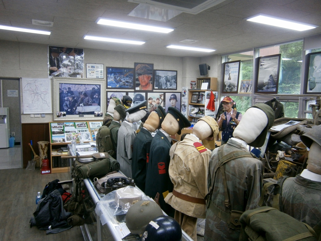
Picture

The small “Chipyongni Museum” housed in the Jipyeong Library.
Its caretaker is in the background, with a red cap, emphasizing some point

I spent a long time here, looking at everything carefully, and listening to the man speak. He had a lot to say and was highly enthusiastic. He is a veteran of the war, and I presume he is from Jipyeong. This is his museum.

There is Korean War paraphernalia of all kinds, uniforms, helmets, equipment salvaged from the battlefield, badges, portraits, photographs, books, maps, and binders filled with photos of the various commemorations over the years. Every year, he told us, a French delegation arrives to honor the French battalion. Descendants of the American veterans also come every year, he said. The man informed us of various fine points the history of the battle (it involved only 300 Koreans, “KATUSAs” embedded in the U.S. Regiment and the French battalion, he said), of the village (it has not really grown much since 1951), of the museum (the new, larger, museum [see above] supposedly opens in 2014, but he doubted it would), and the preservation efforts (he said there was talk of making some or all of the defensive perimeter into a marked hiking path. It would be two miles long or so). This man has documented a lot about the battle. I get the feeling that the new museum, next to the memorial, may have been his initiative.

I noticed the guestbook on the table. When I visited on the afternoon of September 7th, there were no names in it yet for September. In fact, the previous entries were on August 20th, and prior to that, August 11th. I leafed through all the pages, going back to early 2012, and found only a small handful written in English, and those belonged in all but one case to U.S. Military personnel. They wrote their “address” as “Camp Humphreys” or the like, nothing more. There may have been about five military who visited. There was a single non-military foreigner in the past year, the man recalled. He said she was a middle-aged woman from Texas visiting her daughter who was teaching English in a nearby city. He described her.

I signed the guestbook, leaving my name and address.
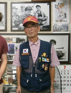
Picture

The museum keeper of Chipyongni

The man, at one point, criticized young Koreans for their anti-Americanism. He became a little more animated. He was apparently saying that they are ungrateful and spoiled. This is characteristic of his generation’s attitudes. The younger generations were fully ready, a few years ago, to believe that U.S. soldiers had deliberately murdered two Korean middle school girls by running them over with their tank during an exercise for fun, even (or so goes the lie) backing up several times over them to ensure the girls were dead. These U.S. soldiers were animated solely by hatred for Koreans, many believed or claimed to believe. Then, they were tried in a U.S. military court and found not guilty, further evidence of American disregard for Korean life! (The court found the incident to be a tragic accident, and determined that the girls were walking in a strictly-restricted zone that day). That Koreans really believed the storyline as presented above is baffling. I attribute it to the “follower” mentality. No, it’s not rational, but others are saying it, so we’ve got to follow. That story probably literally originated with North Korea. It’s the kind of thing they do. The protests against U.S. beef of the late 2000s, and then the protests against the FTA of the early 2010s were equally ridiculous, the museum-keeper commented. (U.S. beef is still not being sold in South Korea in my experience.)

At the end, the kind and energetic man gave me two pamphlets about Chipyongni in English and Korean, and a medallion that says “We Will Not Forget / Battle of Chipyong-Ni” and something in Korean.

After leaving the museum, we walked to the train station to get tickets on the “normal train” get back to Bucheon, with the intention of also finding some of the other historical markers the kind old man at the museum had discussed.

Another act of unprovoked kindness followed at the train station. The attendant said no seats were available, but that we could come back later and maybe some would open up via cancellations. Someone in Seoul or Bucheon would’ve just sold us “standing tickets” (the same price, for some reason, as sitting tickets) and been done with it. This man, though, waited, and constantly monitored the status of seats available via his computer. He tracked us down outside the station an hour or more later and said he’d reserved the tickets. We paid. We rode back to Seoul that evening in seats, and fell fast asleep (having woken up at 6:00 AM), which would’ve been impossible with standing tickets. Why did this man go so far to make our trip more convenient? He gained nothing from it. These Jipyeong people are amazing, I concluded.

Before leaving, I found a few more historical markers. The French memorial is near the train station:
Picture

The French Memorial, near the French Battalion’s headquarters during the battle (according to the museum-keeper).
Picture

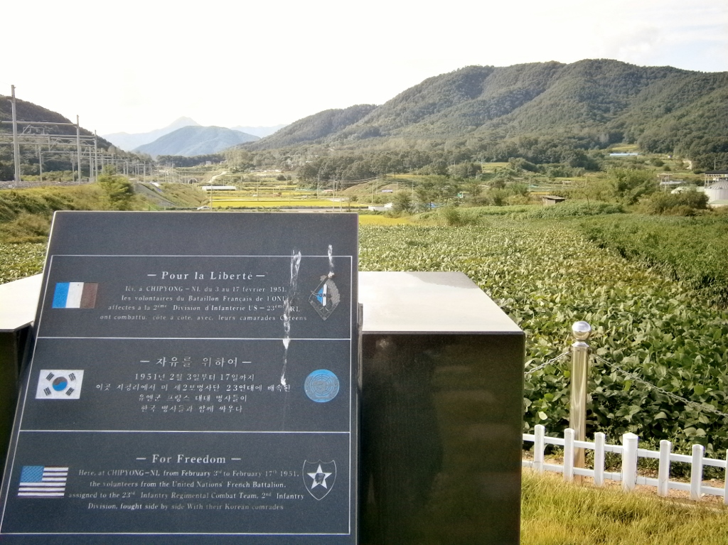
Memorial stone for the French Battalion at Chipyongni, in French, Korean, and English. [Click to expand]

We ate a small dinner at this spot, on the grass.

I suspect that these memorials were set up by the Americans because of the grass. Both here and at the main battle memorial (discussed above), the grass is of the softest kind you often find on American front-lawns, not unlike my memories of my mother’s front lawn from years ago, so soft it’s more pleasant to lay on than a bed.

Judging by my comparison of the current map and the battle-history map, this was probably the above was about the view the French soldiers had as the Chinese approached and attacked.


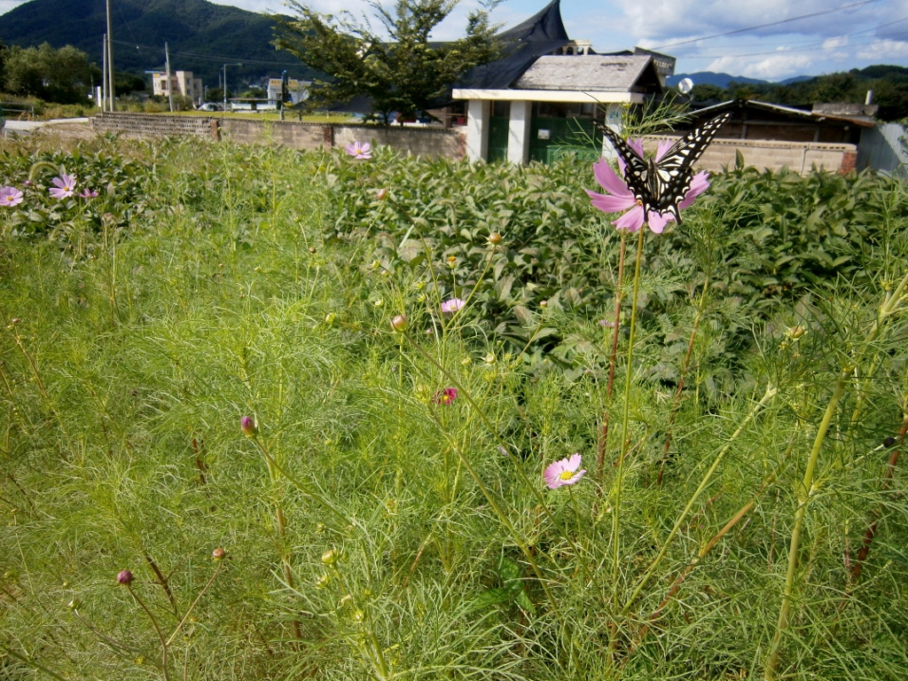
One curious thing during this visit to Jipyeong was the butterflies. They were everywhere. I captured one in a photo:
Picture

A typical sight in Jipyeong during my visit


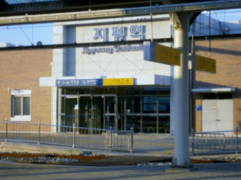
Finally, the train came through at 6:09 PM, and about six people got on at Jipyeong Station, myself included. The train was already packed, having started way down in Andong, but we had seats due to the vigilance of the attendant.
Picture

Jipyeong Station

Minutes after settling into the train seat, I fell asleep. I awoke in Yongsan, central Seoul, and hour later, amazed at what a great day-trip I’d just had.

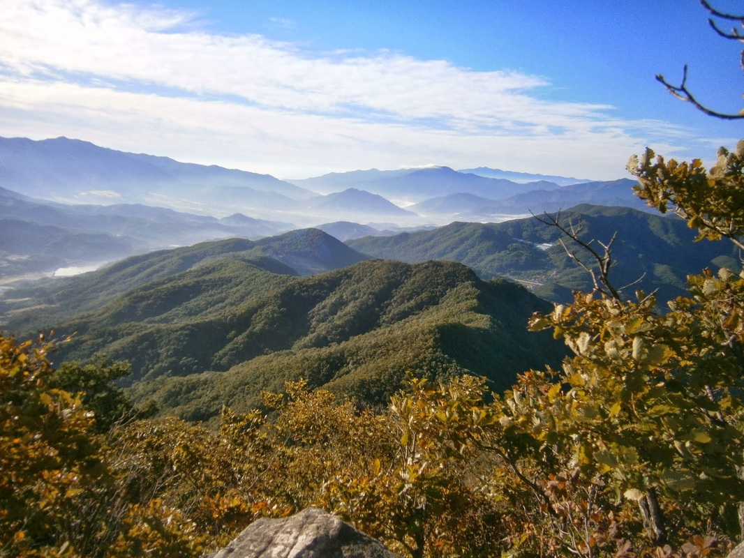
bookmark_borderPost-148: September 11th, 2011

Tomorrow is September 11th. Two years ago on that day, I left the USA by plane to come to Korea for the second time. I started a job. Now two years have passed. I regret staying at this particular job that second year. It was a mistake.

In 2011, I knew I had to come (again, that is). There were many reasons. For some reason, I took a lot of “audio books” that I copied from the Arlington library, but I ended up listening to very few of them. Maybe only two. Of the clothes I arrived with, relatively few are left. I have more money in my bank account now. I know more about Korea.I’ve seen more places. I’ve seen more people. I’m not sure if I am a more confident teacher. My ex-coworker M.R. (in Korea since 2004), who was said to resemble Steve Job by many students, was so antagonized by management here that he felt “working in Av**** has caused me to become a much worse teacher”. I sympathize with him, and I fear the same.

I don’t know where I am going with this wandering retrospective, but…Oh, and somewhere along in there I got the idea to do a big hiking trip across South Korea, which I will begin on September 16th.

Ever since I’ve been able to “see the end”, I’ve been doing various things I need to do to “get my affairs in order”, and have not had the energy or desire to update this thing. Oh, right, I also started this blog in the two years I’ve been here, but have not much publicized it.

I still have never eaten dog nor “still-living octopus” (산낙지), but I could if I wanted to without much trouble.

bookmark_borderPost-147: Chipyong-ni (Feb. 1951), “the Gettysburg of Korea”

The dramatic Battle of Chipyong-ni (지평리) [Feb. 13-15, 1951] was the “Gettysburg of the Korean War”, they say, in that it was the first time, when under Chinese attack, that the Americans didn’t retreat. (The linked-to book discusses the entire “Wonju Campaign” of February 1951, of which the siege of Chipyongni was the most significant part.)

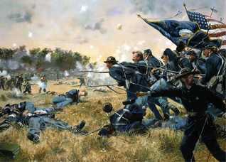
PictureGettysburg Art, by Don Troiani

In the long (500 pages), detailed military history of the U.S. Civil War I read a few years ago, I believe it was called How the North Won, I was surprised at how little attention was given to Gettysburg. Only a few paragraphs. The authors actually had a small appendix explaining why they neglected Gettysburg. It was actually of little final importance in the defeat of the Confederacy in military terms (the purpose of the book). They explained how unlikely it was that Lee was “about to win the war” with a victory there, and about how it was not a turning point.

This goes against what we’ve been told in movies. Gettysburg was the turning point, we are told. The strategic situation in the East was exactly the same in Fall 1863 (after Gettysburg) as it had been in Spring 1863 (before Gettysburg). Nothing changed. It was, by definition, not a turning point, because nothing changed. I remember thinking, “Okay, but Gettysburg must have increased Union Army morale”. It was the first time the Army of the Potomac (the eastern Union army) actually decisively won a major battle. It was the first time the Army of the Potomac did not retreat after a battle. That must count for something.


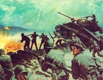
PictureChipyong-ni Artwork

Likewise, Chipyong-ni was the first bright spot after so many weeks of retreats in Korea, “the longest retreat in U.S. military history”. It was the first time the Americans did not retreat when attacked by the Chinese. The incredible casualty ratio made the formerly-invincible-seeming Chinese seem like amateurs: 5,000 Chinese killed and wounded, versus 400 U.S. and French casualties.

See the long essay from the U.S. Center for Military History entitled “Restoring the Balance: 25 January to 8 July 1951” for a full history of the campaign.

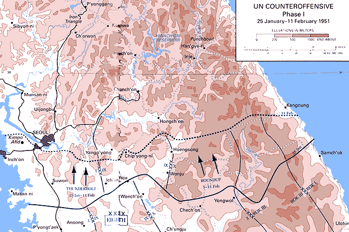
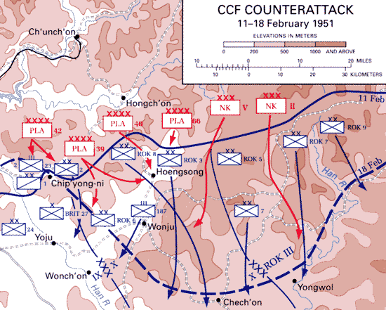
In the two weeks before the February 13th-15th battle, the UN had taken a limited offensive, as below. The dark line was the frontline as of January 25th, and the dotted line was the front as of February 11th. Note that Chipyong-ni was the point of furthest advance in the area.


Picture

Map of the UN offensives between January 25th and February 11th, 1951. Chipyong-ni was the point of furthest advance. It was encircled by the Chinese on February 13th. “Thunderbolt” and “Roundup” were codenames for the UN offensives.

[From “Restoring the Balance”]
While UN forces in Operation THUNDERBOLT advanced to an area just south of the Han against only minor resistance, Chinese and North Korean forces were massing in the central sector north of Hoengsong seeking to renew their offensive south. On the night of 11-12 February the enemy struck with five Chinese People’s Liberation Army (PLA) armies and two North Korean corps, totaling approximately 135,000 soldiers. The main effort was against X Corps’ ROK divisions north of Hoengsong. The Chinese attack, dramatically announced with bugle calls and drum beating, penetrated the ROK line and forced the South Koreans into a ragged withdrawal to the southeast via snow-covered passes in the rugged mountains. The ROK units, particularly the 8th Division, were badly battered in the process, creating large holes in the UN defenses. Accordingly, UN forces were soon in a general withdrawal to the south in the central section, giving up most of the terrain recently regained. Despite an attempt to form a solid defensive line, Hoengsong itself was abandoned on 13 February.

Also on the thirteenth the Chinese broadened the offensive against the X Corps with attacks against U.S. 2d Infantry Division positions near Chip’yong-ni, on the left of the corps’ front. They also struck farther to the west out of a bridgehead south of the Han near Yangp’yong against elements of the U.S. 24th Infantry Division, holding the IX Corps’ right flank. The 21st Infantry of the 24th Division quickly contained the Yangp’yong attack that was aimed toward Suwon, but at Chip’yong-ni the Chinese encircled the 2d Division’s 23d Infantry and its attached French Army battalion, cleverly exploiting a gap in the overextended American lines.

Chip’yong-ni was a key road junction surrounded by a ring of small hills. Rather than have the 23d Infantry withdraw, General Ridgway directed that the position be held to block or delay Chinese access to the nearby Han River Valley. An enemy advance down the east bank of the Han would threaten the positions of the IX and I Corps west of the river. Accordingly, the UN forces at Chip’yong-ni dug into the surrounding hills and formed a solid perimeter while reinforcements were mustered. The role of the Air Force was essential at Chip’yong-ni with close air support forcing the attackers to conduct their assaults only after dark. And once the enemy had cut off the ground routes, all resupply was by air.

 As Ridgway hoped, the 5,000 defenders of Chip’yong-ni quickly became the focus of Chinese attention. Throughout the night of 13-14 February, three Chinese divisions assaulted the perimeter, supported by artillery. The attackers shifted to different sections of the two-mile American perimeter probing for weak points. The Chinese were often stopped only at the barbed wire protecting the individual American positions, with the defenders employing extensive artillery support and automatic weapons fire from an attached antiaircraft artillery battalion. Daylight brought a respite to the attacks. True to form, the Chinese renewed their assaults the night of 14-15 February. Again the fighting was intense. During the 14 February attack, Sfc. William Sitman, a machine gun section leader in Company M, 23d Infantry, was posthumously awarded the Medal of Honor for his actions in providing support to an infantry company, in the end placing his body between an enemy grenade and five fellow soldiers.

Picture

Chipyong-ni Battle Map (from here), Originally published in “Ebb and Flow, November 1950 to July 1951“. The dark part in the middle is the village. The railroad that passes through it still exists.

While the 23d Infantry held on at Chip’yong-ni, the situation to the southeast was grave. At the time Ridgway and Maj. Gen. Edward M. Almond, the X Corps commander, were seeking to stabilize the front line between Chip’yong-ni and Wonju, where the destruction of the ROK forces around Hoengsong had created major gaps in the defensive line. For three desperate days, the front wavered as the Chinese attempted to exploit these gaps before UN reinforcements could arrive on the scene. Ridgway acted quickly to push units into the critical areas, ordering IX Corps to move the 27th British Commonwealth Brigade and the ROK 6th Division over to X Corps and into the gap south of Chip’yong-ni. The action proved timely. On the night of 13-14 February, the Chinese conducted major assaults at Chip’yong-ni, Ch’uam-ni, five miles southeast of Chip’yong-ni, and at Wonju. But supported by massed artillery and air support, the UN forces repulsed the attacks, causing heavy Chinese casualties.

To provide additional support, the IX Corps, commanded by Maj. Gen. Bryant E. Moore, now began directly assisting the X Corps in restoring the front and relieving Chip’yong-ni. On 14 February the 5th Cavalry, detached from the U.S. 1st Cavalry Division, was taken out of IX Corps reserve and assigned the relief mission. For the task, the three infantry battalions of the 5th Cavalry were reinforced with two field artillery battalions, two tank companies, and a company each of combat engineers and medics. Initially the relief force advanced rapidly, making half the twelve-mile distance to Chip’yong-ni from the main U.S. defensive line on the first day. Damaged bridges and roadblocks then slowed movement. On the morning of the fifteenth, two of the infantry battalions assaulted enemy positions on the high ground north of the secondary road leading to Chip’yong-ni. When the attack stalled against firm Chinese resistance, Col. Marcel Crombez, 5th Cavalry commander, organized a force of twenty-three tanks, with infantry and engineers riding on them, to cut through the final six miles to the 23d Infantry. The tank-infantry force advanced in the late afternoon, using mobility and firepower to run a gauntlet of enemy defenses. Poor coordination between the tanks and supporting artillery made progress slow. Nevertheless, in an hour and fifteen minutes the task force reached the encircled garrison and spent the night there. At daylight the tanks returned to the main body of the relief force unopposed and came back to Chip’yong-ni spearheading a supply column. With the defenders resupplied and linked up with friendly forces, the siege could be considered over. UN casualties totaled 404, including 52 soldiers killed. Chinese losses were far greater. Captured documents later revealed that the enemy suffered at least 5,000 casualties. The defense of Chip’yong-ni was a major factor in the successful blunting of the Chinese counteroffensive in February 1951 and a major boost to UN morale.                                     [From “Restoring the Balance“]

Chipyong-ni stayed in U.S. hands for the rest of the war.

Far off to the east of Chipyong-ni, Seoul itself was still in Chinese hands at the time of the battle (Feb. 1951), and would be till mid-March. It was nearly recaptured yet again by the Chinese in April/May 1951. “Chinese hands”. That’s the other interesting thing about Chipyong-ni. It was a major battle of the Korean War, but very few Koreans were actually involved. According to the elderly museum-keeper at Chipyong-ni, only 150 Koreans were part of the U.S. force at Chipyong-ni and they were KATUSAs (English-speaking Koreans to facilitate communication).


I first became aware of Chipyong-ni in the recent Korean War history The Longest Winter (2007). I grew to dislike that book as I was reading it, because it was more a political screed than an actual history. The author spent more time on 1940s/1950s U.S. politics than anything. He chose specific personalities to vilify for his own political purposes (it seemed to me), including General MacArthur himself, whom he paints as a buffoon. He even vilified the leader of the relief column at Chipyongni, Colonel Crombez, for wasting his soldiers’ lives. He put lots of men with rifles on top of the tanks. When soldiers fell off tanks, Colonel Crombez ordered the convoy on. Many of the men who fell off ended up dead or POWs. (Crombez prioritized breaking the siege, which was the right decision, General Ridgeway later said.)

Chipyongni 2013
I visited the site of the Battle of Chipyongni in September 2013. In 2012, after reading The Longest Winter, I identified the location of the battle by figuring out its current name. What we wrote in English in the 1950s as “Chipyong” is now written as “Jipyeong” [Gee-pyuhng] (지평리 in Korean). Its suffix, ri or ni, means “village” in Korean. It has since been promoted to “myeon”, a slightly larger settlement than a ri/ni. The current name is thus Jipyeong-myeon (지평면).

I will write about the visit later. For now I can say it was one of the most significant excursions of my time in Korea. I feel blessed that it worked out the way it did. The word “Chipyongni” does not even appear in the tourist guidebook I have. It was something I independently discovered.

bookmark_borderPost-146: Across South Korea on Foot

It’s as good a time as any to reveal that I plan to hike across South Korea, from south-central to northeast.

It will take seven to eight weeks. I begin on September 16th. I doubt there will be many, if any, updates in those weeks. The trail is called, in Korean, “Baekdu-Daegan”. It’s sort of a Korean “Appalachian Trail”.

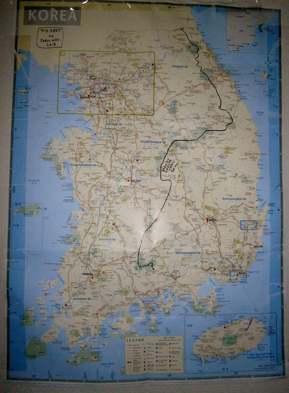
Here is a wall map on which I plotted out the approximate course.

Picture

Wallmap of South Korea on which I plotted my hiking course. [Click to Expand]
Start: In the south [Jiri Mountains].
Planned End: Northeast [near DMZ].

I will post more on this later, I hope. I hardly find time these days. This is an ambitious plan, but with proper planning and sufficient courage, it can be done.

Tomorrow, I visit Chipyongni, a February 1951 battlefield. It’s due east of Seoul, but near halfway across the country. It’ll take up to three hours to get there by train. It’s rural: I’ll camp overnight. It’ll be a kind of “practice run” for the hike.

bookmark_borderPost-145: Trip to the Incheon Visa Office

Nine days till my last day at this job.

Problem: My visa is running out before I plan to leave. Thus, this morning I paid I (successful) visit to the Incheon Immigration [Visa Control] Office. I asked to extend my visa and it was done. My Alien Registration Card got a new “expiration date” printed on it, 28 days later than the original. Phew; Another thing done, I thought.

The Incheon Immigration Office is inexplicably located very far away from anything. I managed to get there by train and then bus. I got off at the station inexplicably named “East-Incheon Train Station” (it is in the west of Incheon). I’d been here before with my friend CH. It is not far from Freedom Park, which features the giant MacArthur statue.

Very few of us got off at this station. One whom I noticed was a man, East-Asian in appearance but foreign-seeming to me. He seemed drawn from the ex-Soviet world, though this may be wrong. I base this on his walk [tough guy], his clothes [suit, not well-fitting; not in Korean fashion], his haircut [close-cut, nearly shaved-head], his shabby briefcase, and his build [big]. I didn’t even see his face. He got in a taxi outside the train station. I went to try to find a bus. Twenty minutes later, I saw him at the foreigner office, talking to a Visa Control agent. I was right. He was a foreigner. The agent spoke to him in Korean, and he nodded along. All I know for sure is that he was not Chinese. There are two wings at the Immigration Office, one for Chinese, one for others. He was in the “non-Chinese” section.

The process for me was easy. The woman wanted me to write down what I planned to do after I finished working to give me a “tourist” extension. She gave me a blank A4 paper. At first, I wrote a single sentence, but she wanted more. I listed some places. She asked me to sign it. I wondered why this would matter, and realized it’s possible that she did it out of personal interest. This is like the police in Kazakhstan in 2011. Living up to the ex-Soviet police stereotype, they demanded I produce ID or passport on the street for no apparent reason. I never had serious problems. The times they did this to me, or at least one of the times, I got the feeling the guy was just curious where I was from, but felt too awkward or lacking language-confidence to ask it in a jovial way, so he just used his position to impel me to show him my passport,which would give him the information he wanted.

Anyway, the agent did not comment on the list of destinations I wrote out. She disappeared and reaappared with the Alien Card within two minutes or so. The card had a new expiry date printed on the back. “That’s all. Bye!”, she said.

I emerged to find a bus going back to East-Incheon Train Station. The neighborhood was totally empty. I got on a #24 bus. It was unexpectedly packed with people, and suitcases. No seats were empty. It must’ve come from the airport, I figured. I heard a few Chinese voices. One of the signs on the bus was written in Chinese and Korean. I was confused about this, but I guess Incheon really does have a lot of Chinese. I rode the back to the train station and rode back to Songnae Station, the closest to my home/workplace. I ate a small lunch at Lotteria, a Korean knockoff of McDonald’s. It was only 11:00 AM. As I ate, I read the newspaper about Syria (somebody proposing a “No-Fly Zone“) and the shocking recent indictments against pro-North-Korean National Assembly members (for plotting “Underground Revolution”), and finally got another bus home. It was well before noon. I’d left home at about 9:15.

I’d call the morning genuinely pleasant.

Partly, it was pleasant because it all really felt like “travelling”. The core of “old” Incheon feels somewhat like  Southeast-Asia to me (or what I imagine SE-Asia to be, having never been there): poorer, dirtier, less efficient, not-well-organized, lazier; but relaxed, unpretentious, authentic.

bookmark_borderPost-144: Entering the Army

On September 10th of 2013, my Korean friend Hoon will enter the South Korean army for his mandatory service. He is now 26, some years older than the average conscript. He worked as an assistant at the language-institute here for a number of months in 2012. He was the head assistant, and was consistently kind to me/us, one of the few who were.

Twenty-one months is the term of service for all able-bodied, full-blooded, male South Korean citizens. Foreign citizen ethnic-Koreans (“Gyopos”), and mixed-race citizens, are exempt.

I met him for a final meal recently, and he seemed in good spirits.

bookmark_borderPost-143: Punish the Homicidal (Syrian) Maniac! War! War!

“Every war when it comes, or before it comes, is represented not as a war but as an act of self-defense against a homicidal maniac.”   Orwell
The U.S. Must Act Against Assad by Eugene Robinson

President Obama has to punish Syrian dictator Bashar al-Assad’s homicidal regime with a military strike.


PictureEugene Robinson

The editorial by this man Robinson (“Punish the homicidal maniac!” ) is just the same as one reproduced this week by the Korea Herald, written by none other than Tony Blair. The latter seems to call for an Iraq-style invasion/occupation of Syria. The editorial was titled “It is time to take action in the Middle East“. 

This really is, face it, “warmongering”, strictly. 


Picture

Both men assure the reader that toppling Syria’s government would be an act of self-defense. In so doing, they nestle themselves snugly into Orwell’s mold of the hypothetical pushers of “every war”, of course.

Blair’s final sentences:


They have to be defeated. We should defeat them, however long it takes, because otherwise they will not disappear. They will grow stronger, until we will reach another crossroads; at that point, there will be no choice.

This all makes me a bit dizzy. Blair seems to be talking about Radical Muslims, but isn’t the Syrian government sort of an Arab Fascist government? I mean, if “fascist” were not a pure pejorative (Orwell wrote an essay on the uselessness of the word “fascist” by the 1940s in English since English already has the word “bad”, I think is what he wrote). Syria’s government is not Radical-Islamic, and is actually trying to kill Radical Muslims on a daily basis, in this war.

bookmark_borderPost-142: Royce

I gave a student the “English name” of Royce on Wednesday.

The boy’s real name is Kim J.H. He was born in September 2000. This is his very first week at the institute, according to the the online system. He is in seventh grade and lives in the Sang-Dong neighborhood of Bucheon. His attitude is optimistically-boyish, as it has neither been pressured-downward by adolescence yet nor, frankly (as he is new), has it yet been soured by this institute’s weekly grind (lots of homework and endless and pointless memorization of English words, both under threat of “detention” if not completed, and with no significant breaks in the year).

Kim J.H. said he had no English name. A friend from school his was also in the class, sitting next to him in fact, and declared, “He needs an English name!”  A wave of excitement washed over several students in the room.


Why English Names?
In fact, I’ve always felt a “vicarious guilt” (I’ve never done it myself but others here have) about the idea of imposing English names. My feeling is, who is an English-speaking foreigner to just cruise into a place and bestow an “English name” on somebody? They already have names, after all.

Incidentally, at my Ilsan job English names were never used. At this Bucheon job, English names are used for about 90% of students, with the rest insisting on retaining their Korean names. These are usually the angriest and most sullen students. This, at least, fits with the Koreans’ idea that English names are “fun”. There is (in my experience) a strong correlation: Those having the least fun learning English are most likely to reject English names. I don’t think use or non-use of English names has anything to do with causation of that unhappiness, though.


An Ad-Hoc Naming Plan
The issue was in the air. English name! English name! Okay, I thought, I can use this as an opportunity to try to make the students laugh by doing something unexpected. (My best strategy in that particular undertaking is to amuse myself. It usually succeeds in amusing them, too.) I asked a random student to “choose any number between 1 and 26”. She was confused but took it in good humor. She chose 18. I counted it out: “R” is the 18th letter. I said to Kim J.H., “Okay, your English name will start with ‘R’. Let’s see…” and I started listing, on the board, all the names beginning with “R” I could think of. Ronald, Roger, Rex, Roland, Ricky, Roy, Robert, Ralph, Randy…..

My idea at this point was to put the names on the board and leave it to the Darwinian nature of the open classroom. Some names would be ridiculed by the class while others would be thought “cool” and one of the “cool” ones would win (a kind of mini, on-the-fly social experiment). Some discussion of that kind did follow. This was very much an ad-hoc plan, as it must have been since I didn’t know this “English name” issue would come up at all.

The boy, Kim J.H., hitherto English-name-less, was hesitating.

Anything But “Kevin”!
Around this time, J.H.’s friend Jack suggested “Kevin”. Argh. Not Kevin! A search of the online database yields 66 “Kevins” enrolled as middle school students at the institute since 2007. It is a very popular name. By comparison, there’ve been only 53 “Johns” and 41 “Jameses”.

My old British coworker, E.R., believed that certain English names augur trouble (in terms of behavior problems from the student), and “Kevin” was the first one she cited. I tend to agree. I wonder why problem-students end up choosing and/or being given “Kevin” so much in Korea.

I rejected “Kevin” outright. I’d have felt like I failed if he ended up merely another “Kevin”, one of dozens. He’s already saddled with “Kim”. Give the boy a unique identity!

Choosing “Royce
We spent three or four minutes discussing this English-name issue. It was the first day, so my goal was to make the class more fun-oriented. Still thinking about the “Kevin is too common” concern, I circled and gently suggested the name “Royce” on the board, another of the “R’s”. I guessed it may have never been used in the history of this institute, of all its thousands of students since 2007. (It turns out this was right. There have been four “Roys”, but no “Royces”.)

Kim J.H. remained indecisive. Probably too shy, I thought. My vague guilt feelings persisted about “forcing an ‘English name’ on an East-Asian”, so I gave him the attendance sheet and told him to write whichever name he chose next to his Korean name. He took a minute. To my surprise, he wrote “Royce”, the name I’d circled on the board. I realize now he’d wanted the decision made for him by an authority figure, in the typical East-Asian fashion, and I’d done it.

And thus was “Royce” christened. I was so proud of this naming that I went onto the staff website that very night and input this as the student’s “영어이름” (English name).


My First “English Name”
This may be the very first time I have given an “English name” to a student. Others have discussed “changing” theirs with me, but never before had I had a student who claimed to have never received an English name yet in life.

I think this is a happy side effect of my being moved down to the lowest-level classes for my last three weeks, my last partial semester here. Only in a low-level class would a student show up in that condition, i.e. without already possessing an “English name”. (The class was actually “MI”, about mid-range in skill level.)


Postscript: How Common is the Name “Royce”?
You can check the popularity of baby names by year of birth in the USA here. It turns out “Royce” was one of the top-500 boy-names from the 1910s through the 1960s, and then became less popular. It even fell off the top-1,000 list by the early 2000s. Curiously, it recovered to rank #493 in 2012.

Popularity Rank of “Royce” as a Boy’s Name in the USA, By Year
2012 : 493rd [i.e., 492 other boy-names were more commonly given to babies born in 2012]
2011 : 529th
2010 : 743rd
2009 : 941st

493rd is the highest ranking that “Royce” has had since 1963. I wonder why the sudden popularity jump.

bookmark_borderPost-141: Writing Cartoons With Students

This is the last week of the semester for elementary students, and I decided to do a fun activity. It ended up being very successful with a class that has been difficult this semester, to my pleasant surprise.

Here is part of the activity:

Picture

“Writing Cartoons” End-of-Semester Lesson, August 2013. [Click to Enlarge]

I stole the two strips you see from here and here.

As you might guess, the activity was first reading and discussing the comics, then asking them (in pairs) to think of possible new dialogue for the pictures. I pretended these two strips were connected. On another page, they were supposed to continue with nine more boxes, all totally empty. They were to draw, write the dialogue, and caption each box. Groups that were most advanced I had finally write the comic as a narrative (“One day, a boss had a meeting with a worker…”). At the end were half-hearted, giggly presentations and candy prizes. Most groups had fun.

My apologies to Scott Adams for using his Dilbert comic without permission, but on the positive side for him, this activity exposed two dozen students to Dilbert. None of them had ever seen it. One or two said it looked like the “Wimpy Kid” series they use in class.


[Warning: Negativity Below]
The success of this activity, which I came up with in only fifteen minutes, and the success of an MI class at the end of the day in which all the kids were enthusiastic, contrasted sharply with my rising anger toward Management, whose hostility increases by the day. I mentioned in post-140 the issue of back pay for about 50 essays I did months ago. I was accused of “lying” about doing them. Argh….Really. Well, I took the time this afternoon to carefully take screenshot evidence proving beyond any sensible person’s doubt that I did, in fact, complete those essays and submitted them into the system. The parents paid this institute, but the pay never got to me. I presented really knockout evidence. I gave Stringbean the paper with the evidence. An hour later, the paper appears back on my desk marked up with ways she still “thinks” I am “lying”. If one untangles the logic of the implied continuing-accusation that I am “lying” despite evidence from the online system (which I screenshotted and explained exactly how she can check directly, herself), then the implication from Manager Stringbean is that I have hacked into that website and manipulated evidence, a theory so wildly implausible as to be laughable…..if it weren’t happening to me.

See post-138 for an artist’s rendition of Manager Stringbean’s appearance.


bookmark_borderPost-138: Earth’s Longest Insect and Starcraft

I was surprised to learn that the world’s longest insect lives in neither Africa nor the Amazon, but in Malaysia (Borneo). It is called “Chan’s Megastick“. With its legs fully stretched out, it can reach two feet in length. Picture below:
Picture

World’s Longest Insect. [Image from here]


A two-foot-long insect is really reminiscent of a “zergling” of the Starcraft computer game. That game is a common point of reference for all males born after 1980 or so in South Korea. Really, it is. They all know it, in and out.

I wonder why Starcraft became so popular in South Korea. There may be some social significance that I can’t see.

Picture

Zerglings attacking a Protoss enemy [Starcraft]. Found online.

I played the game in the late 1990s and early 2000s a bit. I often tell boys here that when my friends and I played on the Battle.net server back then, we informally resolved to avoid playing against Koreans because they beat us so easily and so quickly that it was just depressing and no fun. (We also half saw them as “cheaters” for some complicated reasons, but I don’t mention that to the kids.)

bookmark_borderPost-139: Syria Intervention and Atrocity Propaganda

U.S. intervention in Syria may be imminent. That makes me sad.

Behold the magic wand of atrocity propaganda:

August 25th:

There is very little doubt at this point that a chemical weapon was used by the Syrian regime against civilians…

Talk of Strike on Syria Moves From ‘Will It Happen?’ to ‘When’


In 1990, a Kuwaiti woman testified before Congress that she “had seen” Iraqi troops kill babies in Kuwaiti hospitals. Her allegation was later proven to be totally false. She just lied; plain-old made it up. The truth only came out after the Rubicon was crossed and the war was waged. They say this single liar’s performance before Congress, then-believed, so outraged Americans that it helped push the USA to go to war against Iraq. She said:

I saw the Iraqi soldiers come into the hospital with guns. They took the babies out of the incubators, took the incubators, and left the babies on the cold floor to die. [Crying] It was horrifying.

It turned out this “eyewitness” was actually the daughter of the Kuwaiti ambassador to the USA. She had been coached to tell this lie. What a disgrace, although she should’ve gotten an award for theatrics, anyway.

In 2003, I was in high school, and one teacher had us watch live as Colin Powell told lies about Iraq’s fantasy-WMDs. I disbelieved in what he was saying at the time and I was conscious of being a clear minority in that. I discussed this a lot with my friend Paras in early 2003. He said he was against the war, but he believed there may have been WMD. I was insistent there were no WMD. I don’t know why I was so sure. What the heck did I know? But I was right.

One of the most flagrant and shamefaced examples of phony atrocity propaganda that I know of was in WWI. German soldiers were said to have been “bayoneting Belgian babies” by the thousands. Nothing like that ever happened, but it was used to whip-up war frenzy. See this poster:
Picture

Atrocity Propaganda in WWI — “The Hun Murders Belgian Babies”


On Syria again, if we look closely at this, the story (as presented) is very suspicious, as summarized neatly here:

Comment from Nornoel Vincent [August 26th, 2013]
Assad would have nothing to gain and everything to lose by using chemical weapons in a war he is already winning by ‘conventional’ means; but (2) the Syrian Government’s opposition (inter alia), who are presently losing, not only have the ability to make and deploy these chemical weapons, but would gain by enlisting European and American support with claims that Assad’s government has done this. Finally, (3) the U.N. Inspectors are saying that it may be “difficult” or impossible to pinpoint the culpable party. On the basis of these points alone, any intervention seems premature and foolhardy, at best.

bookmark_borderPost-140: WashPost Commenters Angry About Syria

More bad news keeps coming from work. The dark clouds are gathering. The latest, they refuse to pay me for several dozen essays I did months ago. Pathetic.

Speaking of dark clouds, tonight I browsed the comments to a Washington Post article on the (seemingly) impending war against Syria. John Kerry 2013 sounds a lot like Donald Rumsfeld 2003: “There must be accountability for those who would use the world’s most heinous weapons against the world’s most vulnerable people. Nothing today is more serious […] This international norm cannot be violated without consequences,” said Rumsfeld, err, Kerry.

This led to what somebody, or some algorithm, selected as the top reader comment:

The reader comments were amazing. They were overwhelmingly against the war, a bit to my surprise. There were almost no non-ad-hominem-based pro-war comments (see the end of this post for the one I found). I will post some representative comments below:
The above makes most sense to me, to be honest.
Of all the dozens of substantive comments I saw, only one was pro-war, although others were (partisanly) “anti-anti-war”, attacking “Tea Party” members and attacking Republicans, the relevance of which I cannot determine.

This is the single “pro-war comment” which was not based in ad-hominem:

bookmark_borderPost-137: Five Months; New Banner

Five months is not a short time. Post-1 was five months ago.

In honor of the occasion of this blog’s five-month anniversary (or, “fifth monthiversary”), I will retire what has hitherto been its (clumsily-made) banner.

Instead, I clumsily made a new banner:

Picture

New top-banner, created August 26th, 2013


Ah. These have been a hard five months, in some ways, due to my work situation. The inclusion of the Dilbert comic is an “homage” to that. The train track pushes on, and disappears off into a brighter future.

I first posted the Dilbert comic in post-19. I took the picture of the railroad tracks during my hike from Lynchburg to Roanoke in Fall 2010, when I visited my friend Jonathan S. The symbolism in this banner was unintentional, but works for me.